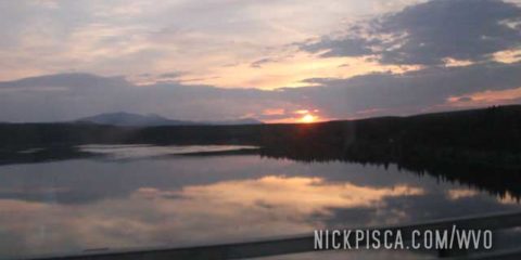
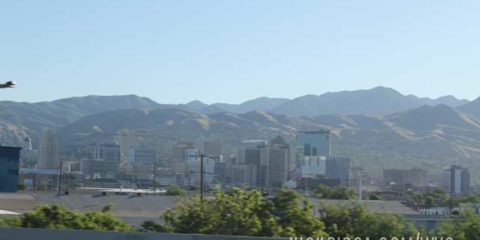
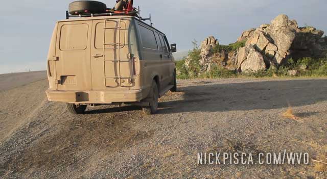
2013:
2018:
Now that I compare the photos, you can really tell 2013 was a hot year with lots of forest fires. There were some major fires in Alaska and the Yukon that year that made the air all smokey. Sunsets were remarkably red that trip.
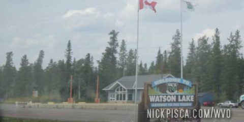
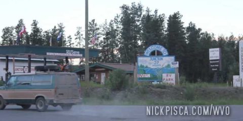
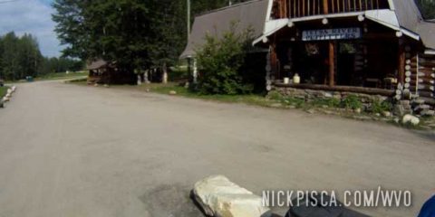
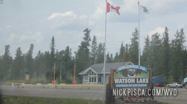
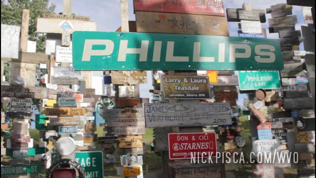
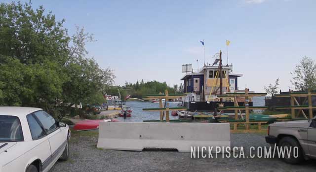
We’ve been to Watson Lake a half dozen times now. The first time was in 2008 when we cruised through with the Jetta after a hail storm.
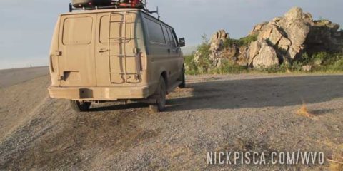
The next time was in 2013 with the Veggie Van. Here’s a pic from the good ol’ days:
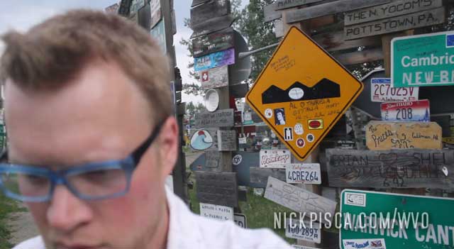
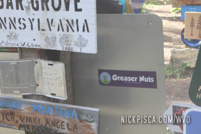
I miss that shirt. Back on that day in 2013, we put a Greaser Nuts bumper sticker on one of the signs. Anyway, back on topic.
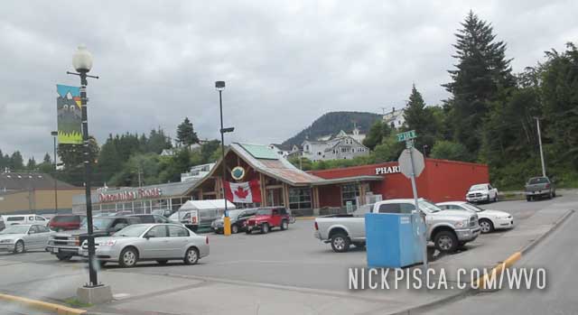
The latest time we visited this town was the 2018 trip up to Tuktoyaktuk. We snapped even more photos because this place is growing exponentially.
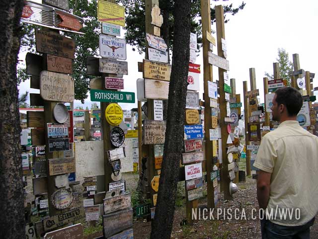
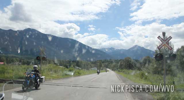
Watson Lake has this folk art “forest” of signs from all the people who drove the Alaska Highway.
On the way back down to the States in 2018, we found our bumper sticker we put there in 2013. Pretty cool.
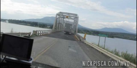
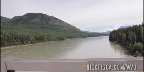
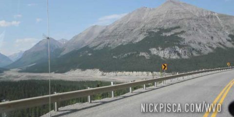
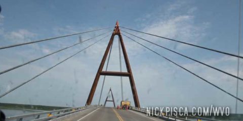
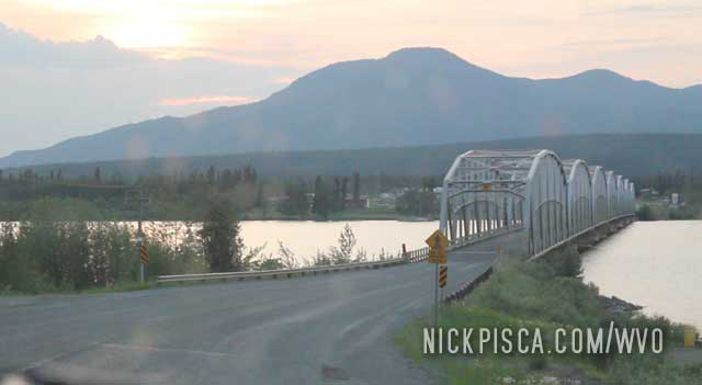
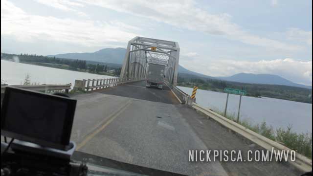
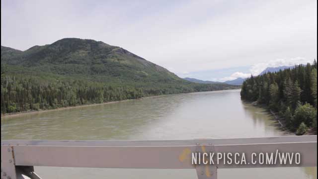
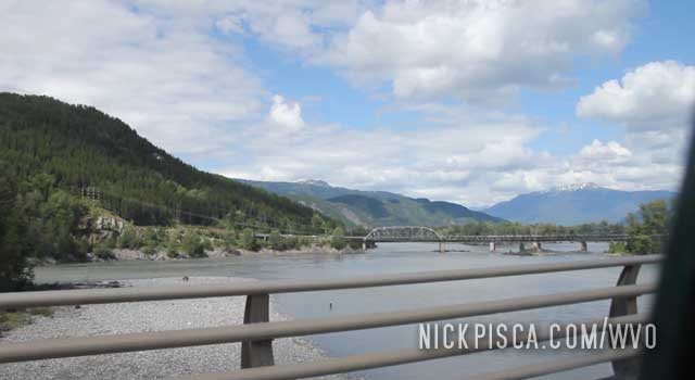
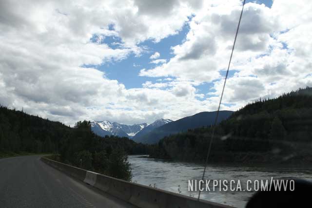
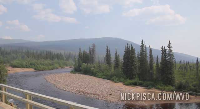
Since we’ve taken the Alcan Highway something like five times now, we have lots of pictures of this bridge and river.
2013:
2018
2018
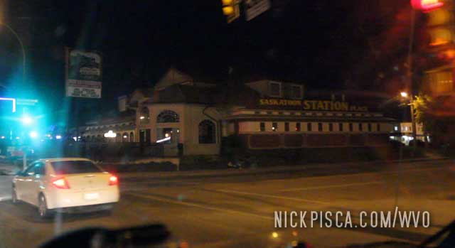
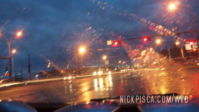
On the 2018 WVO Roadtrip, after catching some Z’s at the Saskatoon Ramada, and Glenn finally washing his body, we decided to reenter our fart-riddled van for the next three days. But since we were still kinda out of it, we forgot to close the back door. After a mile of driving down Saskatoon’s main drag, some kid hung out the window of a neighboring car and told us our shit was falling out. Thank god. We had a few tools in the back and thankfully he told us before they all crashed on the pavement.
On the 2013 WVO Roadtrip, we once again reentered Saskatoon. We were driving through the night to make up time from the drive from Prince Rupert to Wisconsin.
Saskatoon is an interesting town. We cruised the strip just to change up the monotony of driving the plains of the Yellowhead Highway.
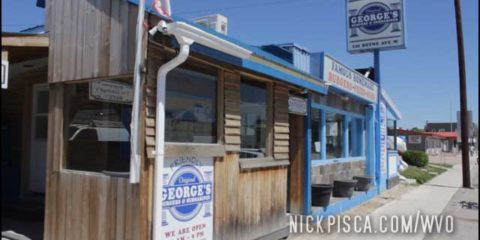
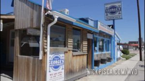
Still running behind schedule. Thankfully, the border patrol didn’t detain us for too long, and we were able to get a recommendation from the tourism center that George’s Burgers was a good local place to eat.
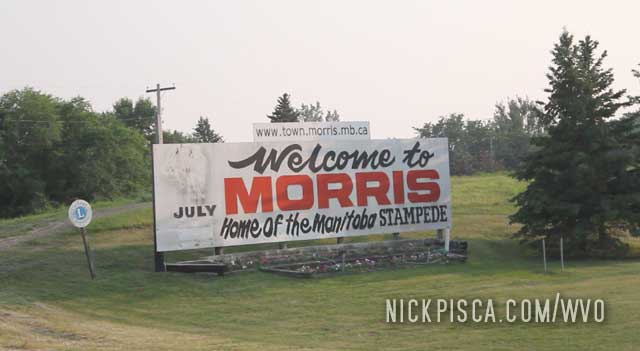
We pulled into Morris Manitoba around lunchtime.
George’s Burgers was ok. Not much of a selection. But it’s a small town, so beggars can’t be choosers.
Canada has the best tourism centers in the world.
Every town has a tourist center, and every provincial and international boundary has a center. And, all these centers have free maps, advice, and booklets on what to do in the area. Once we were crossing into the Northwest Territories on the way to Yellowknife in 2013, and the border is literally as far from anything as you can imagine. But every border crossing has a center, and this remote location even had a center.
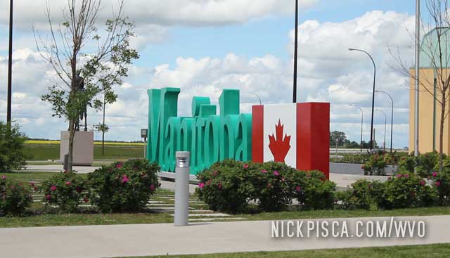
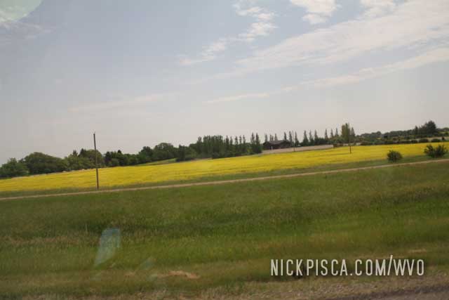
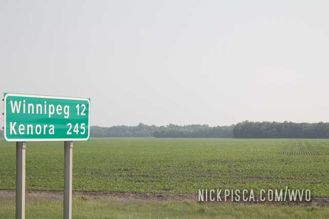
Back to this WVO road trip… We crossed the border, and got some advice on some good hotels and restaurants for our trip up to Winnipeg. And this is the farmland between the border and the Peg.
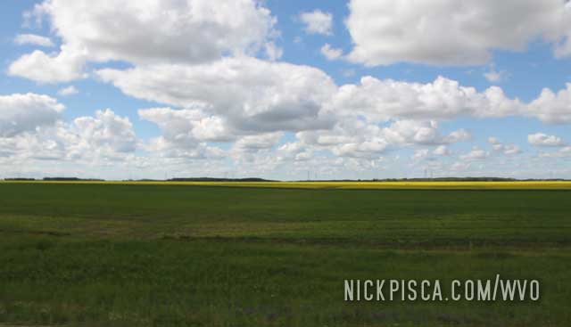
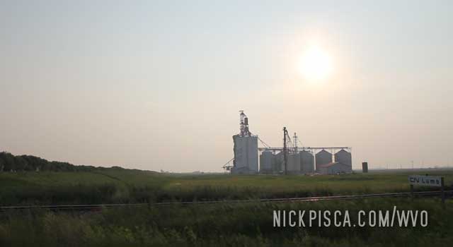
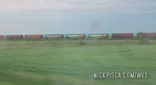
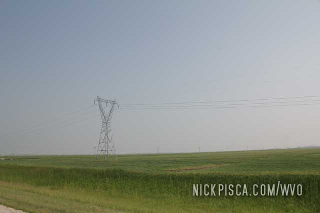
And there are lots of farms, silos, and agricultural infrastructure scattered on the horizon.
After getting a bite to eat at the Red Iguana in SLC, we drove through the evening to get a hotel Cedar City by midnight. We needed to find a hotel that was just north of the entrance to Zion National Park for the morning.
That morning we reorganized the cubes and grease, filled up the tank, and wrapped up any last minute things, because after our national park visit, we would plan to finish the remainder of the drive to Vegas and ultimately Los Angeles before midnight.
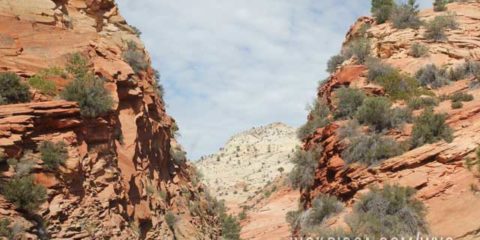
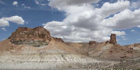
Driving into Zion is kind of a pain. You have to take state roads to find the entrance, which is a lengthy detour. Eventually you make it to the gate, but since this place is heavily visited and it’s the middle of July, the tourism overload is in full effect.
Ultimately we finally got in and Zion didn’t disappoint.
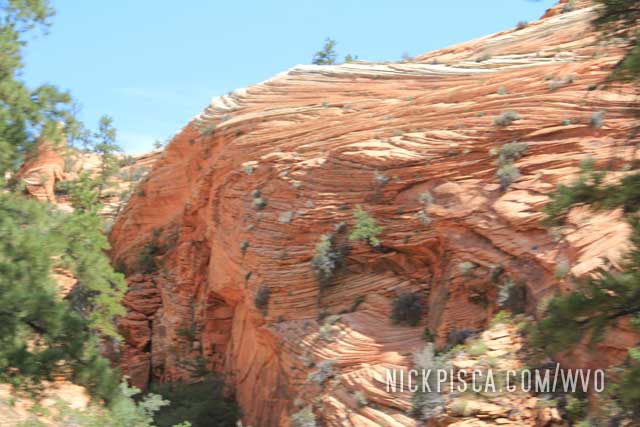
The mountains are surreal. Warped and twisted layers of red rock everywhere. And the roadway was make with red aggregate, so it’s truly almost like a Martian environment.
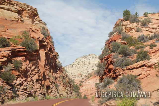
We pulled over many times to stop and survey the landscape. At the end of the park, there is a massive visitor’s center with a gift shop, museum, and other restaurants. But since it was so packed, the parking was a nightmare. Just imagine parking a massive veggie van amongst thousands of other cars… It took some finagling.
Overall, I like Zion, but I will only return to the park in the off season. Onward to Vegas!
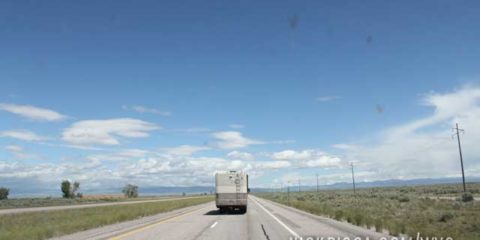
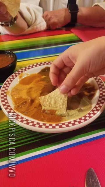
We stopped off in Rock Springs WY to fill up the grease tank and refill the ice in our cooler. Then we kept cruising west in the hopes to make it to SLC before dinner. There is an outstanding restaurant called the Red Iguana that makes the best Mexican food on the planet. Even better than the food in Mexico.
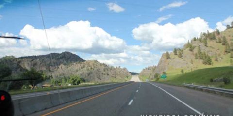
Interstate 80 in Wyoming is a special treat. The mountains and deserts are pristine and amazing. You go down a steep and long decline en route to Salt Lake City, and eventually the town emerges on the horizon.
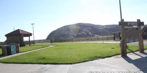
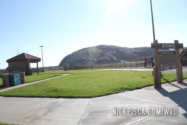
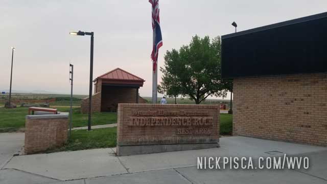
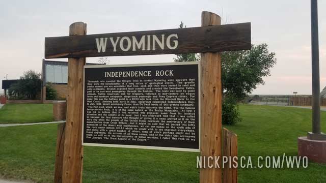
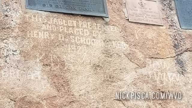
An important site in the history of America is Independence Rock. This out-of-place rock was the predictor of potential success for the thousands of wagon trains that headed up the Oregon Trail. The conventional wisdom was, if you can make it to Independence Rock by the date of July 4 (Independence Day), then you have enough time to traverse the Rocky Mountain passes before the autumn storms and snow hits. If you get to the rock too late, you are SOL.
So if you are driving the exceedingly remote State Road 220 through Wyoming, make time to visit the infamous rock. There is a walkway to allow people to circumambulate the behemoth and get really close. The rock is vandalized by hundreds of 19th century travelers, carving their names and dates into the stone in archaic fonts from the old days.
On the 2021 Roadtrip….
We returned to this remote site on the 2021 trip. Pretty much exactly the same as we left it 8 years ago.
Lots more mosquitoes this time… be careful walking through the grass. I’m kinda confused how green grass grows out here in late July, but it’s green alright. Maybe it’s high altitude.
Walked up to the rock again. Can’t believe it was 8 years. Feels like yesterday we stopped here.
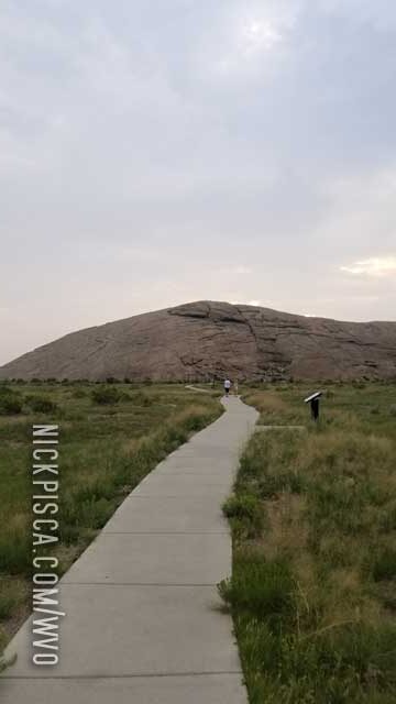
This time we really examined the carvings in the side. Neat stuff. Real history.
See you again in 8 years….
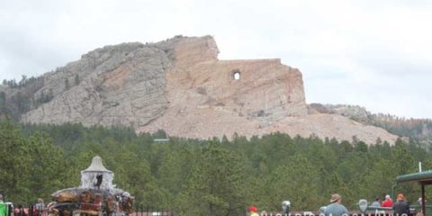
There is an ongoing massive sculptural project in the Black Hills of South Dakota. It’s the Crazy Horse Monument, and it is staggeringly larger in scale compared to Mount Rushmore. I have been keeping track of this project since 1993, and we have visited it in 2004, 2013, and 2016. We would have visited it in 2015 as well, but it was getting late in the day and we elected to watch the Mount Rushmore night show, which is nearby.
In 2015, we visited the monument in the afternoon. The progress is still slow, but it’s making some headway. Get it? They recently finished the face and they are working on the arms next. The sculpture is situated in the forest, and people are encouraged to visit the site by occupying a rather large complex, housing a museum, cafe, gift shop, and other things. They have musicians playing native instruments, and the museum is entirely focused on native artifacts.
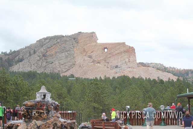
It’s really impressive, much more impressive than Mount Rushmore. But the original designer of the monument was stringently anti-government, and he and his family has rejected all offers to aide him in the process of finishing this work.
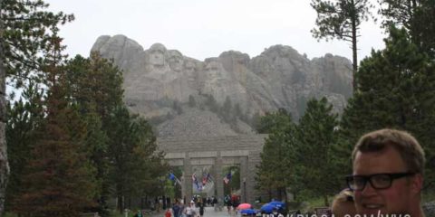
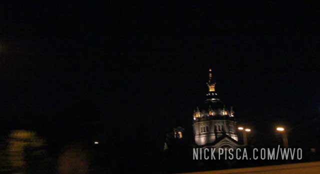
Another South Dakota site we’ve visited over and over and over is Mount Rushmore. It never really gets old.
In 2013, it happened to be raining so we rushed out of the van to the patio. I think the rain lead to decreased visitors, which was good because we were here in the heart of the summer tourist season.
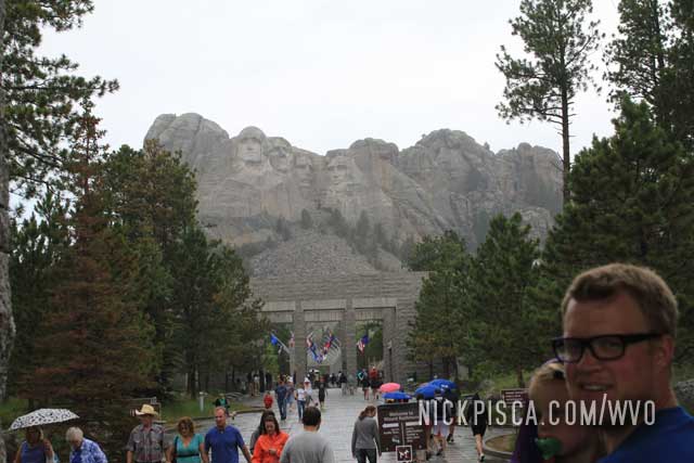
In 2015, we stopped here to see the monument at night. We were driving through with some family friends hitching a ride with us to Los Angeles, and it happened to be really late by the time we got to Wall Drug. I didn’t realize they have a night-show at Mount Rushmore, so we “rushed” to the monument to get a good spot.
I don’t have the pictures from that day. Bummer. It was really cool, but they are lost in the digital ether. We left to drive through the night to get to Yellowstone before the morning.
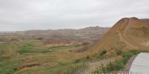
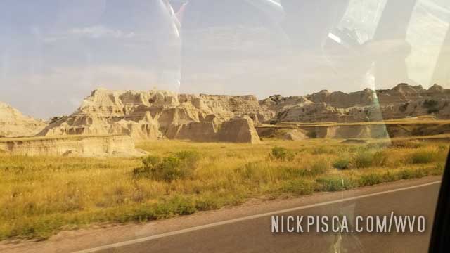
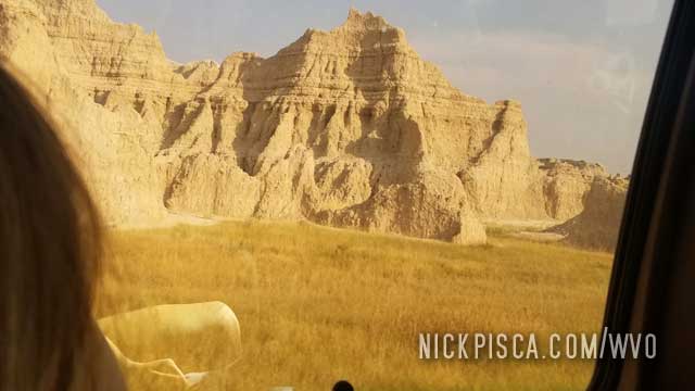
We’ve been to the Badlands on several of these trips. It’s one of the quintessential national parks in the western United States. It’s a must stop if you are cruising the I-90.
We stopped here in 2013, 2015, and we even stopped here in 2004 before we even got started with the biofuel fun. Eons ago, back when I was a tiny lad, I stopped here with my family on my first westward road trip in 1993. It was places like this that inspired me to be a traveler.
In 2013, we pulled over here on the Badlands Scenic Drive, because my 2-year-old got car sick. We just ate at the Badlands diner at the entrance, and then took the curvy and windy road amongst the hills. I guess it was too much for the little girl, and she blew chunks. Just by coincidence, I was in the back of the van with her playing a game, and I had the “fortune” of being able to catch the vomit in my hand and throw it out the window. Not my idea of a fun day, but at least we didn’t to wash puke out of the carpet.
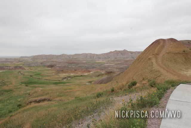
It rained later that day, so most of the chunks got washed off on the road. Memorable times….
On to 2021….
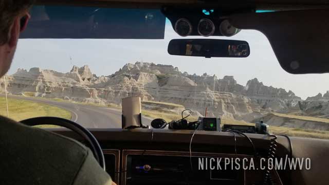
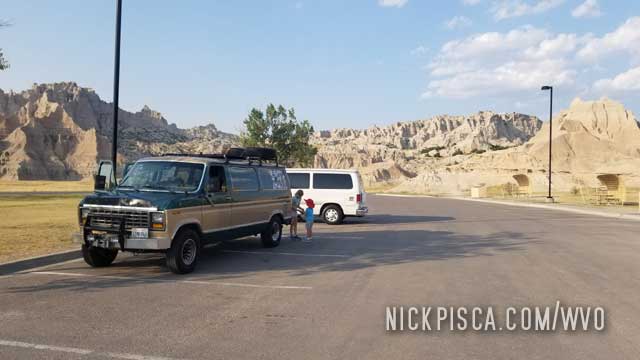
We were on the epic 2021 convoy roadtrip with our California family, we stopped through the Badlands again.
It was already after 5pm, so all the museums, gift shops, and sites were closed up. We did get to drive the main road, and stop off at a few places to climb up and around the formations.
The kids decided to be the camera-guys on this venture.
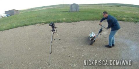
Eventually, I had to pull over and fill up the old grease tank. We inspected the trans leak, and it appeared to be ok. There was still a drip, but it seemed to stop when idling. Hard to tell if it was draining while at highway speeds.
On to Rapids City to find the hotel.
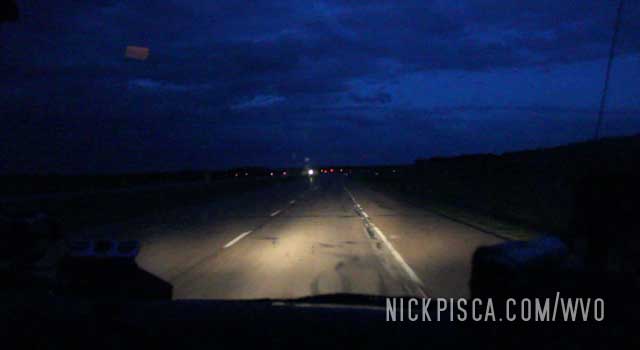
Driving through the night again. We have been driving from Prince Rupert BC all the way to Wisconsin, and this is the last night drive. Three days in a row is a tough drive. We took turns all the way, and pushed on. I had a wedding to attend later the next day, so we had to be home in central Wisconsin by 7am.
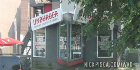
After visiting one of Manitoba’s many oddity museums scattered along the THC, we stopped of at our favorite hamburger joint in The Peg.
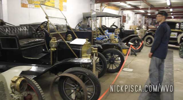
But first, some pictures of the museum. If you don’t know, Canada is a baby country. Anything older than 50 years is considered “historical” so most towns collect all their trash and put it in a “museum.” It’s a great place to get off the road for an hour, stretch your legs, and see cars from the 1970’s and two-headed cows.
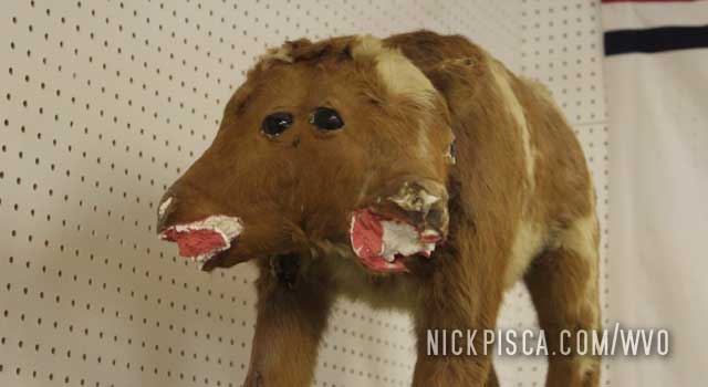
I can’t recall which museum this was. We’ve been to probably every one of these oddball museums in the Great Plains, so they all kind of blur together. This museum even had a few cars that were older than 1970. Crazy.
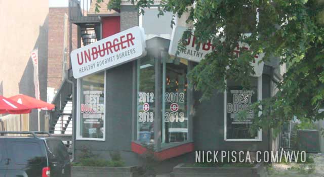
Anyway, nothing wets the appetite like mutated bovine meat, so we stopped at Nuburger. Or maybe it’s called Unburger. Who knows. My picture shows “UNBURGER” but google says it’s “Nuburger.” I guess seeing is not believing. Instead, believe your internet corporate overlords.
A while back, we went to Winnipeg on a different trip. As always, we must stop in at the local tourism center and hassle the clerks. They are glorious. We ask, “Where is the most unique place to eat here in this city?” And like a genie in a lamp, they grant our wish.
We went to Nuburger as per their suggestion because they have some oddball burgers. Falafal burgers, bison burgers, all sorts of burgers. And the toppings are tops. Not some slimy poor-quality fast food here, but rather much nicer high-end stuff.
We returned to the Nuburger in 2016 and 2017 as well. Basically, if we are cruising through The Peg, we are getting an Unburger STAT.
We filled up the grease tank in their parking lot after the meal, and headed to the States. That’s the end of our journey in Canada for 2013, but that’s not the end of the entire roadtrip.
We’ve driven across the Plains Provinces of Manitoba, Saskatchewan, and Alberta a lot: 2010, 2012, 2013, 2016, 2017, and 2018. People don’t really realize how long of a drive this is. Unlike the United States which are much smaller and there is a formal interstate highway system, there is mainly a two-lane road for the majority of the THC and Yellowhead highways. All secondary and tertiary roads are even smaller, and mostly gravel paths. In some cases, the tertiary roads are even dirt tracks.
So the trip from Prince Rupert to Wisconsin is very slow, usually averaging around 100 km/h (60 mph) at best. And it can take a whole day to traverse the average plains province east-west, and several days going north-south.
The scenario can grow on you. There are farms and silos everywhere. We approached the farming town of Brandon after driving through Saskatoon and Regina in the night. We didn’t want to find a place to sleep, we just wanted to push through this drive as soon as possible.
Endless acres of farmland near Brandon MB.
Eventually, we cruised the THC long enough to get to the outskirts of The Peg. We have a favorite hamburger joint there, and it’s getting close to lunch.
We’ve stayed in Edson in 2010 and found a hotel. We assumed that a hotel here would be much cheaper than finding a hotel in the mountain towns near Jasper. It was, but marginally. Like most of Canada, there is very little sprawl. That means unlike the U.S. where good hotels are outside of town, most of the cheaper lodging is located near the city center. In hindsight, the cheapest option would have been to find a hotel near the Edmonton airport, and got up early to make the drive to Jasper.
From the 2010 log:
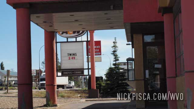
East of Edson was probably the highest latitude that we drove thru on the 2010 WVO Roadtrip. (53.6°) As we checked out the local A&W, Glenn thought $349 for a set of twins was a reasonable price for hookers.
Also, we cruised through Edson in 2013 on the Prince Rupert drive. It was between meal times, so we pushed on to Edmonton.
We have visited Jasper BC twice. Once in 2010 on our detoured east-to-west trip along the Yellowhead highway, and once in 2013 on the west-to-east journey from Prince Rupert to Wisconsin.
In 2010:
Hwy 93, near Jasper Nat’l Park at the Kootenay Crossing, BC. 206408. 9:11pm Sun.
Added 1.5 cubes. Finally! Something other than prairie! Jasper Nat’l Park from a distance:
Entrance into the park is $19 Canadian. I guess that’s the cost of viewing the last glacier below the Arctic Circle.  The mountains are pretty amazing. We couldn’t stop through Jasper on the 2008 Veggie trip from LA to Fairbanks and back. It was originally on the itinerary, but had to be cut because it is avoided by the Alcan Highway and the route from Prince George to Vancouver. Now it’s on this trip and it was never on this itinerary.
Still one of my favorite pictures from all of our WVO Roadtrips:
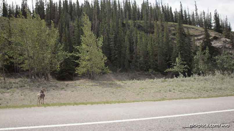
The park is quite full of wildlife. Saw a black bear, some mountain goats, and dozens of deer.
Part of the reason we went to Jasper was because of the wash out at Medicine Hat. But another driving force was the visitor’s center in Manitoba. They told us to head west on the Yellowhead, and then handed us a magazine detailing the whole highway. The cover had a cable-car. Maybe it was the hours of driving over farm land that inspired us to head toward Jasper Park. Here’s the cab.
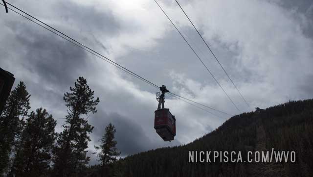
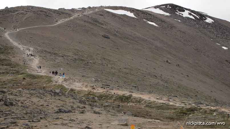
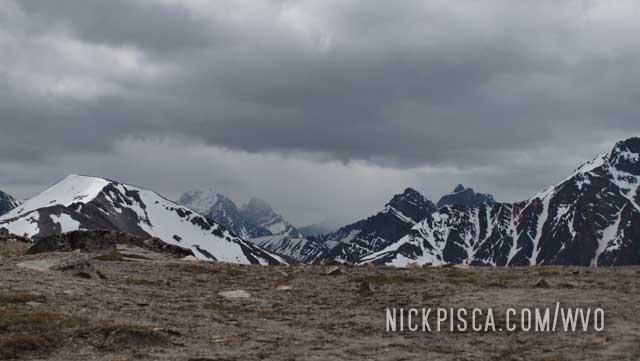
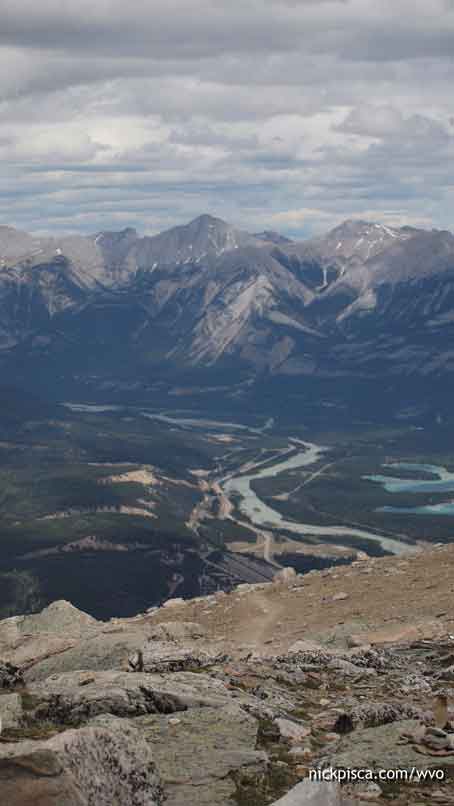
At the top of the route, there are trails to the top of the mountain. You have great views of the city of Jasper, the Canadian Rockies, and huge valley
I kind of wish I didn’t wear shorts. It was windy and cold for July.
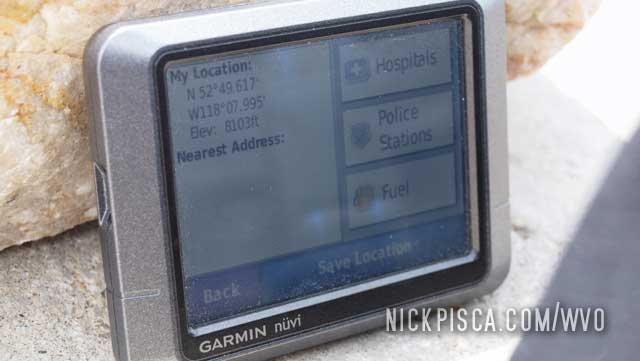
We climbed to the top. I figured it would be packed with travelers, but luckily, most people stayed near the cable car, gift shop, and restaurant. After 30 minutes of hiking, this was probably the highest elevation for the 2010 WVO trip: 8103ft.
We grabbed some grub at the mountain top restaurant. It actually wasn’t that expensive. Get the catch of the day.
In 2013, we stopped into town to get a bite to eat. We walked the streets to stretch our legs found a bar and grill to get a burger.
We hung out for an hour or so delaying the inevitable. We needed to hit the road as soon as possible because the drive through massive Canadian plains provinces is slow.
Jasper is the last stop for seeing the mountains of Canada.
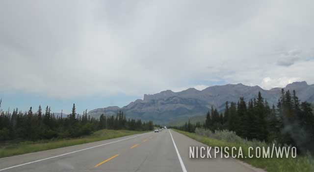
After this, it’s 2000 miles of farmland. After driving the Cassiar and Yellowhead for days and seeing thousands of miles of picturesque mountain vistas, it’s going to be a depressing change.
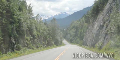
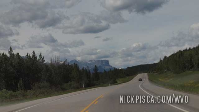
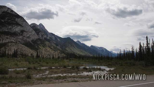
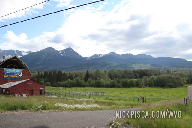
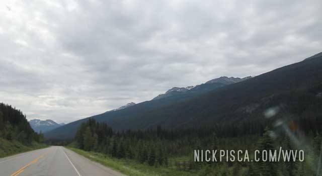
As we traveled east of Houston and Smithers BC, we got into the thick of the Canadian Rockies.
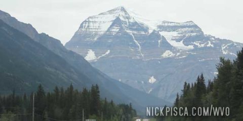
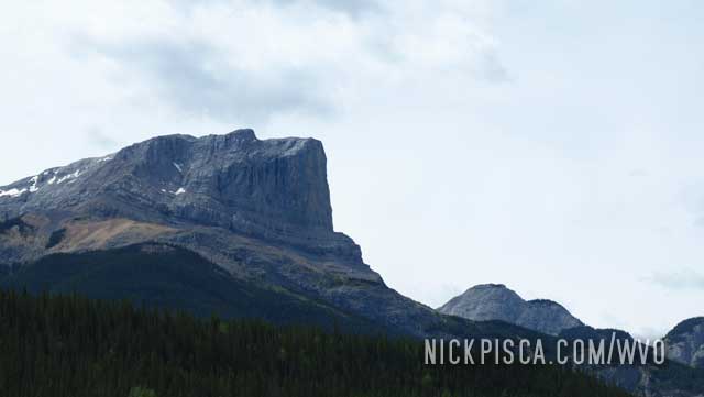
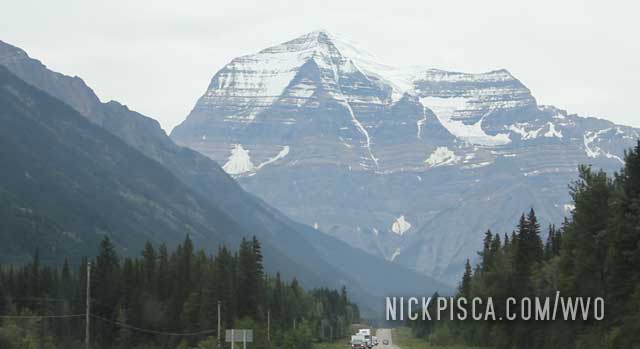
For a major east-west highway, there wasn’t a lot of traffic. We approached the outskirts of Mount Robson Provincial Park, one of the most spectacular parks in the world. If this wasn’t already embedded inside a context of continuous Rocky mountains, this “provincial” park would be a fully-funded national park anywhere else in the world.
We turned the corner on the Yellowhead, and then saw a perfectly framed Mount Robson on the horizon. This is crazy. This peak is a mere “provincial” park.
We got a bite to eat at the local pizza place, and moved on. Since we had a hotel, shower, and bed in Prince Rupert, we figured we could make the 3-day drive to Wisconsin without stopping.
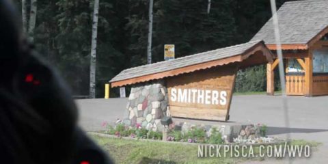
We cruised through Smithers on the way east to Wisconsin.
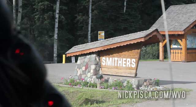
Aside from eating some Bannock on the outskirts of town, we didn’t linger.
Interesting tidbit. On a ferry from Labrador to Newfoundland, about 5000 miles from Smithers, we struck up a conversation with a couple on a road trip. Turned out they were from Smithers, and I mentioned our visit to the Bannock Shack in 2013. Of course, Glenn had already forgotten about this trip, as he tends to do. They seemed surprised we knew about that local treat and the stand. They said that frequent that stand a lot. Small world.
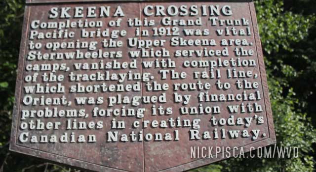
As we drove east on the Yellowhead, we were approaching the town of Smithers and the area around the Skeena River Crossing.
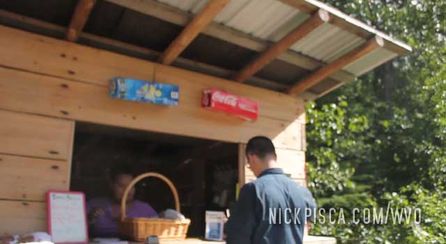
On the side of the road was a small stand selling something called Bannock. If you don’t know what that is, it’s basically a sweet bread, and you pour on honey or corn syrup to give it a little oomph. The closest analog in the American southwest would be sopapillas or in the midwest would be a light and airy biscuit.
Ever since this visit in 2013, we have been looking for more bannock. In Dryden Ontario, there was a cool shop that sold Bannock Burgers. Really amazing.
Nearby we stopped at a rest area to stretch our legs. The sites of the Canadian Rockies along the Yellowhead are amazing. Here was the horizon near Houston British Columbia. Every minute was a postcard moment.
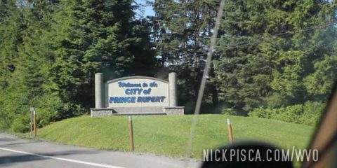
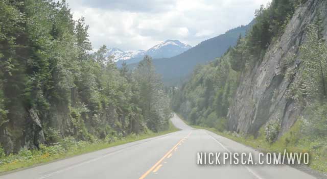
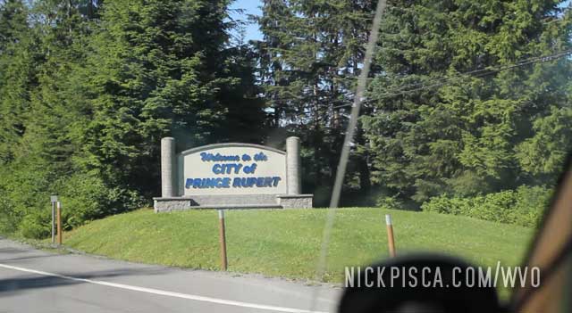
The end of the road westward on the Yellowhead is the city of Prince Rupert. You have to navigate some massive mountains and valleys to get there, but since the Yellowhead is paved and highly managed.
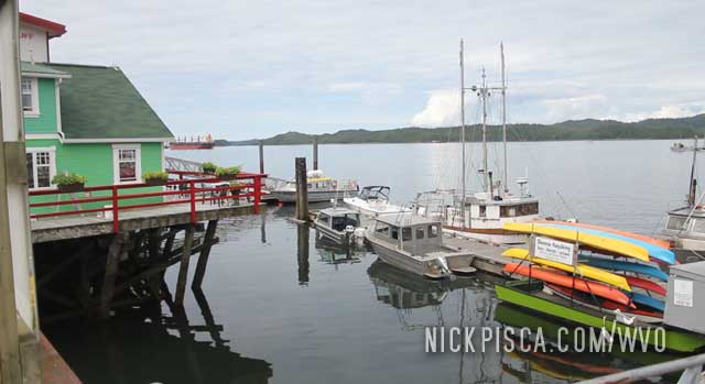
This is a pretty decent sized town, because it services the Marine Highway. Lots of tourists come in when the cruise ships dock here.
We took the opportunity to replenish our food, parts, and other supplies. We hadn’t been to a regular supermarket since our stop in Fairbanks.
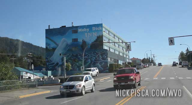
We stayed the night at the Moby Dick Inn. The last time we slept in beds and got a shower was in Prudhoe Bay Alaska, about 4 or 5 days ago. Also, after driving for two weeks, we needed a crankcase oil change. Lots to do to get the van in working order. We also ordered a pizza delivered. Canada has a weird type of pepperoni… it’s more like salami.
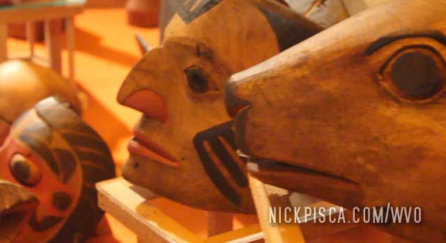
The next day we went down to the Pacific Ocean and did some touristy stuff. We visited the Museum of Northern British Columbia and ate at a nearby restaurant.
While we were eating and looking out on the harbor, we both looked beat.
We discussed the remainder of the trip. It was a 4-day drive from Prince Rupert to Wisconsin. We both just resigned to the fact that we accomplished a lot already, and maybe it was time to wrap it up. So we headed east along the Yellowhead Highway onward to Wisconsin.
We drove to the end of the Cassiar Highway where it meets with the massive Yellowhead highway. We have driven the Yellowhead in 2010, but never out this far west. We gave up around Jasper, then headed south. But now we are still deep in the Canadian Rockies, and we are cruising west all the way to the Pacific Ocean.
There were lots of bugs on the Cassiar, as our windshield can demonstrate.
Around every corner is a majestic mountain range. It’s outstanding. This was the scene east of Terrace BC.
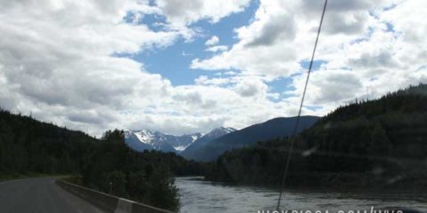
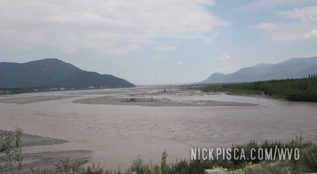
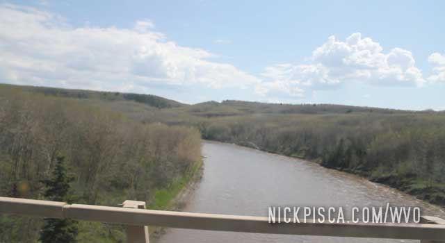
Also, in every valley was a beautiful river.
Then on the way to Prince Rupert we navigated a massive valley. Sheer cliffs and snow-capped peaks all around.
Every mile of the Cassiar is outstanding. It almost got kind of boring. The first few hundred miles of splendor is all good and whatnot, but eventually there is a limit to the amount of sublimity a human can endure.
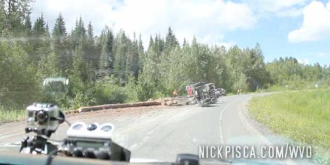
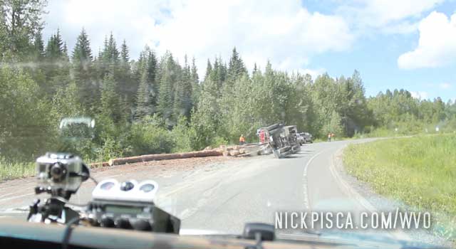
The around a mild corner, we stumbled upon a recently-overturned logging truck. Logs were scattered all over the roadway and ditch. The drive was ok, but the rig was totalled. Either his truck was overloaded or he was driving way too fast.
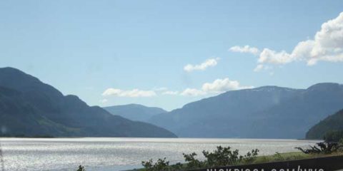
About a hundred miles down the Cassair is a huge lake nestled in the Canadian Rockies. It’s Dease Lake, and it’s spectacular.
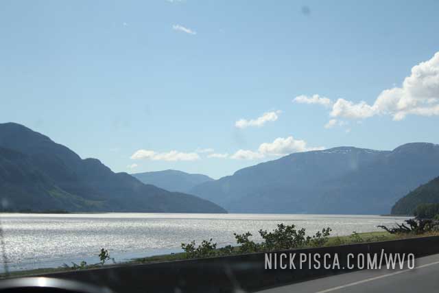
We stopped on in, and checked it out. Didn’t have a lot of time to blow here, so we kept on keepin’ on.
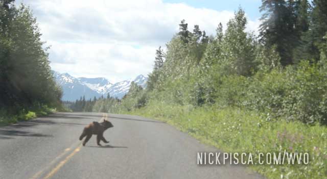
After a few miles, we saw a bear cub and mother cross the road in front of us. This place is wild.
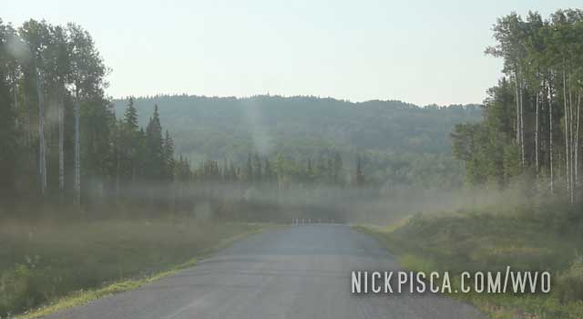
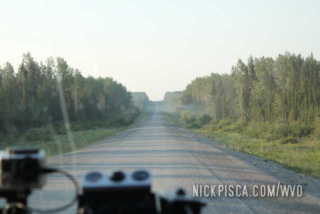
Not far down the Cassair road did we realize that this trip was going to be special. It felt like around every corner was another scenic view that could be put on a postcard.
We pulled off on the Rabid Grizzly rest area to fill up the veggie oil tank.
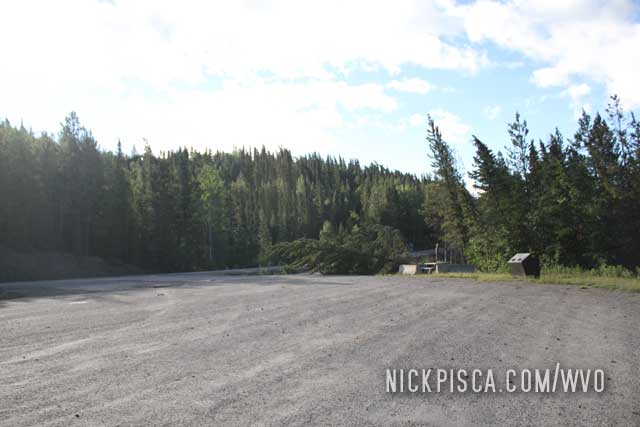
Sadly, this particular rest stop didn’t have a pit toilet.
Walking out into the wilderness was a foreign experience. There wasn’t really any solid ground to walk on. It was as if I was teetering on two meters of piled pine needles and leaves. It was like walking on a sponge or spring. I suspect no human strolled in that forest in a hundred years, or at all.
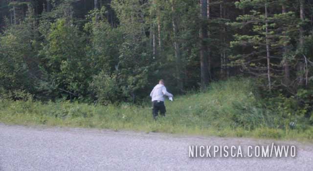
After we finished our business, we got back in the van and headed south toward Dease Lake. In the middle of nowhere, we somehow got a CBC broadcast on the radio. The really coincidental topic on the show was the scourge of Americans taking dumps in their pristine forests. I’m not a paranoid person, but that was a little on the nose.
Onward.
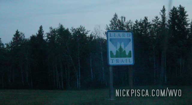
After we left Whitehorse, we made our way down the Alcan Highway to the Cassair Turnoff. The Cassair Hwy is a roadway that runs parallel to the Alaska Highway, but is sparsely populated (relative to the Alcan) and has less services. Not many take it, but it is an exceptional drive, leading a path through the Canadian Rockies. It’s by far the best drive I’ve ever experienced.
This was the first time we got to see nighttime in a week. Since we hadn’t slept in a few days, we elected to pull off before the Cassair turnoff to rest for a few hours. Before the trip, I told Glenn to NEVER use the e-brake. It doesn’t turn off. While we were resting in the van, I started sleeptalking, as I usually do. I kept dreaming that we were rolling off the cliff, and needed to put the e-brake on. Apparently, I was talking about it too. Eventually Glenn, who was annoyed with me constantly waking him up, obliged my demand that we use the e-brake.
The next morning, we woke up and I got in the driver’s seat. Furious, I asked Glenn why he put on the e-brake. Astonished, Glenn explained my comments in the night. Thankfully, the e-brake happened to release that particular time.
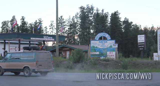
The Cassair turnoff is before Watson Lake. We still drove down to Watson Lake to get a bite to eat at their diner, then returned to the Cassair to make the drive.
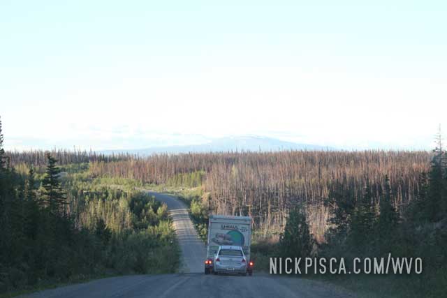
For most of the drive, we didn’t see a single soul. Except for the U-Haul in front of us. So odd that for thousands of miles, we didn’t see anyone, but then there is a commercial rental truck towing a car. Wild.
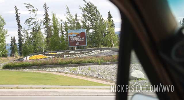
We’ve been to Whitehorse over six times now. It’s one of our favorite towns on the planet.
We visited Whitehorse in 2008 when we drove the Jetta up. That’s where we met Skeeter and Mike who hooked us up with some clean grease.
From our 2008 travel log:
Then in 2013, we returned to Whitehorse on our southbound trip from Dawson.
We pulled into town from the north end, and contacted Mike and Skeeter to meet up again.
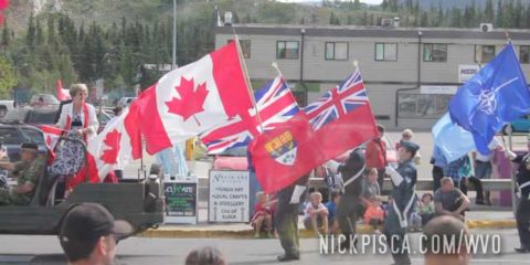
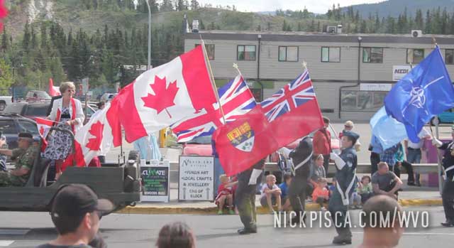
We got a bite to eat with Skeeter at Klondike’s again, and had some Caribou burgers and fish. It happened to be Canada Day, and there was a parade going on outside. It’s nice to see civilization again after all these days of driving in the wilderness.
We also spent a few hours at the Yukon Transportation Museum checking out their exhibits.
![]()
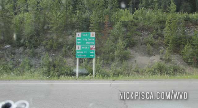
We told Skeeter we are going to take the Cassair Highway south to the states. It’s the only alternative to the Alaska Highway, and it runs parallel near the pacific coast. And it meanders throughout the British Columbia Rockies.
We also visited Whitehorse again in 2018.
We met up with Skeeter and Mike again. This time we stopped in on the way up north to Tuktoyaktuk. We unloaded our van to make sure our vehicle didn’t have too much weight in it. We read the Dempster highway had some weight restrictions due to recent washouts and construction on the road. So unloading was a prudent thing, and we could reinsert all those cubes when we headed back south. Also, Mike and Skeeter donated some more cubes for our trip back to Wisconsin. We stopped off and got a bite to eat with them at the A&W in town. Once again, we are eternally grateful to those guys for all their help over the years.
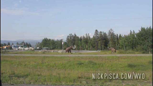
There’s a pic of the mastodon sculptures north of town.
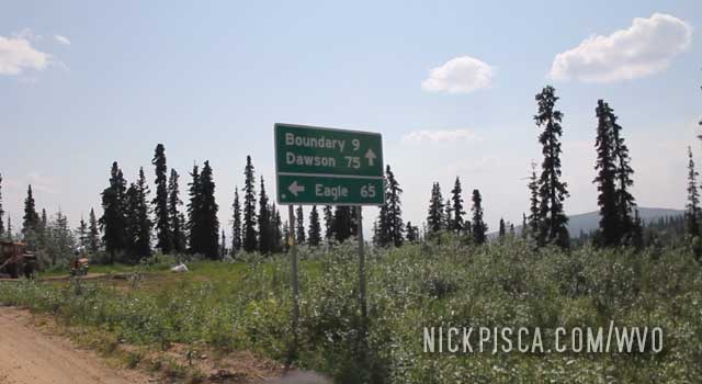
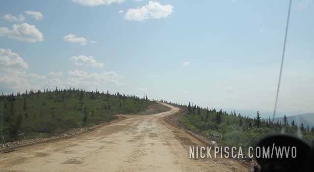
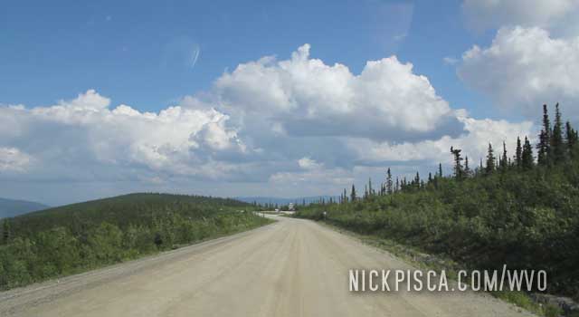
We headed east of Dawson and kept going. Finally, after days and days of gravel driving on the Dalton and Top of the World Highways, we got some pavement! Thank you Canadian government!
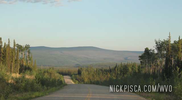
Lots of rivers and forest up there.
![]()
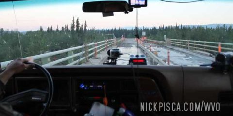
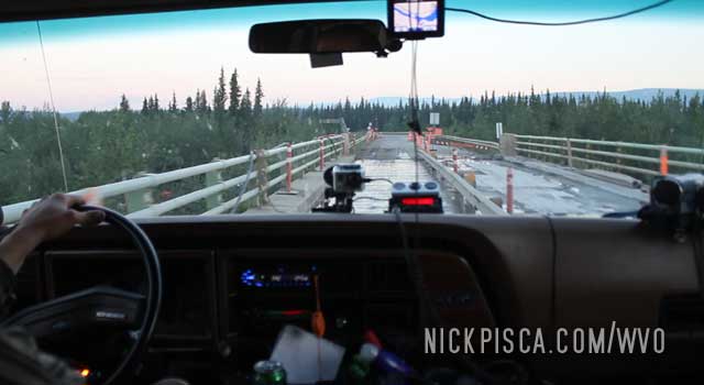
Then we got to a sketchy wooden bridge near Stewart’s Crossing. Lots of these up here. I figure if the logging trucks can make these crossings, then our overloaded van will.
We finished up driving the “Top of the World Highway” and pulled up to the raging Yukon River, dividing us from the tourist town of Dawson City. There were two lines: one line for standard automobiles, and another line for semis, dump trucks, logging trucks, commercial trucks, and RV’s. The ferry would zip back and forth every few dozen minutes, fighting the enormous current from the influx of spring melt-water. They would fill the ferry with a dozen cars, and only one truck was allowed per visit. Since our van is considered a “car,” we didn’t have to wait forever.
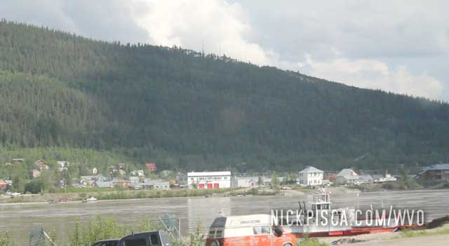
That was probably the scariest ferry ride ever. The current was massive, the driver was amazing, and the shoreline was constantly being rebuilt by a guy in a bulldozer every few minutes.
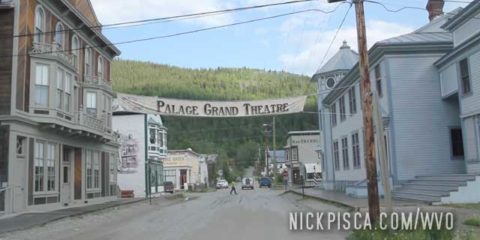
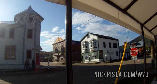
Dawson is a weird town. It’s supposed to be a close reenactment of the Klondike gold-rush days. There are even people who dress in character and give tours of the buildings. It’s a touristy destination for many Canadians who want to head up north and experience what it’s like to have 1-hour nights.
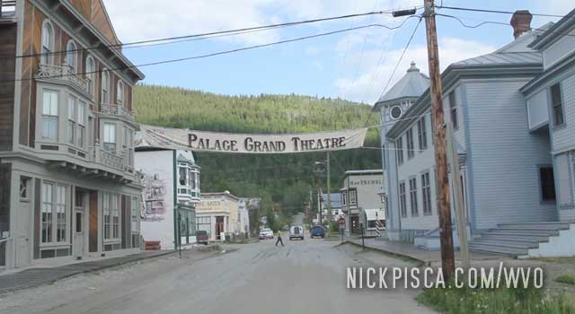
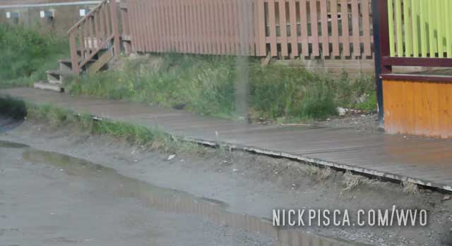
Every street has campy wooden sidewalks, just like in the ol’ days. That’s actually kinda neat. We visited Dawson in 2013 and 2018, and both times we utilized the wooden planks to meander around the city. It’s a nice break from the constant driving.
Eventually we got a bite to eat at Klondike Kate’s, as per Skeeter’s suggestion when we were back in Whitehorse. Nice food and good company.
Time to get going. If we hurry, we might be able to get a hotel in Whitehorse, but it’s looking late.
Eventually we approached the northernmost border station on the western hemisphere on the “Top of the World Highway.”
They really use the word “Highway” liberally up here.
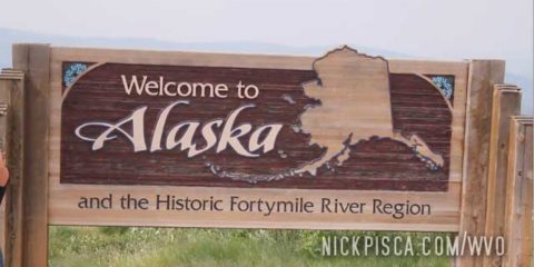
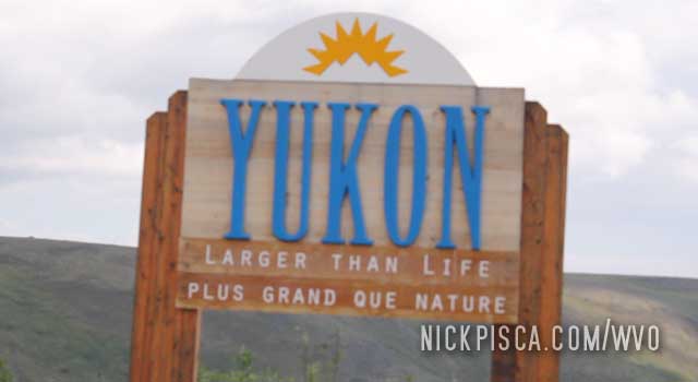
Since we were traveling from Alaska to the Yukon, we saw the Alaska sign first.
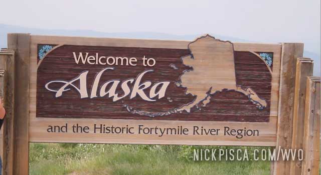
Then we saw the Yukon one after we crossed the border. Thankfully the agents were really cool about the veggie oil and we didn’t have to wait long.
Then it started raining. This road is mainly dirt, mud, and gravel, so it’s a tough drive. One slip up and we go down the ravine.
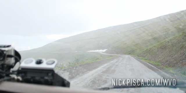
Thankfully the weather cleared up and things got dryer. Onward to Dawson City.
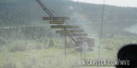
Instead of driving directly back from Fairbanks to Whitehorse on the Alaska Highway, we decided to detour through Chicken and Dawson City via the “Top of the World Highway.” It’s not much of a highway.
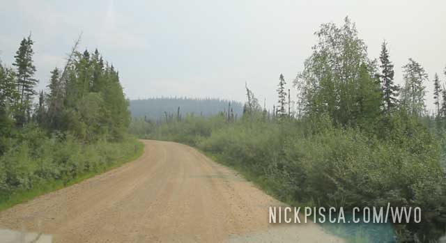
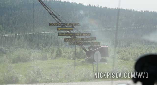
Eventually we got to the “town” of Chicken which isn’t much more than a few buildings.
While driving around this pristine wilderness, we needed to fill up the veggie oil. While pulling vegetable oil filled cubes out of the back of the van, we encountered a “leaker.” That’s a cube that got a pinhole leak during the drive, and made a mess in the back. We always lay down plastic so if a leaker occurs, it’s not a major hassle. If we are lucky, the hole is near the top and not a lot of grease escapes the cube. But this one was near the middle, and about a gallon leaked out. Ouch. We had to unload the van in the middle of nowhere, and reorganize and clean up.
Kind of weird being so far from civilization and hauling cubes around. It looked a lot like this:
Pretty soon, we got close to the border. I gotta wonder what are the hours at this border station and precisely just how many people cross this border.
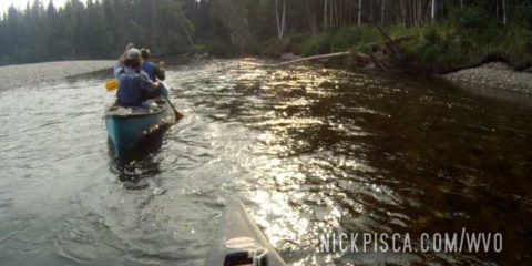
After visiting Prudhoe Bay, we drove down to Fairbanks to visit a friend of ours from central Wisconsin, Kristin. We knew each other since high school and early college, and eventually she moved up to Alaska.
We stayed in touch, and connected on the trip. She and her friends were going canoeing, so we tagged along. Glenn and I hadn’t canoed in a few decades, so we were really rusty. Scratch that, really terrible.
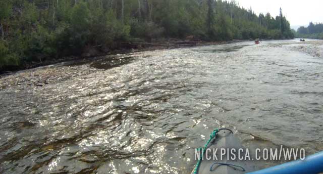
It got so bad that they decided to split us up so that we don’t end up in the drink. Probably the best plan. We hadn’t slept since our time in Prudhoe Bay so we were kind of spent, but pushed on. It was a really rewarding time, canoeing in the Alaskan wilderness.

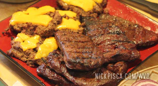
At the end of the day, they treated us to a pile of hunted meats. They were amazing hosts.
Eventually, we had to hit the road. The sun still wasn’t setting, so we just decided to keep driving south and see how far we can get.
After we fixed up the vacuum pump, got our brakes back in working order, and ate a last meal at the Prudhoe Bay Hotel with some new friends, we headed back south. We needed to make up for some ground because we ended up staying in Deadhorse for over 3 days, which was 2 days more than expected. We had to catch up with some friends in Fairbanks for some canoeing.
When we left Prudhoe Bay, it had been raining. It rained all through the Dalton drive, and it took a toll on our van. It didn’t stop Glenn from hammering down. When we drove up, it took us 16 hours. But with Glenn not caring anymore, he got us to Fairbanks in 13 hours flat.
The Dalton Hwy doesn’t go all the way to the Arctic Ocean. Instead, it stops about 30 miles short, and the only way to the coastline is by taking an oil company tour. They spend the majority of the time shuttling around retired workers and his jetlagged families to the oil fields and derricks. At the end of the tour, they let the occupants of the shuttle out by the ocean to dip their toes, if they so choose.
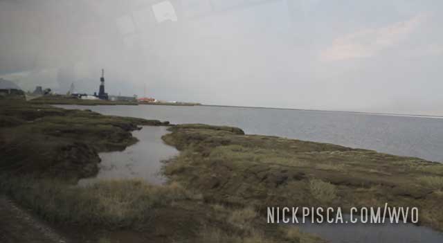
As exciting as the oil field tour was, the main goal of this trip was to swim in the ocean. It was against company rules to swim in the Arctic but we still put our trunks on under our pants just in case the opportunity arose.
The tour held us in the shuttle for a while when they surveyed the horizon for polar bears. If a bear appeared, they would abort the ocean visit. About only one in three visits allow for the occupants to depart the bus, so we had a rare chance at touching this elusive ocean. Thankfully, no bears were present, and they let us off the bus.
As we approached the shore, Glenn decided to strip off all his clothes and jump in the bay. Everyone was cheering and it was wild. I decided not to do it. Not that the water was cold, but the freaking mosquitoes were horrendous. I elected to set up all the cameras and hold his towel for him, so that he didn’t have to put it in the mud. Put my feet in the water and watched as Glenn induced his own bout of hypothermia.
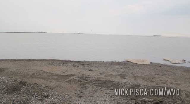
The tour was fun. And this constitutes the furthest north we both had ever traveled. See our “records” page for other cool facts.
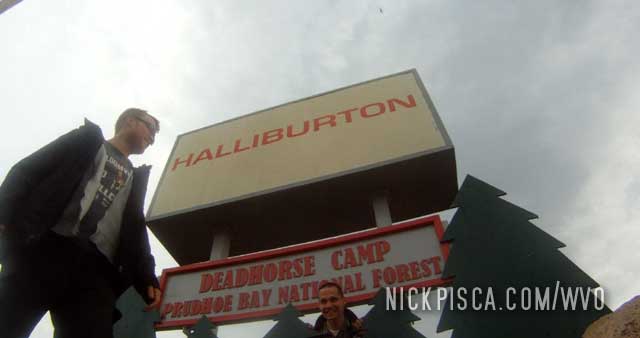
It’s about a 200-mile drive from the Atigun Pass to Prudhoe Bay. It’s all gradual downhill and eventually you get to about sea level. The Dalton highway does not go all the way to the Arctic Ocean (unlike the Canadian Tuktoyaktuk Dempster Hwy) but stops short in the tiny hamlet of Deadhorse. Prudhoe Bay and Deadhorse are companion settlements, with Deadhorse being the primary civilian complex, and Prudhoe pertaining to the private oil company development. We drove up as far as we could, and got stopped in Deadhorse.
One thing we noticed on drive up near Deadhorse, was that our brakes stopped working. Just great. All those bumps and washboards must have blown out the vacuum pump on the van. We still had some non-power-assisted brakes but it was rather dicey. We limped it to the settlement at about 20 mph.
As we pulled into town, there was a small sign and mail box. They said to take a free map of town. Inside the box was a few dozen 8 1/2 x 11 pieces of photocopied paper, with a hand drawn map of the town. As crude as it was, this was crucial, because the town doesn’t have any signage, road signs, street signs, anything…. And since most the buildings are literal trailers brought up from Fairbanks, every building looks the same. So the map is important.
Since we didn’t have brakes, our first stop was the Prudhoe Bay Hotel. We honestly didn’t know what to expect. Perhaps they had no vacancy? Perhaps they only catered to the oil company workers?
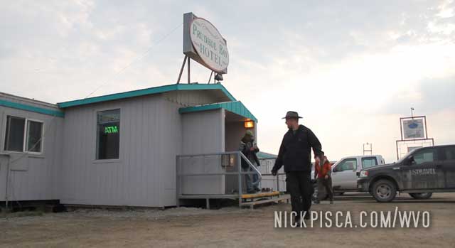
The first thing we did was go to their lobby, find their wifi, and overnighted a new vacuum pump. Then we went asked if they had any vacancy, since we’d need to spend the night waiting for our pump. They had vacancy, and thankfully, they were able to score us a room with two beds. This place is kind of like a barracks so lots of the oil company workers stay here. It was kind of expensive (about $205 per person), but once we realized what came with that price, it was well worth it.
Since Prudhoe Bay is basically a company town, there isn’t much for services. There are no restaurants. So this hotel includes an impressive buffet for breakfast, lunch, and dinner, and also they have a small after-hours hot meal program as well. They had a real chef that cooked some amazing food. That was worth half the cost of the room alone.
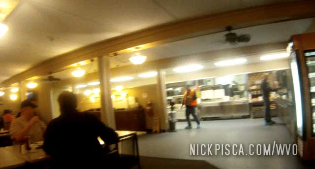
Also, the Prudhoe Bay Hotel has a gym, rec room, and entertainment room. While we were there, two other retirement couples got stranded in the town due to vehicle mechanical issues as well. But the majority of the clients were guys coming and going to the oil fields.
The next day, that vacuum pump didn’t show up. In fact, when we booked the room, the staff laughed at us when we told them we had “overnighted” something up to Prudhoe Bay. We should have known.
Then we decided to see if the local “NAPA” or mechanics could help us out. On the paper map, there was supposedly a NAPA on the outside of town. We drove to the place, but didn’t see any NAPA sign. We entered, and it was a NAPA, and it had one of everything. It was impressively stocked. They even had a vacuum pump for the 1980’s IDI Truck. However, not so much for the IDI Van.
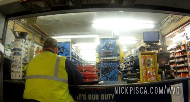
The guy at NAPA said that it’s too bad we have a gasoline vehicle, because all the shops in town focus on diesels. We replied that we did have a van, and he got us in touch with the Ford mechanic in town.
We drove over and met up with the main Ford guy. He was from Menominee Wisconsin! Small world. He said they used to work on these IDI’s all the time, but ever since the proliferation of the powerstroke, they don’t see much of them anymore. But his shop was open 24-hours (company rules to support the neverending oil company projects) and he took it upon himself and a few colleagues to see if they could rig up a vac pump for me. They tried to fit a powerstroke pump in the spot for the van, but the frame rail got in the way. I got to give them credit, they tried for an hour to get it to work, but it just wasn’t possible. Even as I tried to pay, they declined. Nice guys.
He then suggested we “Goldstreak” the part up from Fairbanks. We asked what that was. Turns out that in these remote parts of the great North, there is a service where if there is availability on the plane, Alaska Airlines will fly up auto parts from Fairbanks or Anchorage. The NAPA person in the south literally drives the part to the airport, puts it on the plane, and then it comes up with the passengers. Crazy huh? It’s not a sure bet. Depending on the size, weight, and trouble with the part, it doesn’t always get shipped up north. In fact, Priority goes to Postal Mail, then passengers, and then if and only if there is space left on the plane, then auto parts are good to go.
After hearing all this preamble, we were concerned how much was this going to cost. The cost of the flight up here must be crazy expensive. The mechanic said it cost an extra fifty bucks. HOLY COW! Just that?! I jokingly told him to send three.
Now all we had to do was wait. We booked another night in the hotel and decided this was the time to see the Arctic Ocean for the first time. Since the road doesn’t go all the ocean, civilians must book a trip with the oil companies to get a tour. So we took care of that and went to the ocean (to be documented in another article).
Afterwards, we stopped off at the Prudhoe Bay post office and general store. Very very small, but has a little of everything.
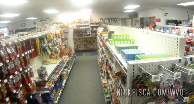
We bought some snacks for the road trip back down to Fairbanks.
Then we went out adventuring. The sun never set so it was hard to tell what was night and day time. After two full days of dinking around, we finally got the part. We made friends with lots of the people at the Prudhoe Bay hotel, hanging out in their cafeteria and recreation rooms.
In the rain, we replaced the vacuum pump and tested out the van. Thankfully, the brakes now worked. We looked at the open road, and decided to come back in to the Prudhoe Bay hotel for one last buffet dinner. Our new friends were confused at first to see us again, but once we told them we wanted one last meal with them, it as a good time.
It’s all uphill from here.
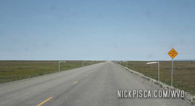
Eventually, you get so far north that it’s just road, pipeline, bogs, and grasses. It’s almost like an alien landscape. It’s almost like being on the moon.
Near the Sag River we saw a herd of muskoxen trudging up to the ocean. The locals said they migrate in the summer to get away from the mosquitoes. I can understand their urgency. Basically from Coldfoot to here, if we had to pull over to fill up the grease or take a leak, we would put on long sleeve shirts and pants, gloves, and head netting. Glenn, who had a skin-head look at the time, had so many mosquitoes hovering his head netting, that they would bite through the top fabric into his scalp. We used 3 bottles of Afterbite on this trip.
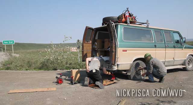
They recommend you take two full size spare tires when driving the Dalton Highway. The roadway is comprised of broken up pieces of rock and shale found from the area. These local rocks can easily shred regular tires. I had just replaced my tires with brand new Michelins, and with only 7000 miles on them, the rear passenger tire blew on the Dalton. I didn’t really notice it was flat, because the road is so bumpy and gravely. I probably drove for five miles on that flat before I really noticed the van being really squirrely. I woke up Glenn and told him to check the tires on his side, and he hung his head out the window to check stuff out. Sure enough, the tire was messed up. We pulled over by a sign saying Ice Cut, whatever that was, because there was a small gravel turnout to work in. We probably spent an hour there doing the job. There are no trees around here on the north slope, so it was mainly just shrugs, mosses, and grasses. And mosquitoes, hence the bug netting.
We actually packed 3 spare tires, just in case we had several blow out on us. Always repaired.
The trip up to Prudhoe Bay requires us to cross the Atigun Pass on the Dalton Hwy. It’s not necessarily most difficult pass to traverse, but it is muddy, gravely, and steep. The Dalton Hwy is not an easy drive; since this was a private road until the 90’s, they didn’t design this roadway to typical American interstate highway standards. Instead of switch-backs and roads following the topography, they just cut a road that was the cheapest and fastest way up to the north side of the range. There were several slopes that reached up to 10 and 12 degrees, so it was rather disconcerting.
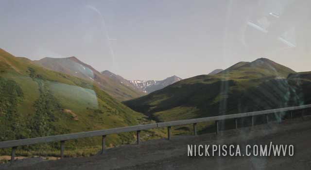
As we crossed the pass, the trees disappeared and there was snow everywhere. I don’t recall the elevation, but I think it was around 5000 ft. This was in late June and there was a massive heat wave in central Alaska, but still it was cold enough that we had to shut down the biofuel supply circuit (due to low engine temps). We could have pulled over to block up the radiator (like it was winter), but we figured it was only a few dozen miles before we got to the lower elevations.
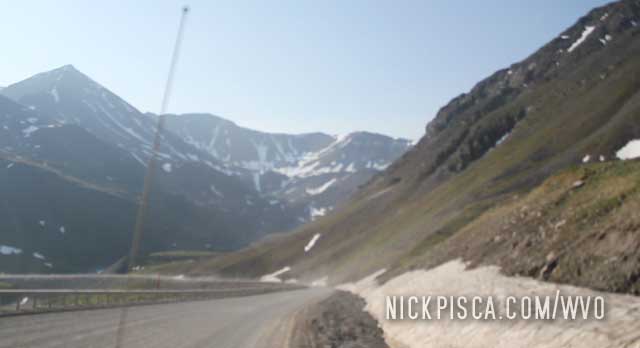
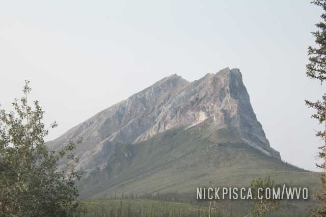
Sukukpak Mountain, along the Dalton Highway north of Coldfoot.
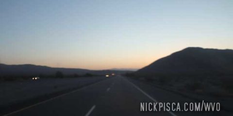
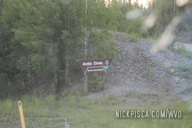
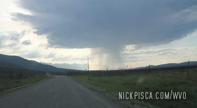
2013 was a particularly hot summer in Alaska. It got up to the 90’s in Fairbanks, and once we got north of the Arctic Circle, the sun never set. That made the drought even worse, so the fires were spreading all over the horizon. Smoke occupied the air. We didn’t know if they would affect our trip on the Dalton, but we pushed on in the hopes that once we got north of the treeline, it would dissipate.
After days of driving, we finally crossed the Arctic Circle! This was the first time we had ever crossed this boundary. Back in 2008, we drove up an hour north of Fairbanks with the Jetta, but never made it up this far. After this, we wouldn’t see the sun set for five full days…. if you can call it a “day.”
The next time we would cross over the Arctic Circle would be our trip in Canada up to Tuktoyaktuk after they finished the Dempster Hwy.
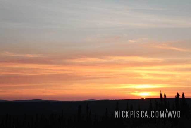
As we got close to the Arctic Circle in Summer, the concept of night was evaporating.
I drove the first shift from Fairbanks to Coldfoot, and Glenn elected to do the 2nd shift to Prudhoe Bay. As I was driving up the foothills, I realized I was driving north and the sun was directly in front of me. It dawned on my that at this particular moment, it was surpassing midnight, and the sun was still on the horizon. Somewhere in Russia, the sun was high in the sky, but we are on the other side of the earth and it’s still visible. Amazing experience.
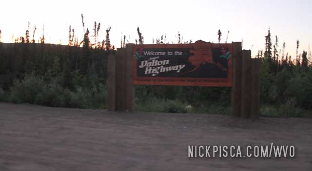
The Dalton Highway is the road that goes up to Prudhoe Bay (or Deadhorse) Alaska. It’s hardly a highway, and more of a gravel road built by the oil companies to access the oil fields across the Arctic coastline. The road does not go all the way to the Arctic Ocean, but with enough planning, you can make reservations with the oil company to do a tour of the fields and ocean, weather/wildlife/availability permitting.
We booked a time with the Arctic Tour while in Fairbanks, because typically on our trips, we cannot plan more than a few days ahead, just in case we run into mechanical or weather delays.
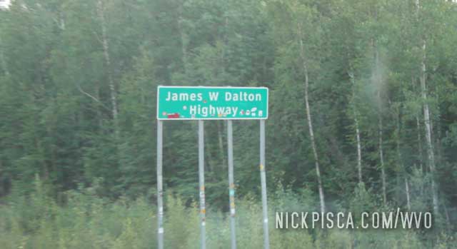
The Dalton highway is often called the “haul road” because it was mainly used by the oil companies to truck their supplies to the pipeline and sites. Also, it doesn’t start in Fairbanks, but rather a few dozen miles further north. At this point, the road surface gets increasingly-more dilapidated, and it’s hard to maintain a reasonable speed.
The road is 492 miles long. The only place to fill up is in Coldfoot, and that’s a really long drive, especially at 25-35mph. We got on the road just before midnight, and we didn’t realize just how long of a drive this would be.
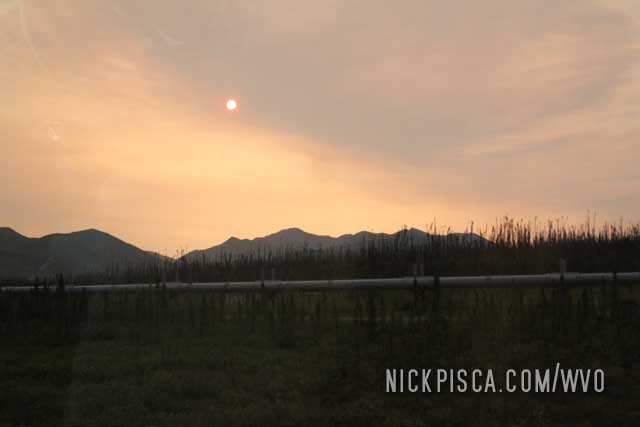
As we headed north of Fairbanks, the road is still really nice an well maintained, then on the horizon, we could see the infamous Alaska Pipeline. Since it runs parallel to the Dalton Highway, it would be our primary companion on the majority trip.
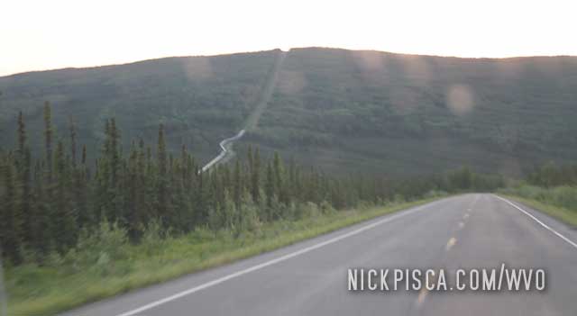
The pipeline sits atop a series of stilts that allows the ground to shift and heave below, without disrupting the continuity of the pipe. Also, there are dozens of pump stations and other service areas so the company can maintain it.
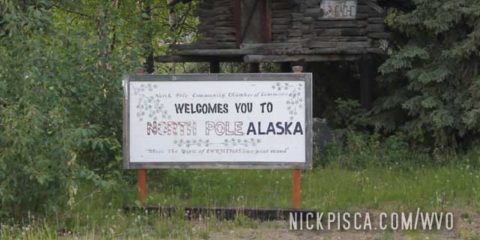
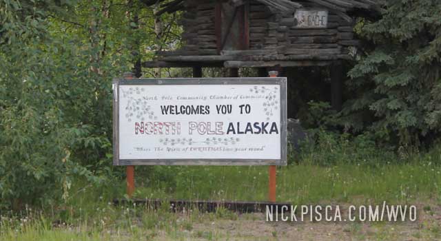
On the way up to Fairbanks, we decided to kill a moment pulling over by the town of North Pole. There is a small touristy building claiming to be Santa’s Workshop. I suspect their post office gets an insurmountable quantity of letters around December 24th every year.
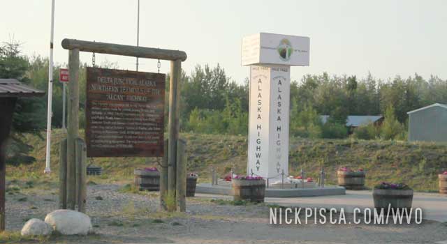
Strangely enough, the end of the Alcan Highway is not in Fairbanks, but in the tiny unknown town of Delta Junction. There is a small monument dedicating the terminus.
Since we are only a hundred-and-some miles to the Arctic Circle, it never really gets dark. We are getting close to Fairbanks and going to push on to Prudhoe Bay.
Back in 2008, we first pulled into Tok after visiting the Yukon. We had some lofty expectations of Alaska, especially since we grew up in Wisconsin, and every other hick dreams of moving up to this place as if it’s Mount Olympus.
Then we faced the reality. Alaska is mostly bogs and swamp, not the pristine mountains and forest from the postcards. If Anchorage is the front door to “beautiful Alaska,” then Tok is the back door. You get to the see the real Alaska that most people on the cruise ships never experience. Unlike the Yukon, which has universal health care, Alaska has a free market and highly-unregulated governmental structure, so people don’t have basic services or building codes. We often found people in Tok without fingers, teeth, or limbs. It wasn’t uncommon to find burned out or collapsed houses. It’s truly like living in the wild west.
In 2008, we wrote:
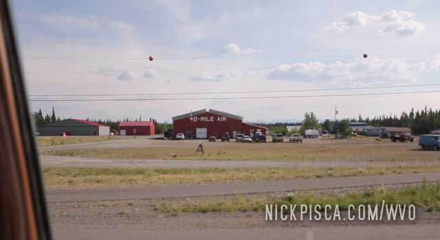
Tok is a tiny little town. While the maps show these places with certain size fonts to describe population, they are barely larger than the smallest towns in Wisconsin. They are hardly towns at all.
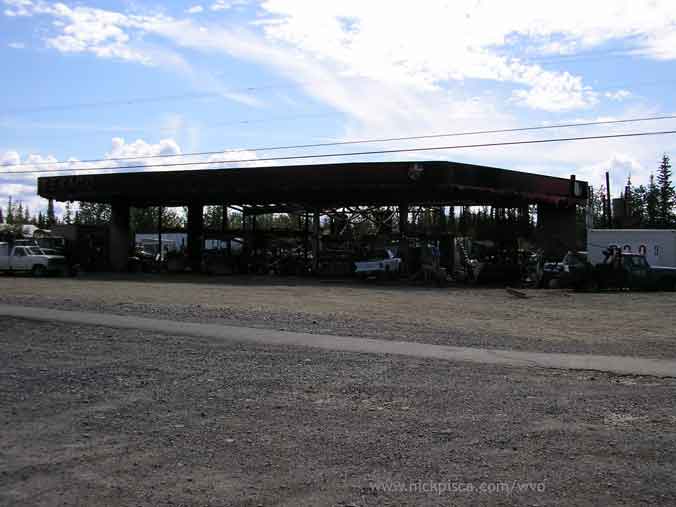
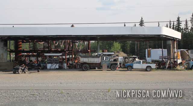
On of the infamous places in Tok is a burned out gas station. As mentioned above in 2008, now in 2013, the owner has used to to have a covered junkyard. Pretty spiffy.
We stopped at one of the few Tok restaurants and ate a dinner. We expected to be on the road for hours and hours and hours up to Fairbanks and ultimately Prudhoe Bay, so we figured this would be the last time we got a non-microwavable meal in a week. Off to Fairbanks we go.
Thankfully, we didn’t have a hassle crossing back into the United States. What people don’t realize about Alaska is, it’s not all like in the postcards. Most of the mountains and glaciers are in the south. The vast majority of the middle is swamp and bogs. Small croppings of evergreen trees and bushes that can survive the frigid winters.
If we made good time, we could be in Tok Alaska for dinner. Ooh la la.
This was a far contrast from the drive from the border to Tok in 2008. The road was in TERRIBLE condition and it was full of frost heaves, construction, and sections of gravel.
The night before, we pulled into Whitehorse really late. It was too late to find a hotel, so we just pulled off and parked the van in the woods at Skeeters. He left us some cubes to make the trip up to the Prudhoe Bay, so we needed to stop by there anyway.
We got an early start the next day, and headed up the Alaska highway as soon as possible. One of the places I distinctly remember on the 2008 WVO Roadtrip was Lake Kluane. At the time, it was under road construction and it was all gravel.
We also passed this lake on the way back down from Anchorage in 2008.
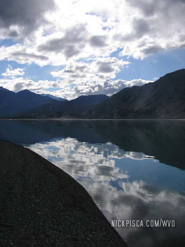
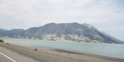
Now in 2013, that’s been paved for five years, and cruising was much easier. I don’t know the geology and geography of the Yukon, but I suspect the light blue color comes from glacial run-off. It’s a really amazing.
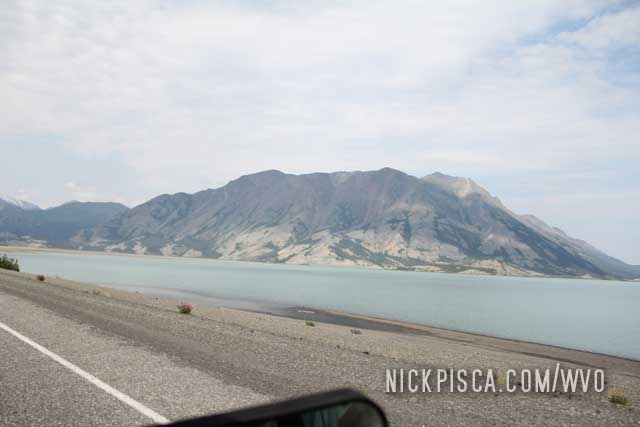
Contrast that to a nearby river, and you can really see the difference in color.
So many different looks for the same lake. It really transforms into something completely different.
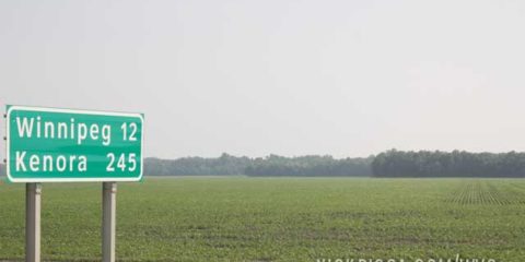
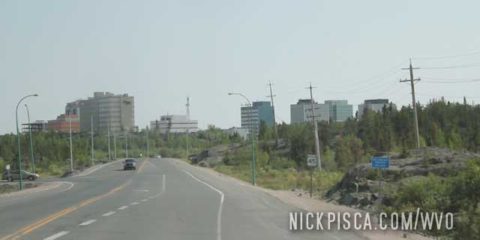
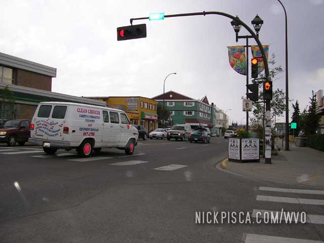
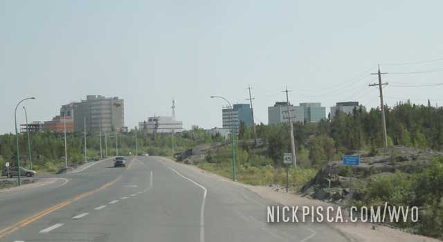
Just like Whitehorse, we really like the town of Yellowknife. It’s up in the middle of nowhere, has a lot of good places to visit, good food, good lifestyle, and plenty of culture. You would think a place this remote would be kind of backwards, but instead, just like Whitehorse, Yellowknife has a lot of forward thinking.
We pulled into town just before rush hour.
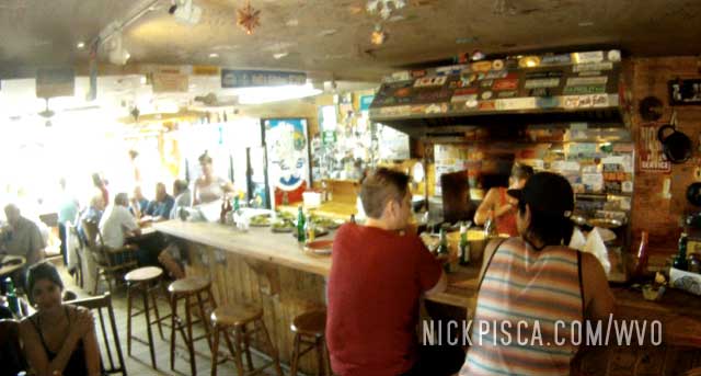
Eventually we stopped in to the local visitor’s center, and we asked about the best unique restaurant in town. They all agreed that Bollucks Bistro was the coolest joint in town.
So we went there. Pulled up a couple spot at the counter. The staff is hilarious and won’t serve you unless you are cool. Since Glenn and I were in no rush, we just hung out for a while till we could get our order in. New customers kept trying to get a seat, and after a while, they would get pissy because the staff was ignoring them. It was wild. After about an hour of us chilling out, Glenn noticed the phone ringing off the hook. Since he’s a chef, he knows the business, and he hollered to the cook if he could man the phone. Elated, the woman let him. So now Glenn was taking phone calls for a while.
Eventually, they got up to us, and took our orders. We ate THE BEST fish fry I have ever eaten. Skewered and marinated on a long stick, the fish was cooked in a couple pounds of butter on a frying pan. Then sprinkled with herbs and drizzled with sweet sauce, the fish is laid on a bed of salad and fries. Amazing.
After dinner, we cruised around the city. Yellowknife is situated on a peninsula on the Slave Lake, and there are all sorts of cool lake houses and houseboats scattered on the shoreline.
After filling up on an alleyway hill, we decided to hit the road before it got too dark. Not that it would get very dark anyway… when you are up at this latitude, the evenings in the summer only lasts a couple of hours.
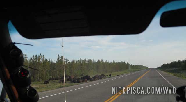
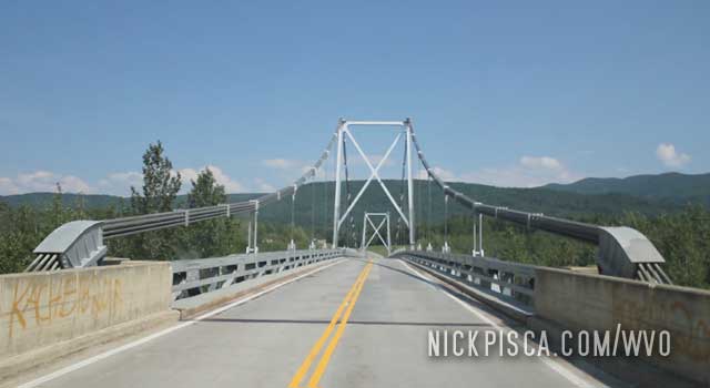
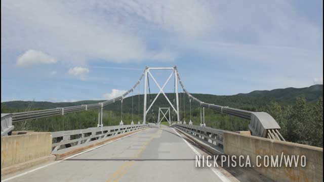
We headed back to the Deh Cho Bridge and saw some bison on the left side of the road. Lastly, we took the advice of the Northwest Territories Visitors Center and began the drive of the infamous MacKenzie Highway.
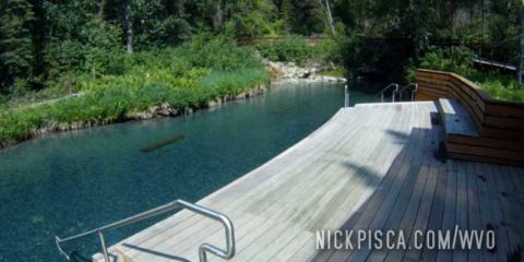
We’ve been to Laird Hot Springs in 2008 and 2013. We could have stopped in 2018, but both our drives north and south put us at a time that meant the springs was closed.
Laird Hot Springs is a MUST stop on the Alcan Highway. After sitting in a car for a few thousand kilometers, you need some time to relax, stretch the muscles, warm the body, and get comfortable.
When we did the first Alaska WVO Roadtrip in 2008, my aunt informed me about this wonderful place. She and her husband used to come up here when they were dogsledders in the 80’s. They would drive up with their dogs and stop here to take a break.
So we pulled off the Alcan and got in the hot spring. It’s great.
From our 2008 WVO Travel Log:
Back in 2008, the facility wasn’t much. Just a wooden walkway and some dock.
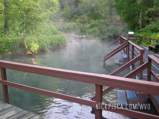
Contrast that to the 2013 WVO roadtrip, and the Canadian government has made some plush improvements. Changing rooms, wooden patios, and all sorts of spiffy stuff.
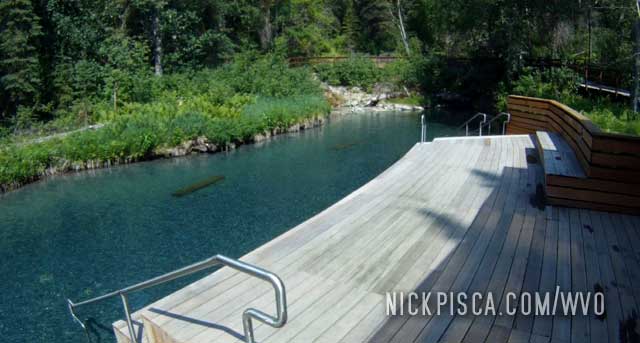
We blew an afternoon relaxing here. If it wasn’t for the fact that we had to make some miles as soon as possible, we’d probably still be there.
After driving a LONG time through the night on the Mackenzie Highway, we got closer to the tiny First Nation hamlet of Fort Laird. It was still really early in the morning, so nothing was going on. We didn’t really see anyone walking around and no businesses were open.
There is a gravel road that connects Yellowknife to the Alcan Hwy. It’s called the MacKenzie Highway. Canadians have this odd ability to name one-lane gravel paths in the forest a “highway,” even though they are hardly a trail. Given a decent rain, these “highways” are no more traversible than a bog. But hey, who am I to judge.
By taking the MacKenzie shortcut, it allows us to save two days of driving to the south. The problem is, the 720-kilometer drive is rather nerve-racking. Take a look of the condition of the road when we started:
Thankfully, it about half bad and half good. When we weren’t avoiding roaming bison and moose, we were finding the optimal path in the washboard gravel and dirt so that the van didn’t rattle to pieces.
Taking the MacKenzie can be a major risk, not just if it were to rain, but also if you need to buy fuel. Thankfully the Veggie Van runs on grease and we can always bring our fuel with us, but for the conventional truck, they need to schedule their drives carefully. The only fuel is at Fort Simpson, and that town is on the other side of a ferry. And that ferry is only open a few hours of the day.
So don’t leave at an odd time. You might end up bear food.
After a few hundred kilometers, the MacKenzie changes into the Laird Highway, not that it really matters. It’s still a dilapidated gravel road in the tundra and there is no other place to turn off. It’s not like there were a lot of options. Either keep driving the Laird Hwy to the Alcan junction, or turn back to Yellowknife.
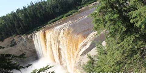
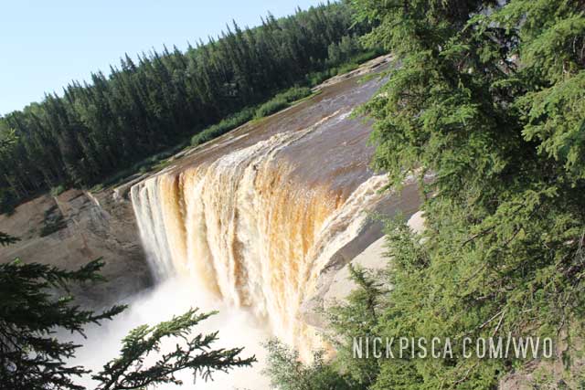
The ranger at the NWT Visitors Center suggested we see this modest waterfall in the Northwest Territories. Holy balls, it was far from modest. If these were in the U.S., this would be a national park, but since it’s up here in the middle of nowhere, it’s just another river.
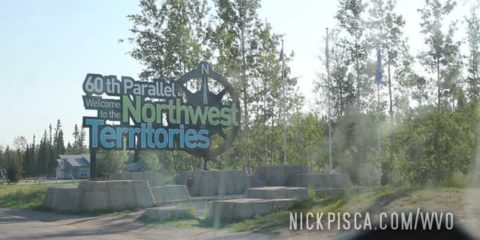
Things are so remote up here, that I’m genuinely surprised there was a sign, let alone such a massive monument to the crossing of the 60th parallel.
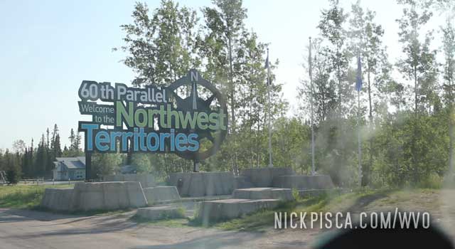
What’s even more astonishing is, there was a visitor’s center up here. Now it’s common knowledge that every Canadian town and provincial border crossing has a well stocked visitor center. What I didn’t expect is one way the hell up here. After the border sign, there is a tiny house and plot of land. There is a playground (for the nonexistent kids traveling around here), and the house has a visitors center and tiny museum. And even more astonishing is there was a human working there. I think we were the first to stop in there in days. He talked our ears off.
He also recommended we visit the nearby Alexandria Falls. He mentioned it was a moderate waterfall, but holy balls. It was massive.
Also, we asked the ranger about the condition of the severely-remote MacKenzie Hwy. By driving the MacKenzie from Yellowknife to the Alcan Hwy, it is a short-cut that will save us two full days of driving. However, it is a one-lane gravel (and dirt) road. We asked the ranger if our van could make it. Since 2013 happened to be exceptionally dry, he figured our tires would make it. It would be a huge gamble, and hopefully his advice would pay off.
After encountering some surly drunkards on a remote part of the highway, we continued north into the afternoon.
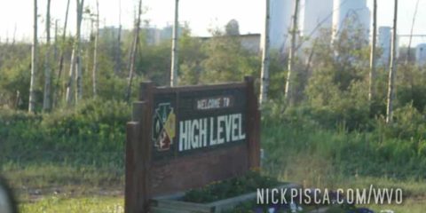
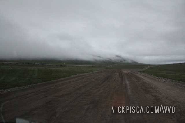
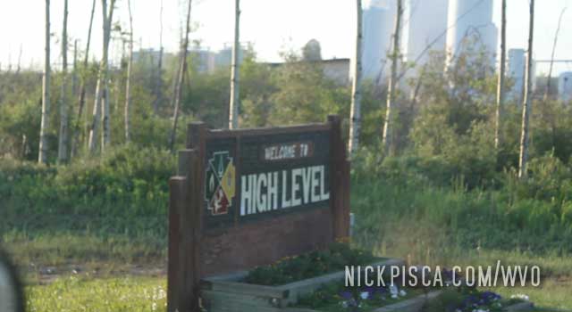
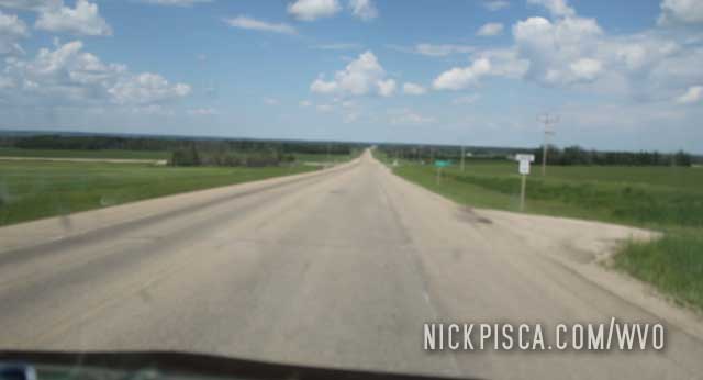
The area south of High Level is really flat and open.
At some point, we needed to fill up on the side of the road. We pulled off on a gravel side road, and set up the cameras.
After a few minutes, a car pulled up, and checked us out. The driver asked us what were were doing. When she realized we had a biofuel van, she was really intrigued. She hung out for a while and even inspected the inside of the van. Her name was Evania and we kept in touch in the future.
Later that year, I contacted her on Facebook and she said she had been tempted to join us on our adventure to the Arctic. We had space, so she would have been welcome to join us. But she had a kid to watch over, so she made the right choice.
After several days of driving north from Los Angeles, we got to Peace River and decided to find a hotel. It was probably the last major town on the way up to Yellowknife, so it was a good opportunity to get some rest and a shower.
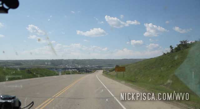
We elected to stay at a place on the west end of town, so we could continue early in the morning on the way up to the Northwest Territories.
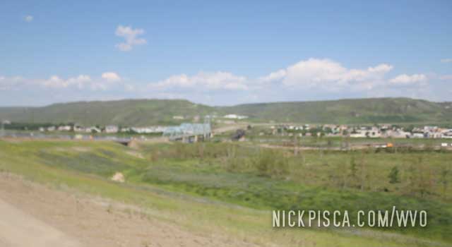
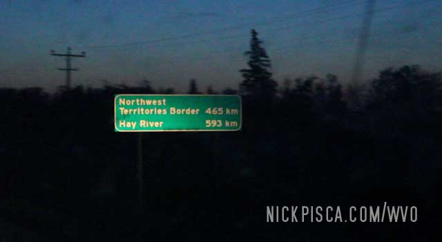
We got up super early and headed north. These provinces are extraordinarily large, especially going north-south. It was almost 500 kilometers to our border, then a bunch more to the town of Yellowknife.
When we got to around the Manning Alberta area, there was a house on the right side of the road. As we drove up, some First Nation guy was pulling a motorcycle out of a bog much like the one in the picture below. An overweight woman and another man were arguing over the man in the drink, and they all were drunk and hangry.
Since we hadn’t seen another car or person in several hundred miles, we slowed down to ask if they needed help. Before we could say anything, the man angrily asked, “What the fuck are you looking at?”
We drove off. Must have been some kind of domestic issue. I suspect they had a party, the first guy tried to drive off but was too drunk, and he put ‘er in the pond. The others ran out to help him, but none were aware enough to help anyone. Kinda surreal.
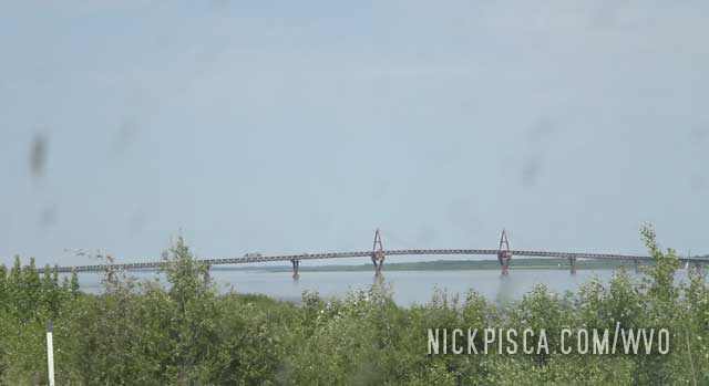
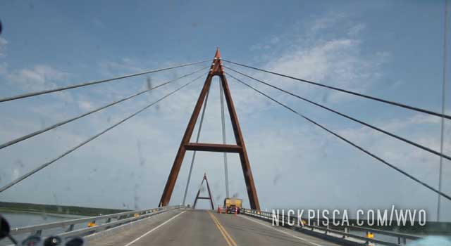
Crossing the MacKenzie River in Canada can be tough. But the newly constructed Deh Cho Bridge makes short work of the waterway. What an elegant structure in the middle of nowhere. Makes you wonder how many Canadians will never get up this far to experience this beauty.
Little Smokey River:
It appears the major rains were only south of us. Once we got above Red Deer and Edmonton, the flooding was minimal.
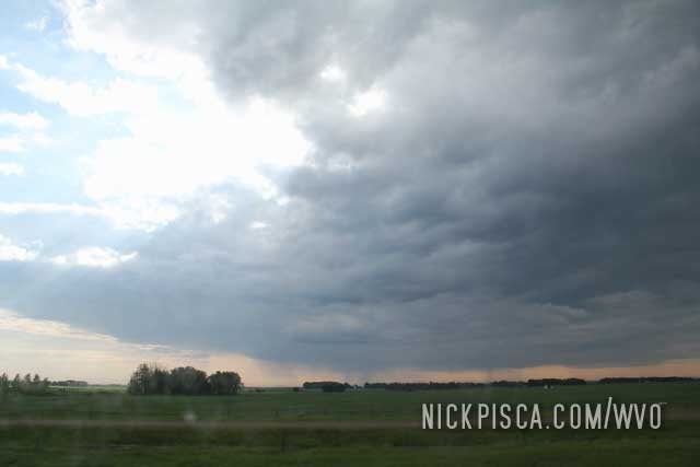
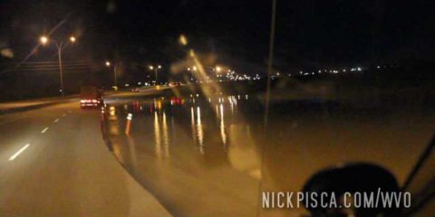
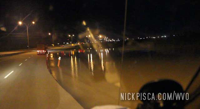
Through a crazy series of events, we ended up driving through Calgary during some MASSIVE flooding. The highway was getting shut down just as we got through the city. The radio was “flooded” with news alerts and evacuations and all sorts of madness.
Just by coincidence, a friend of ours happened to be driving through Canada from west to east. Our plan was to meet up in Calgary this night, but after spending a long time playing phone tag, she told us they had avoided the area. Unlike us, she had been paying attention to the news and she intelligently elected to avoid this evacuation area.
But since we were already in the thick of it, we just pushed on. We figured as long as we could get passed Calgary, then we could rest at a Walmart parking lot in Red Deer.
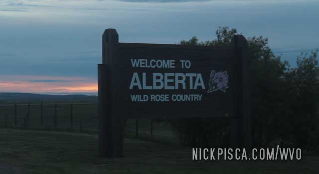
We crossed the border with few issues. Unlike the American border agents, the Canadians are usually pretty cool with the veggie oil in the back.
The 2013 WVO Roadtrip was the first long-scale journey with the Veggie Van. This van is a 1988 full-size Ford 3/4-ton Diesel Clubwagon, which means massive size and weight. That equates to lesser fuel economy than our usual trips in the Jetta, Passat, and Mercedes wagon.
In order to make this journey to the Arctic Ocean and back, we needed more oil than I could pack from Los Angeles. So, we contacted our friends in the Yukon (Skeeter and Mike) to see if they could help, and they offered to load us up. And even with that supplementary biofuel, we calculated that we needed another few dozen cubes.
So, a month prior to this trip to Alaska, Glenn took the time to tow out several cubes and stash them in a storage locker in Shelby Montana. He also left a few scooters that he rebuilt at his house. These scooters would be our backup vehicles if the van had a catastrophic breakdown somewhere on the Alcan, Dalton, Mackenzie, Laird, or Top of the World Highways.
Here’s a picture of Glenn showing me his awesome scoots by Ghost riding the whip.
Almost up to Shelby. Then we cross the border. Keep on keepin’ on.
On the way up to Shelby, where Glenn had previously stowed several cubes and scooters in a storage locker.
Near the Idaho – Montana border…
In 2008 and 2010…
No time to stop in SLC. We need to make up for lost ground doing repairs in Mesquite. Onward to northern Montana.
In 2013 and 2021…
Basically, every single time I go to SLC, I have to stop at the best Mexican restaurant on the planet: The Red Iguana.
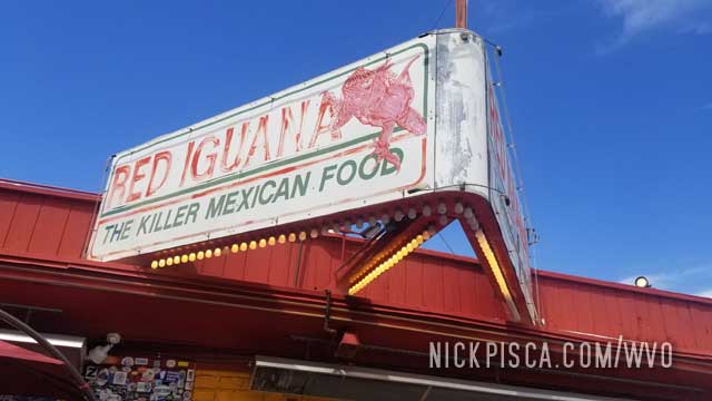
It’s hard to explain just how amazing and flavorful this place is.
That was pretty much the end of the 2021 roadtrip. We ate some food and decided to make the last stretch from Utah, Arizona, Nevada, and California back to LA.
On to the next roadtrip in 2022. Maybe we’ll finally finish the entire Mississippi River. Who knows.
It seems like every time we pass through Mesquite, we have some kind of mechanical failure. It’s really awful luck.
The 2006 WVO Roadtrip was the genesis of the terrible Mesquite breakdown.
10:05pm GN Monday. 1707 Trip Meter Reading.
We added three cubies to the tank. We drove for the longest stretch without adding fuel and literally ran the tank dry. Glenn was concerned because much of the fats and particles collect at the bottom of the tank. Plus the VO acts as a solvent and deteriorates some of the lining of the converted diesel secondary tank.
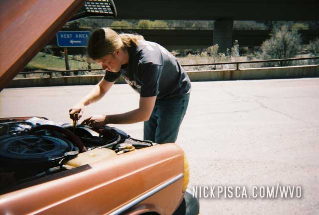
There was some sort of vibration coming from the rear axle, and unfortunately the driver’s side CV boot had cracked. He was somewhat concerned, but claimed that he’d piloted vehicles for thousands of miles without replacing the axle.
Turns out our jacked up height in the back end had put undue stress on the 25-year-old rubber boot. Our fix to one system had introduced a new problem to another.
12:29am GN Tuesday. 1815 Trip Meter Reading.
Small / Primary filter replacement (Silver Shell Container). Eight gallons of diesel purchased.
4:00am GN Tuesday.
Wow.
While Glenn drove through west Utah and Arizona, I slept through the gradually increasing vibration coming from the rear. Slightly disoriented, I hollered to Glenn that we weren’t going to make it through Arizona mountains with this shaking. He reassured me that we had already passed through them, but we maybe had five more miles left on the axle as is. Not only was the vibration out of control, but there was the sound of screeching metal and worn bearings. We approached the town of Mesquite, directly on the Nevada border and promptly found the first exit. I jogged to the back of the car to see smoke billowing from the boot. As a stroke of luck, there was an all-night Walmart literally one block to our right. Glenn suggested that if we could squirt a sizable amount of motor oil on the bearings, we could limp the wagon to the supercenter and purchase some bearing grease: if they even had any. I scavenged around for a plastic bottle from the ditch, from which we punctured the cap to make a squirt-bottle for oil. But the bottle didn’t shoot very far. Then Glenn produced a clear hose and we siphoned some 10W40 into the boot which got us the remainder of the way. The Walmart didn’t have any of the special axle grease Glenn used for the other CV joint. Fortunately, we did stumble upon some generic marine trailer lubricant that would probably hold the best. We figured that trying to close up the boot with duct tape would be futile: our best strategy would be to pump the joint full of marine grease, let it spin loose until empty, and replace the goop every ten miles or so. We just might be able to make it to Las Vegas, only eighty miles away, by sunrise. Otherwise there exist no Mercedes dealerships or mechanics that would have the resources or parts to handle our vehicle.
After a couple laps around the lot, Glenn stated, “Fuck it. Let’s go.” After ten miles down I-15, the vibration returned to a relatively loud level and we repacked the boots at a desert underpass. We repeated this procedure five times until we made it to Vegas and parked at Circus Circus, due to my experience with that casino and proximity to the north of town.
We made it to Vegas, and that story is continued on the Las Vegas article.
This 2013 WVO Roadtrip was another typical breakdown in Mesquite.
This time we were driving through the desert and the veggie tank was getting full.
We pulled over on a semi wayside, and filled up the grease. While waiting for the oil to flow down the funnel, we noticed a fluid dripping from the Overdrive unit. Turned out the rear seal was totally obliterated, and the fluid level was severely low.
We quickly got back in the van asap to limp it to Mesquite NV. We figured what little fluid we had left would drain out if we didn’t get it to civilization quickly. We left the wayside and headed down the road.
Eventually we got to Mesquite which was a few dozen miles from our breakdown. We used the GPS to find a Carquest on the east side of town and they luckily had a replacement tailshaft seal in St George. While we waited for the part to arrive, we parked the van in the back lot and walked around the town to kill some time.
After a few hours of dinking around, we headed back to the auto parts store who had our part in hand. Thank god. IF they couldn’t get the part on this day, we would be stuck in Mesquite for 2 days.
The parts store was really nice, and they let us swap out the tailshaft housing seal in their parking lot. While we were working on our veggie van, another old man was wrenching on his RV next to us. We often jibber jabbered while the other was working. He was a cool guy, but his engine problems were severe. I hope he got it running.
After we got the veggie van all sealed up, we headed north. The section of Arizona on the I-15 is exceptional, and one of the best parts of the entire American highway system.
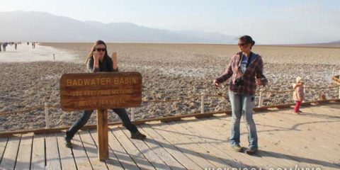
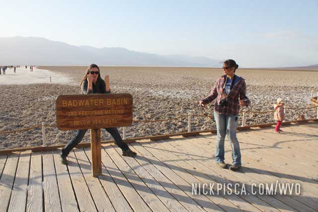
We took a weekend trip to the lowest point on the Western Hemisphere.
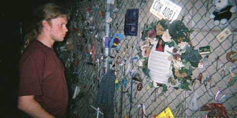
We got into OKC really late in the night and wanted to check out the Bombing Memorial. We had not idea on if the park would be open late at night, but fortunate for us, the place is open and protected by security 24 hours a day. We got to take our time and pay our respects to the people who died in the Oklahoma City Bombing.
Visitors have adorned fences and walls with bits of personal artifacts to commemorate their visit. We didn’t have anything to contribute, so we went about our way.
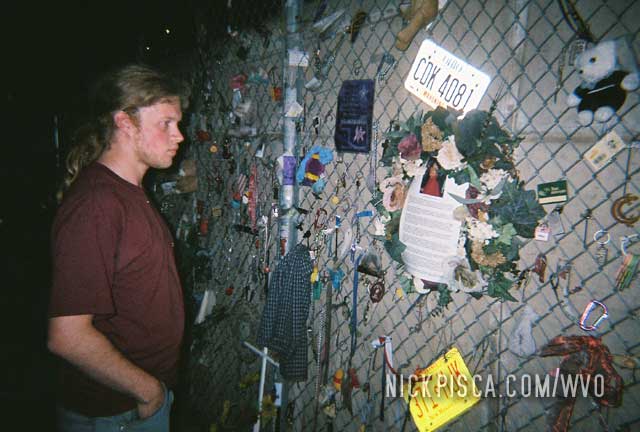
We also visited this site in October of 2013.

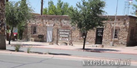
2013, 2018

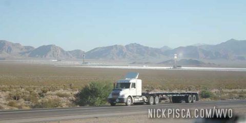
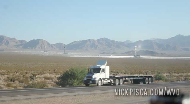
2008, 2013, 2018

2013, 2018

2013, 2018

2013, 2018

2013, 2017

2013, 2015

2013

2013, 2021

2013, 2016

2013, 2015

2013, 2015, 2021

2013

2013

2013

2010, 2013

2010, 2013

2013

2013

2013

2013

2013

2013

2013

2013

2013

2013

2013

2013

2013

2013

2013

2013

2013

2013

2013

2013

2013

2013

2013

2013

2013

2013

2013

2013

2013

2013

2008, 2013

2013

2008, 2013

2013

2013

2008, 2013

2013

2013

2013

2013

2013

2013

2013

2013

2013

2013

2013

2013

2013

2013

2013

2013

2008, 2010, 2013, 2021

2006, 2013

2013

2013

2013

2006, 2013