Honestly, I don’t know why Cleveland gets a bad wrap. It’s a delight!
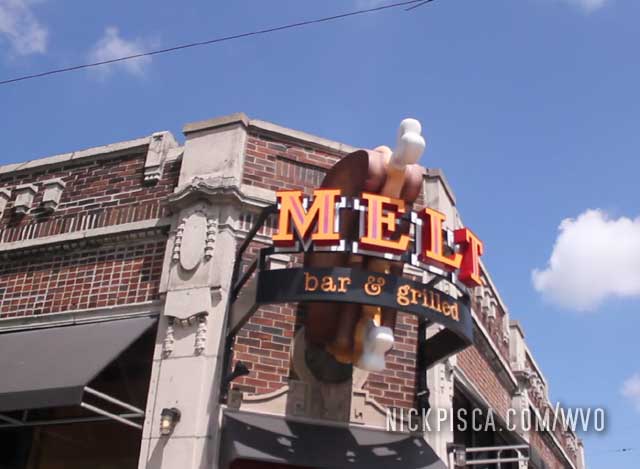
First we asked some locals for a good place to eat, so they suggested the infamous Melt Bar and Grill. They had something like 12 types of grilled cheese.
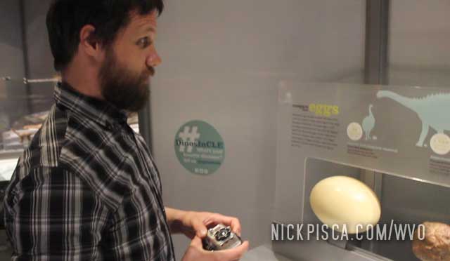
Then we drove to the university area to visit the History Museum. Glenn saw that dinosaur suppository and got a little excited for insertion.
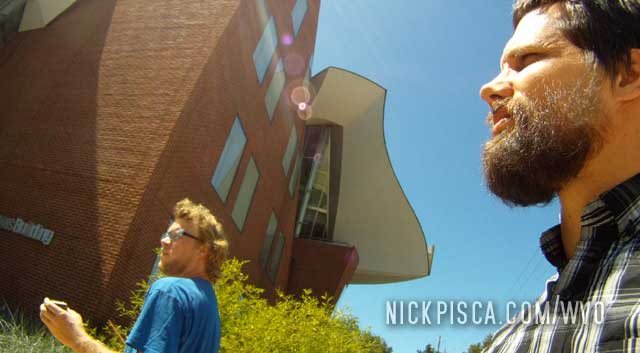
Then we circumambulated the Frank Gehry building on the campus.
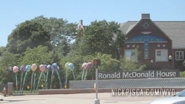
And checked out the famous Ronald McDonald House.
And cruised through downtown.
Cleveland was actually an amazing town.
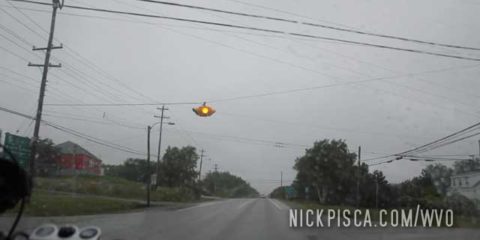
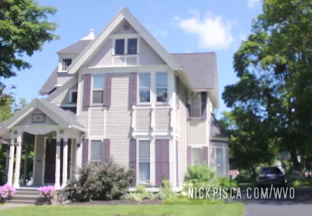
After visiting PEI, we elected to drive through the night to get to Avon, NY. A man named James had contacted us and wanted to meet up. He is a fellow greaser and offered to help us get back to Wisconsin.
So off to Avon it is. On the way there, we saw a bunch of ancient Painted Lady houses.
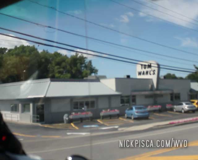
Next we got a burger at Tom Wahl’s. This is a local institution.
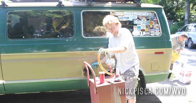
Then we met up with James. He was a great guy. Thanks for giving us a tour of your grease vehicles and topping us off with a full tank of VO. 🙂
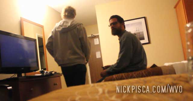
It was getting late so we decided to stay at the historical Avon Inn. It is totally haunted.
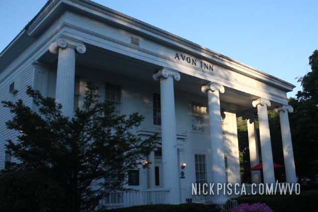
It had this cool 19th century interior with all sorts of creaking and other spooky sounds. Glenn totally got scared throughout the night, and said some ghost raped him.
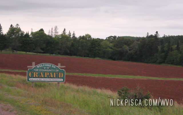
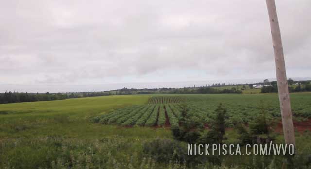
Cruising around Crapaud.
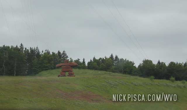
Some huge inukshuk in the heart of PEI.
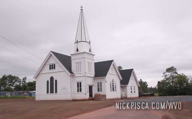
A bunch of churches near Carleton.
Shingled siding near Sackville Nova Scotia
This place is like a time warp. There must have been buildings here from the 19th and possibly the 18th centuries.
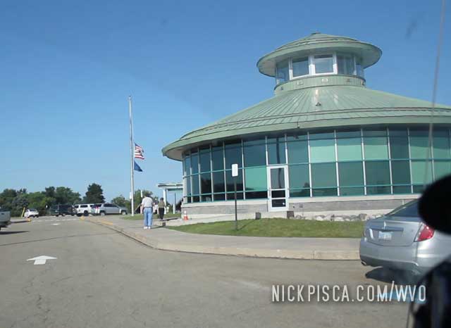
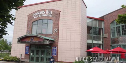
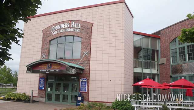
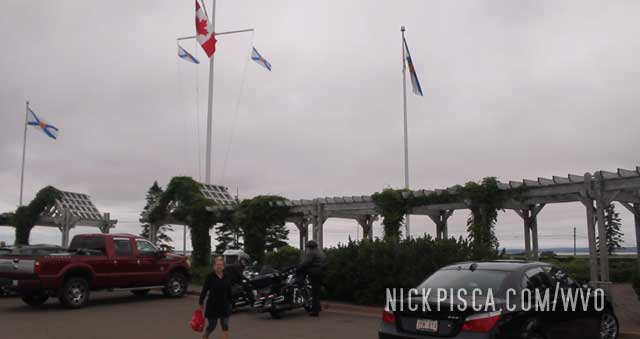
Charlottetown is kind of like the Philadelphia of the U.S. It was where Canada declared it’s quasi-independence. We went on this tour of the Founder’s Hall, where they described how they established their confederacy. Basically, the eastern colony governors met up to have a shindig in 1860-something, and the western territory reps crashed the party. They all got drunk and decided to draft up some kind of union. They didn’t have the balls to declare independence like their big brother America, so they basically stayed the proverbial basement of Great Britain until their 30’s.
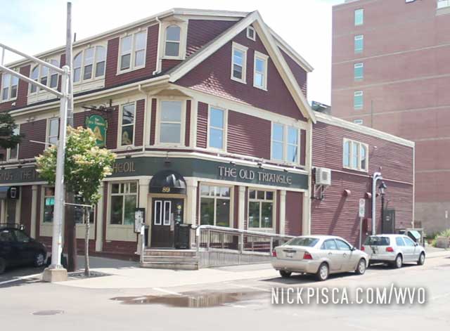
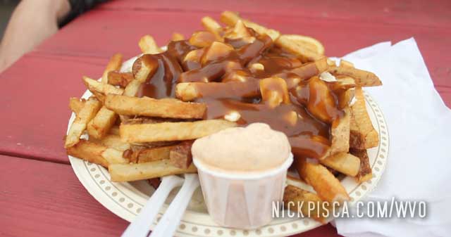
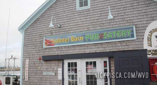
Anyways, enough joking about Canada’s history. Instead, let’s focus on the delicious poutine served up by the hot woman at the Chip Shop in Charlottestown.
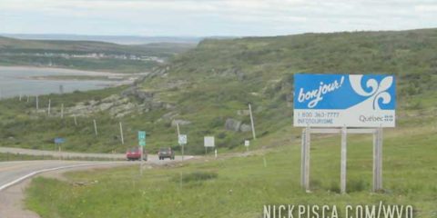
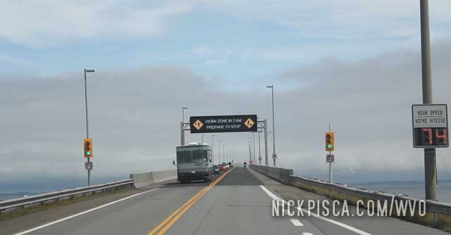
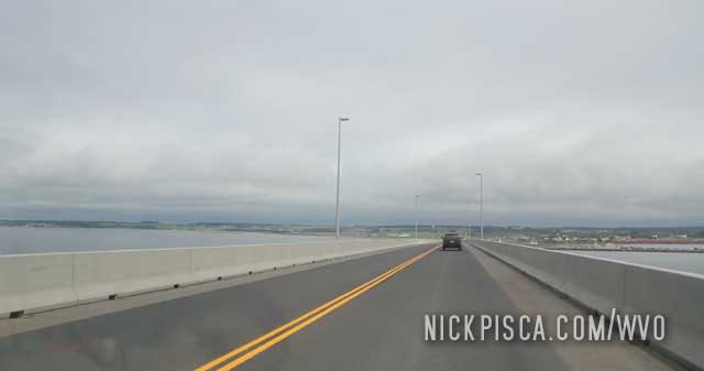
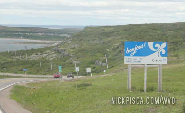
After crossing the biggest bridge in history, we stopped at their nifty visitors center in PEI. They suggested we stop in Victoria on the way to Charlottestown, the capital.
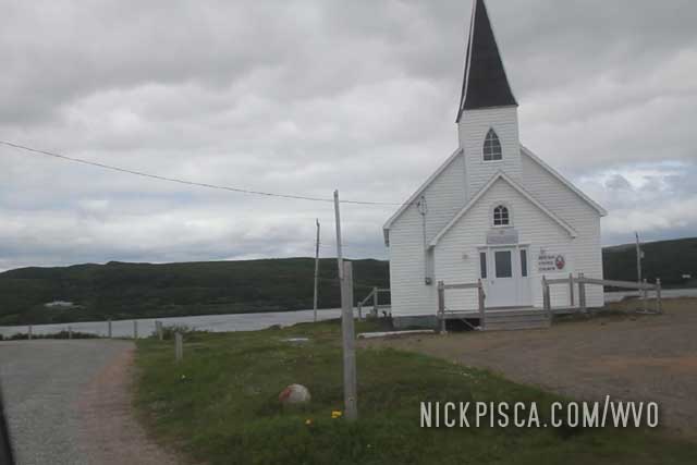
Victoria was a nice place to stop. Kinda touristy and kinda boomer-targeted. The natives told us to try “cold lobster,” which is just boiled lobster that is chilled. You still eat it with butter and whatnot, it’s just cold. I didn’t really get how this was so good. Anyway, I’m a crab guy anyway.
Victoria has a long pier where old couples go to make out. We ruined their fun by smelling like farts.
Apparently Glenn’s butt was so smelly, this couple tried to kayak up wind.
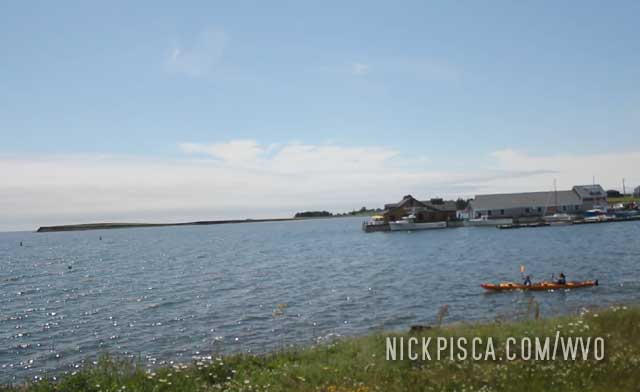
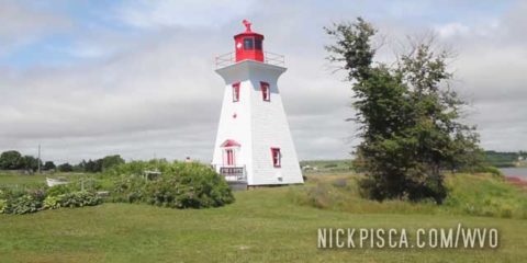
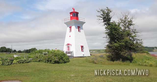
Nearby, there was a decorative lighthouse. Quaint. On to the capital.
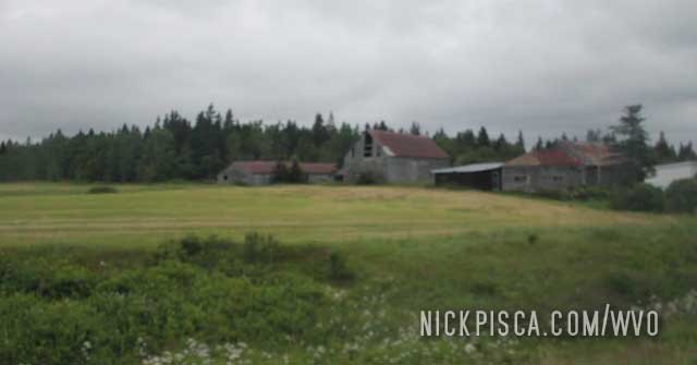
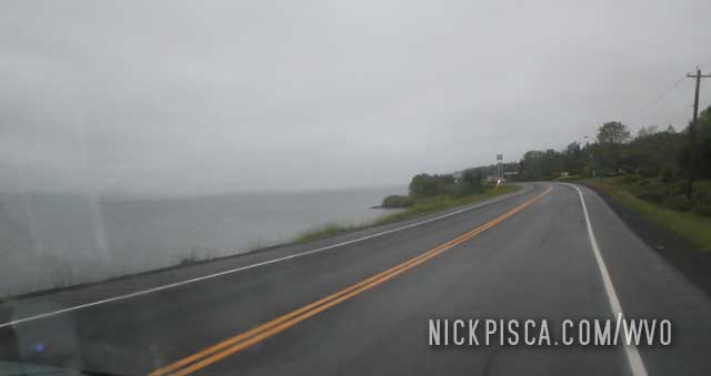
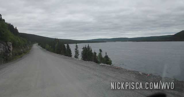
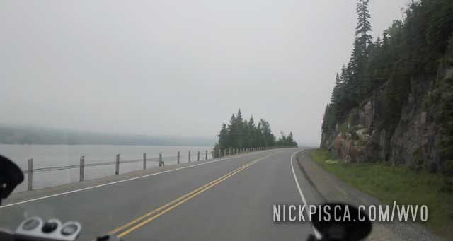
After resting in New Glasgow, we drove for a bit through Nova Scotia. There was this nice rest area near the shore that was interesting. Nova Scotia is kinda like northern Wisconsin. Lots of farms and churches.
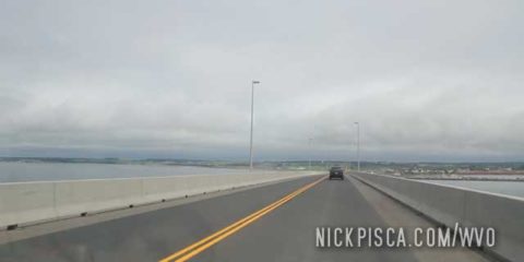
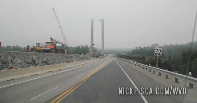
Eventually we approached the MASSIVE bridge which seemed to go on forever.
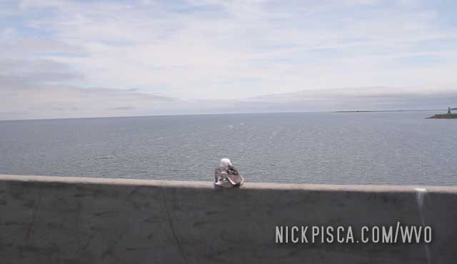
Prince Edward Island (PEI) resides in the St Lawrence Seaway and is separated from the mainland by the Northumberland Strait. Here is a picture of a bird on the strait.
After 129 hours of driving, we finally crossed the bridge onto PEI.
Glenn was looking a little ragged, so we crashed out for the night in New Glasgow. It was about time. The last time we had a shower was 3.5 days ago.
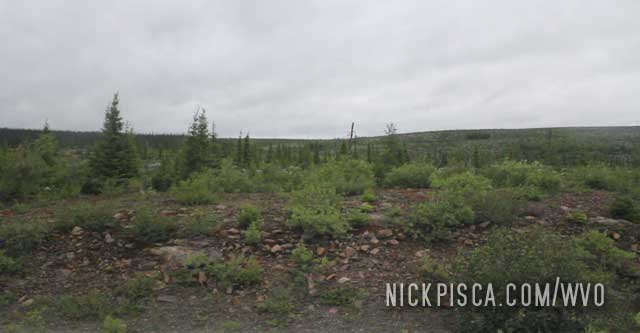
Some pictures of scenic Nova Scotia.
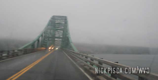
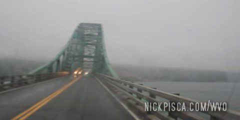
Hawkesbury bridge above. Canso Causeway below.
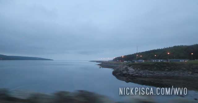
Baddeck NS below.
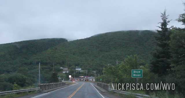
Some mountains near Skye River in the Nova Scotia Smokey Mountains.
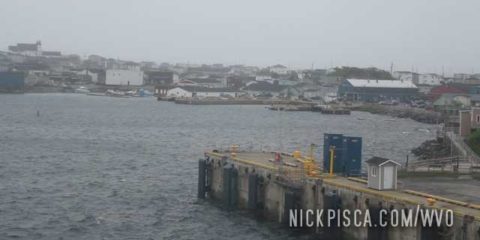
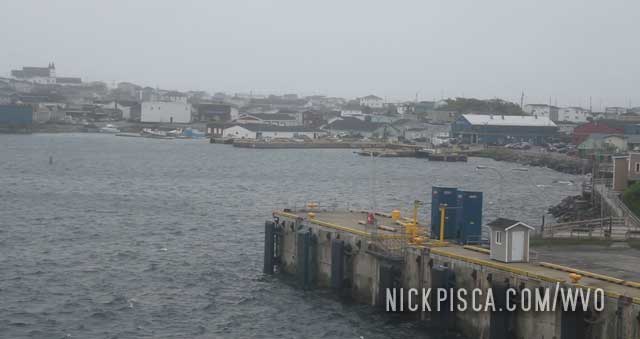
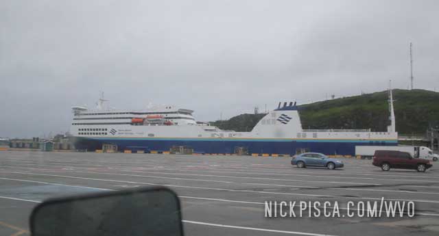
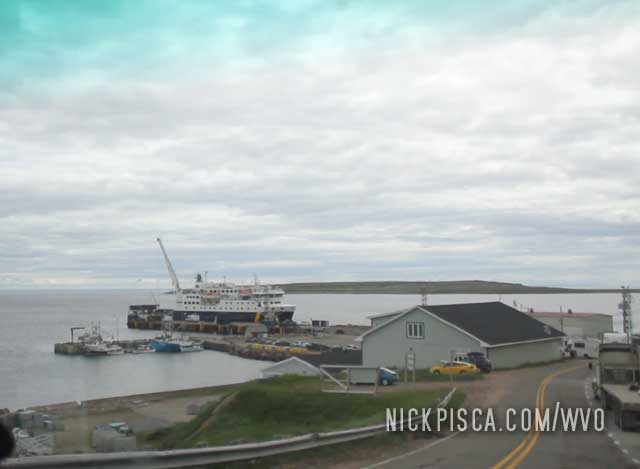
Arrived off the ferry and headed into Sydney.
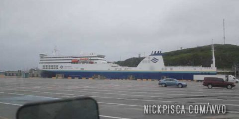
The ferry from Sydney Nova Scotia to Channel-Port Aux Basques connects the Canadian mainland to Newfoundland. It takes about six hours to cross.
The particular day we set sail was exceptionally cold, windy, and stormy. Even though we were loving these plush seats, we were in for a Nor’easter.
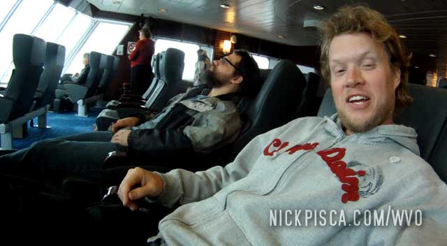
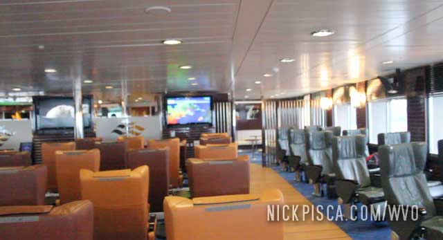
The top level had some nice amenities but few opted to pay for the extra cost to get into the business class. There was an even better premium class above, but god knows how expensive that must have been.
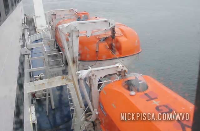
The wind created some decent swells. Even though we were on the third floor, water would crash onto the deck and splash our windows. The waves made walking around the boat really difficult and sickening. At one point I went out to take some pictures, but it made me seasick to stagger around. I elected to stay seated for the duration of the ferry ride.
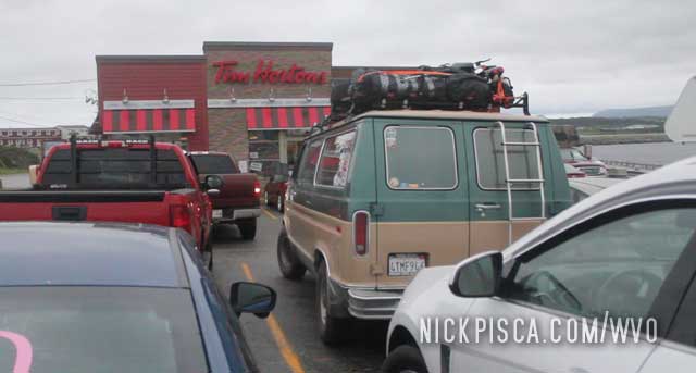
Channel Port Aux Basques is a tiny town on the southern tip of Newfoundland that has a major ferry port back to the Canadian mainland. We drove through the night from St John’s only to arrive in CPAB at around 4am. Naturally, like most typical Canadian small towns, there is nothing open at that hour, except for the trusty Tim Hortons. So we hung out at the TH for a few hours.
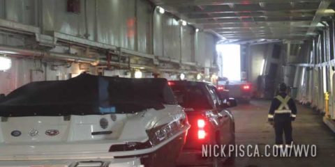
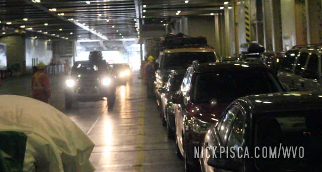
We used the Tim Hortons wifi to book our tickets. Unlike the small ferry from Blanc Sablon to St Barbe, the CPAB ferry is massive like a cruise ship. A standard ticket for the ferry is cheap, but you don’t get a dedicated seat. So we elected to reserve some business class seats in the upper deck, so we could relax for the 6-hour boat ride. We never had a hotel room since the stay at Lans Aux Meadows, so maybe a recliner would be the next best thing.
After a few hours of Tim Hortons breakfast sandwiches, we trekked down to the ferry. pretty spiffy.
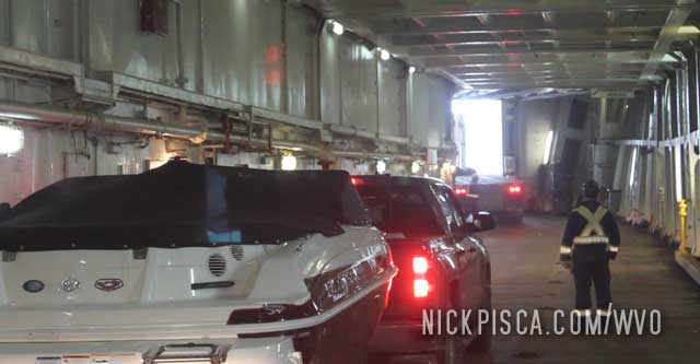
The auto bay was massive. They strapped the wheels down to the deck and we headed up stairs.
We got some good seats with a great view of the town.
An now, we can finally get some sleep.
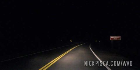
We had to drive throughout the night in order to make our morning ferry at Port Aux Basques.
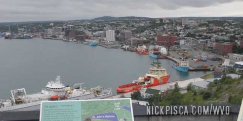
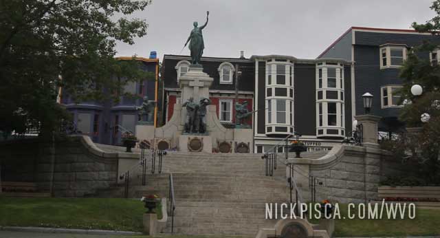
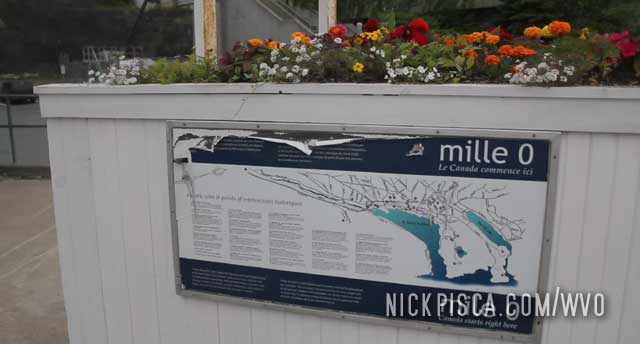
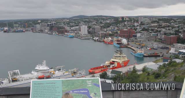
St Johns is the furthest point on the 2015 WVO Roadtrip. It also constitutes the furthest east we ever drove on alternative fuel on any of our journeys. Also, this is the furthest east we drove on the Trans Canadian Hwy (THC), which is colloquial known as Mile One.
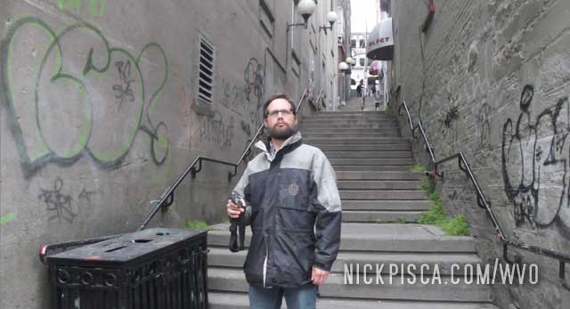
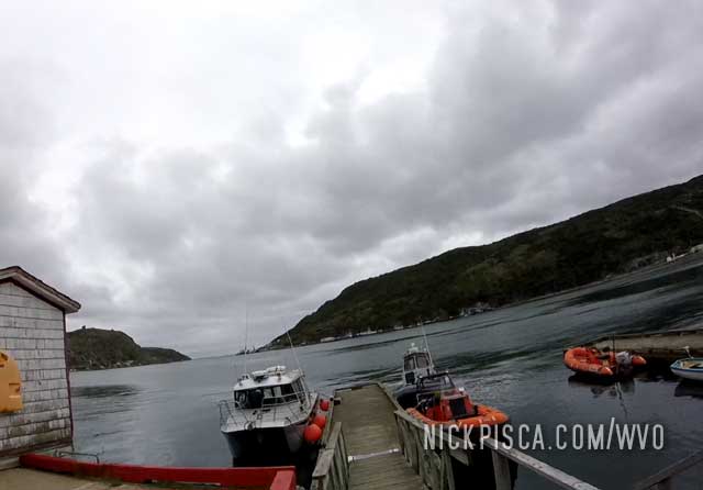
We parked the veggie van and took a long walk around the city.
This confirms it. We have officially driven every mile of the THC over 8 years of Vegetable Oil Roadtrips.
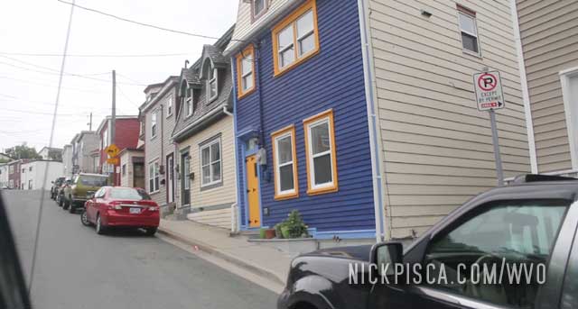
St Johns is really nice. We got to eat some Canadian Fish Sushi at a spiffy Asian fusion joint.
The bay is pretty scenic.
Up on the Battery Hill, you can see the vast expanse of the city. It’s rather large. This is no hamlet in the fjord.
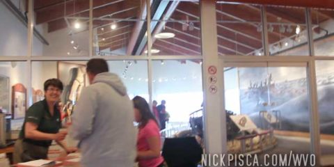
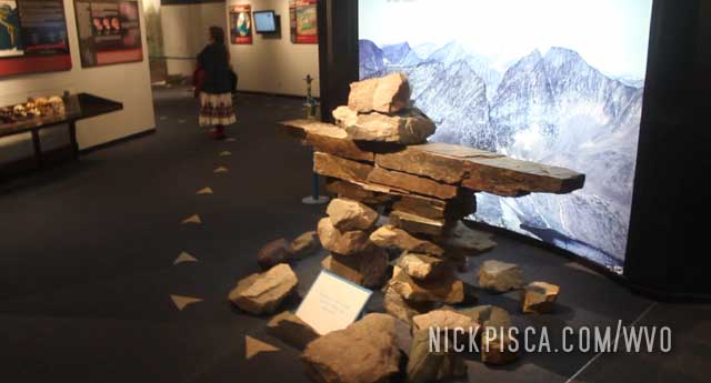
The GEO Science Center has some educational exhibits. They showcase both scientific and indigenous artifacts. Their Titanic showcase is exceptional, because this town was the closest reasonably large settlement that could aide the victims of the sunken vessel.
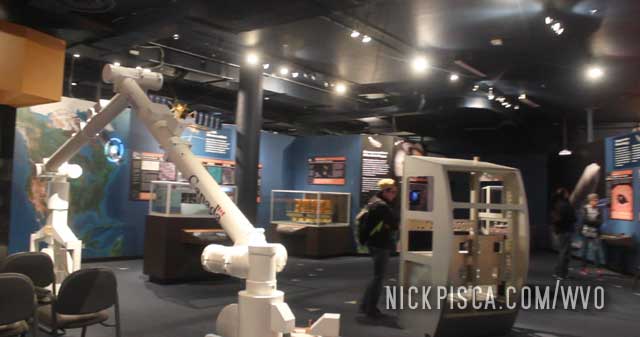
The Canuks are thrilled about their “Canada Arm.” I call it the “Canadian Handy.”
We had to go after only one day of venturing around the town. We knew we would have to drive through the night to catch the ferry at Port Aux Basques in the morning. However, we contemplated taking a day trip to the French territory of St Pierre and Miquelon. Very few realize that there is a French island in the heart of the Canadian east. It would have proved to be a difficult trip, because we could only afford one day there, and with no plans or reservations established, it was prohibitive. Also, we were having some van problems, so we gave up on the project. Oh well, maybe next time.
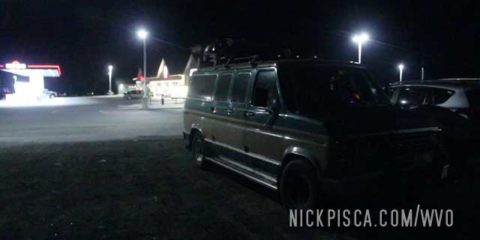
Glenn put on some major miles really fast, so we got to the St Johns area too early. We pulled off in a gas station out of town so we could catch some Z’s before the sun rose.

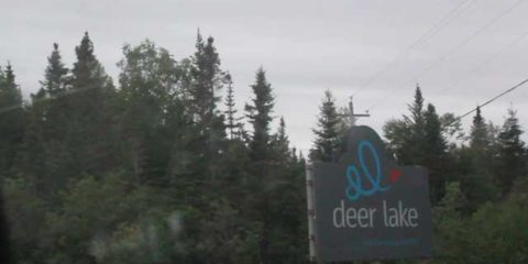
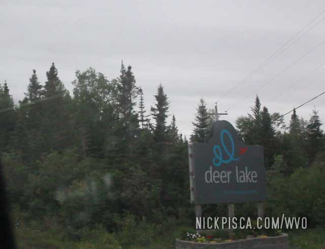
Newfoundland has a portion of the THC (Trans Canadian Highway) that cuts through it. Even though the island doesn’t look that big, it is actually rather huge and it has massive fjords that cut deep into the coastline. That means what is merely a 400-km distance as the crow flies, ends up being a 1000-km drive one-way. We wanted to get to St Johns to limp the van back to Wisconsin and Los Angeles due to the oil-in-coolant problem. So Glenn elected to drive from Deer Lake to St Johns so we can finish the THC once and for all.
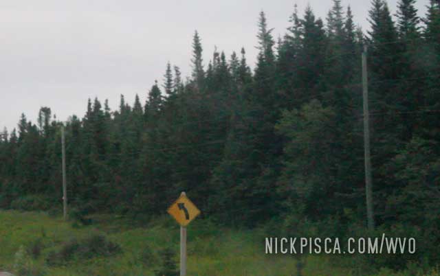
We also drove thru Springdale where the hills and forest start to get really thick.
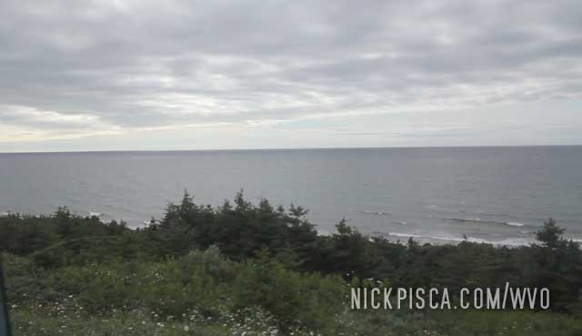
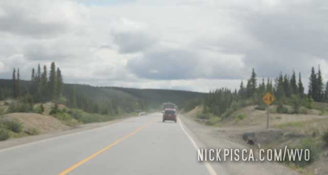
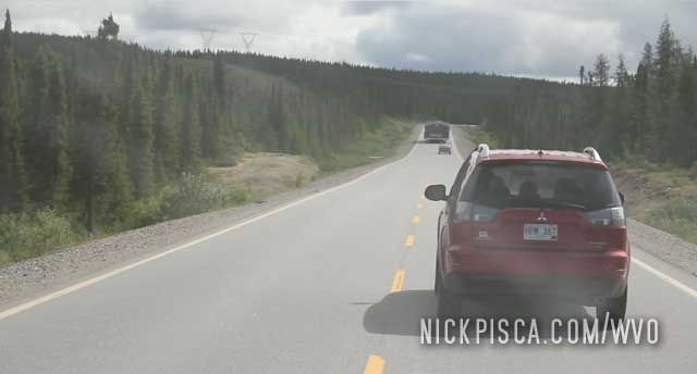
Driving the coast of Newfoundland is fun!
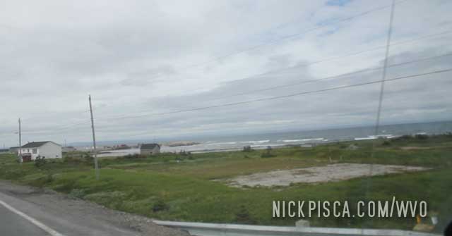
Newfoundland is scattered with tiny towns all over the island. Each has their own little charm.
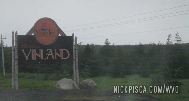
Wow! First time in Newfoundland! After we departed the St Barbe ferry, we headed north to the Lans Aux Meadows World Heritage Site. We didn’t have a definitive plan. We just wanted to get up as far north as possible and find a hotel in the area. As we drove northbound, we saw more and more signs talking about Norse culture.
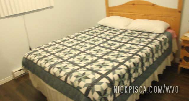
We didn’t realize just how big Newfoundland is. Not only that, the northern part is VERY remote. There wasn’t much for hotels and motels up there. After driving around some, we found a hamlet with a general store that discussed a family that rents out a cottage. Considering this was the first time in a while we could catch some Z’s before the upcoming 1000-km drive to St Johns after visiting the world heritage site tomorrow, the moderately-priced cottage was not too big of a deal.
The cottage was nice and cozy, and it even had two bedrooms so I didn’t have to hear Glenn crap his pants all night. That night, it got below freezing. We even brought the cans of soda into the cottage so that they wouldn’t freeze and explode in the vehicle. I simply cannot believe that in the middle of July, it could be below 32 degrees in the day and evening.
Before we went to bed, we found a small upscale restaurant on the tip of the peninsula. It was called The Norseman, and we were severely underdressed. The food was probably the nicest and elite stuff we had eaten in a decade. Much better than the microwavable meals we usually eat on these trips. We headed back to the cabin for the night.
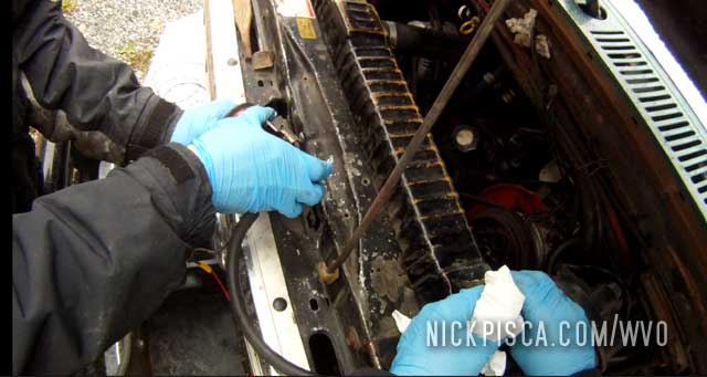
After a good night’s rest, we came outside to check over the van. It had been running for about 8 days straight, so it was overdue for a thorough lookover. Upon inspecting the radiator, we had a catastrophic realization: the oil cooler repair we conducted in Wisconsin at the beginning of the trip did NOT work. There was a substantial quantity of grey oil in the radiator. We spent the majority of our morning trying to siphon out a lot of the oil out of the coolant. Most of it was floating on the coolant, because oil floats on water, but that meant our whole coolant system had been compromised. We had to decide what to do next: keep on going (carefully), or abort the mission. Since we are basically at the halfway point of the entire 2015 WVO roadtrip, it seemed foolish to abort now. In a way, the halfway point is already the de facto abort point, so we elected to keep on going, and make a procedure to pump out the oil as it accumulates in the coolant over the next few days.
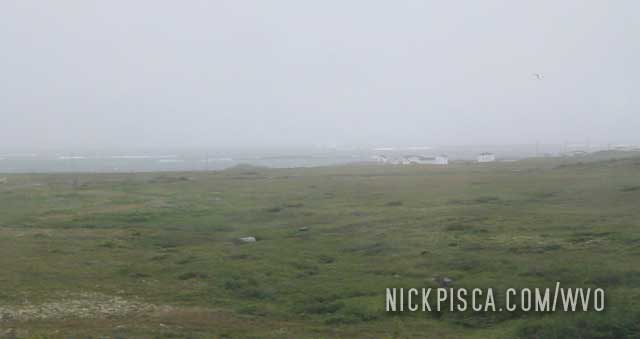
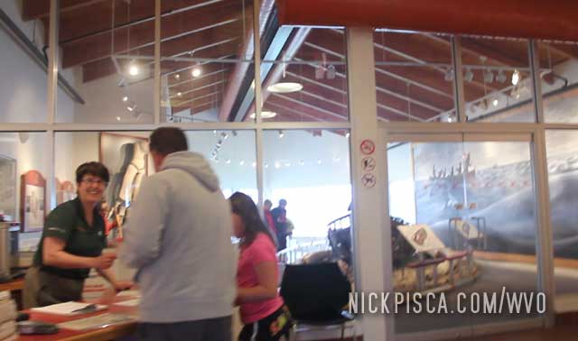
We got to the Lans Aux Meadows site and it’s a truly impressive place. I think this was the first World Heritage Site I had ever visited, and it’s on par with the best of the best national parks facilities. It was FREEZING out, in the low 30’s and with gusts of 30-40mph. I wore literally all the clothes and jackets I packed, because I was not expecting wintery conditions.
As we entered the Lans Aux Meadows visitors centers, there was a bunch of rangers and tourists on the inside. As we struggled to open and close the front door against the gusts of rainy and snowy wind, we got inside to declare, “We should come back here in the summer when it’s warm.” The rangers and tourists got a good laugh out of our joke.
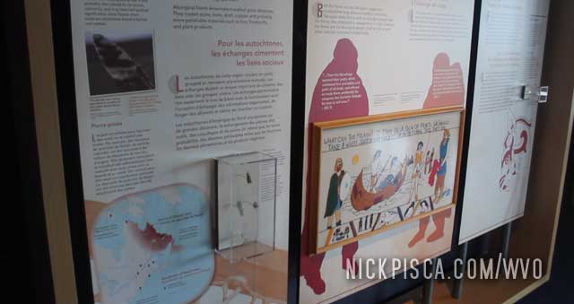
The visitors museums has all sorts of multimedia displays and actual artifacts from the Vikings that lived here in the middle ages. It was an impressive museum.
The site has a series of trails for tourists to explore the grounds. The site is situated directly on the Atlantic coast.
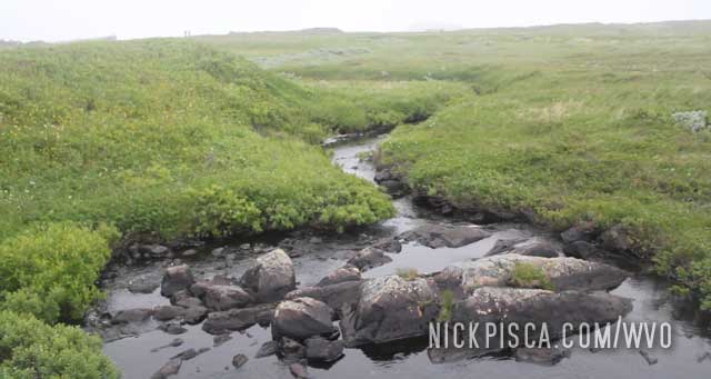
There are little creeks and streams all over the place. There are not a lot of trees. It’s kind of like permafrost or tundra-like terrain, yet the soil didn’t seem too solid. Maybe the growing season is just so small, that trees don’t fair well in this climate.
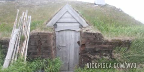
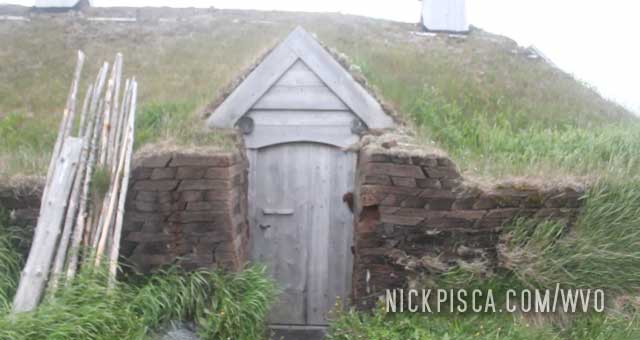
The Vikings that settled here built sod houses in lieu of timbers. They apparently went down to places like Maine because they found wood artifacts on this site that couldn’t have possibly been obtained in eastern and northern Canada or Europe. No known Viking site had been found in that area, yet.
In addition to the Heritage Site and its museum, there are also reinactors that interact with the tourists to show the life and times of the typical Norseman. It was cozy and warm in these sod houses near the fire, especially after the long tour of the grounds by the Heritage Site Tour Guide.
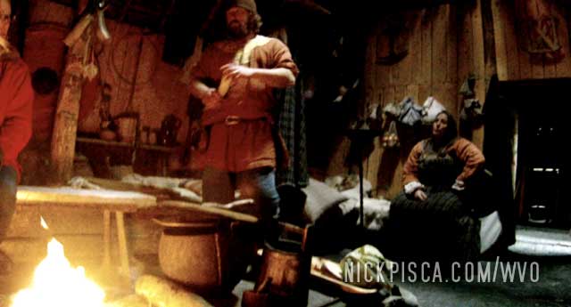
The major thing that piqued my interest was a comment by one of these actors. They said the records show one of Liev Eriksons decedents eventually lead a Viking evacuation of the New World. He had a scuffle with the native population, that led to deaths on both sides. The Indians lead a revolt against the Norsemen, and forced them to egress Newfoundland. When they got back to Scandinavia, they told the Old World not to bother going back, because the native population was such an intimidating military power. That is an astonishing statement, because this was the heyday of Viking supremacy, and if the greatest fighting and pillaging force of that era was afraid of the Newfoundland tribes, that was a testament to the strength and resilience of their tribe.
We got on the ferry in Blanc Sablon, and headed out to sea…. Arg!
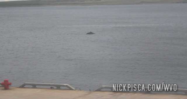
There were whales and dolphins swimming in the frigid waters.
The body of the ferry was full of cars, trucks, semis, and other vehicles. This boat got a lot of usage.
The waters of the Gulf of St Lawrence were rather calm and enjoyable. Later this week though, we would take the Port aux Basques ferry during a storm, and the swaying was unbearable.

It wasn’t uncommon to see icebergs floating around in the water. Pretty spiffy.
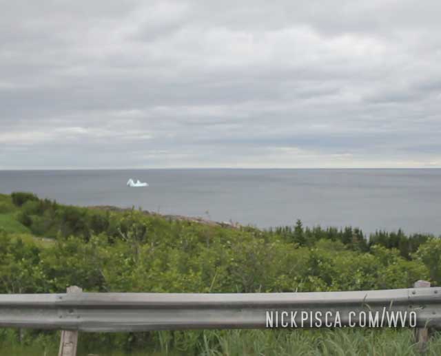
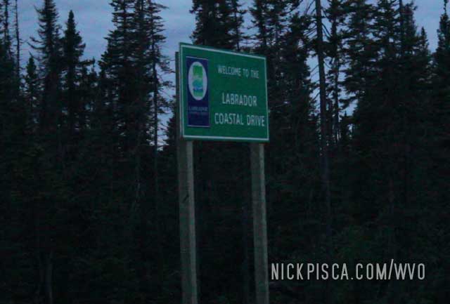
The Atlantic coastal drive was kind of fun on the 2015 WVO Roadtrip. Near Blanc Sablon, we got to see actual icebergs floating passed us as we drove to our ferry.
Much to Glenn’s dismay, we were not done with Quebec when we left the Barrage Daniel Johnson. For a few miles, we’ll be in Quebec for a few minutes while we wait for our ferry. Thankfully for him, very few people in this remote area only spoke French.
The ferry from Blanc Sablon to Newfoundland is pretty small. It’s only a one-hour ride and you can see the island across the gulf.
The wildcard is getting a ticket. Priority goes to other people, since we hadn’t bought our tickets in advance. We managed to get in line, and had to wait and see if the ferry would have room for our van and us. With one extra person after us, we were included in this particular fare.
As we take a leisurely summer drive in the snowy hills of Labrador, we got closer and closer to the coast.
Finally we happened upon the town of Red Bay, which couldn’t be more than a few dozen buildings. I wonder if the town was just for show, because it was rather picturesque.
Eventually we meandered our way down the main road to the Atlantic Ocean and the core buildings of the town.
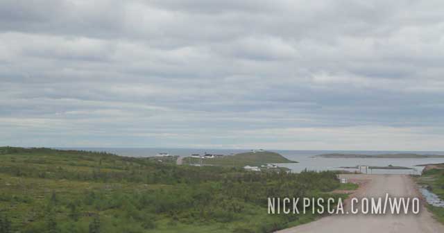
At the end of the peninsula, there was a contemporary structure housing the Red Bay National Historical Site. We made a quick visit because we had to keep moving south to catch our ferry to Newfoundland in a few hours.
A river north of Pinware NL.
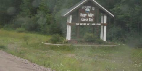
We left Happy Valley Goose Bay after dinner and tried to drive through the night to get to the Newfoundland Ferry before afternoon the next day.
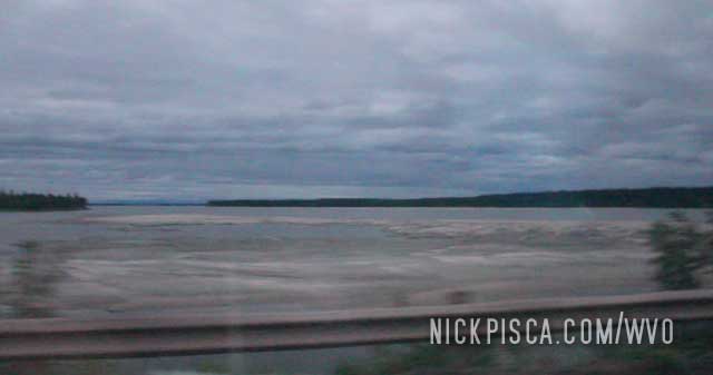
This area is still really cold, even in the summer. There is ice in Lake Melville. Some history: This is the place where Clarence Birdseye got his idea to flash-freeze food to keep its freshness, and it seemed like for every mile we drove on this gravel nightmare, we were getting flash-frozen.
I tried to catch some Z’s while Glenn proceeded into the short night. I would wake up to the van rattling to pieces. The potholes and washboards were horrendous.
Early in the morning, the sky was covered in clouds and the temps kept dropping. It was in the 40’s and sporadic rain.
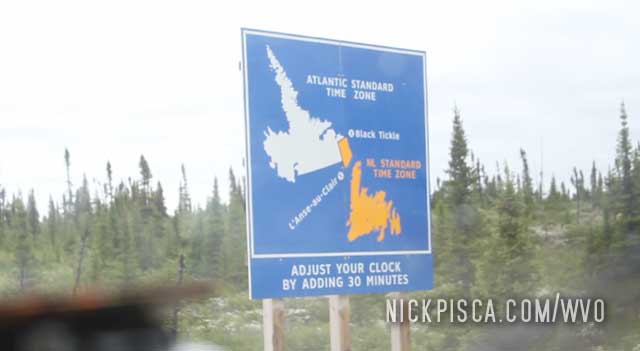
Then in the middle of nowhere, there is a sign explaining something called “Atlantic Time.” Turns out they have an additional time zone that is 30 minutes earlier than Eastern Time. Well that should be confusing.
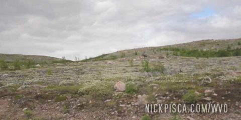
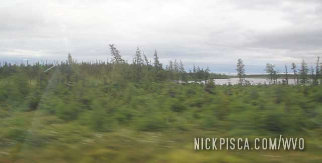
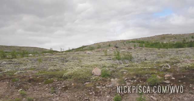
As we got closer to the coast, the landscape really transforms into what it looks like on the North Slope of the Dalton Hwy or up near Tuktoyaktuk.
It’s really an alien landscape, and really cool. I wouldn’t say it was worth the drive, but it was the highlight of the lead up to the coast.
Just to show you how cold it was at the coast, there were still patches of snow on the hills in July. It was easily in the low 40’s and possibly in the high 30’s.
Onward to the Newfoundland Ferry.
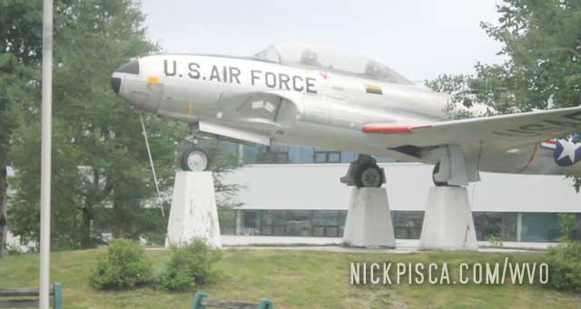
The oddly-named Happy Valley Goose Bay is a village on the Atlantic Coast. This 2015 WVO Roadtrip would allow us to visit the watersheds of three different oceans, and by getting to HVGB, that means we could physically touch a saltwater bay to the Atlantic Ocean. HVGB was named so strangely because it had some sort of US Military background. There are monuments to the American influence. Kind of odd to see U.S. artifacts in a foreign country, but there they are.
As I said in the previous articles, we had a few roadtripping motorcyclists near us on the Labrador Hwy. We even got to meet the famed Philip Funnell! Since we tended to meet all the same guys on these cycles, we decided to formally get to know each other.
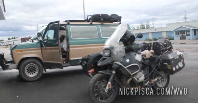
So at the Labrador North visitor’s center, we all went to eat at an actual restaurant!! Woah, money bags!
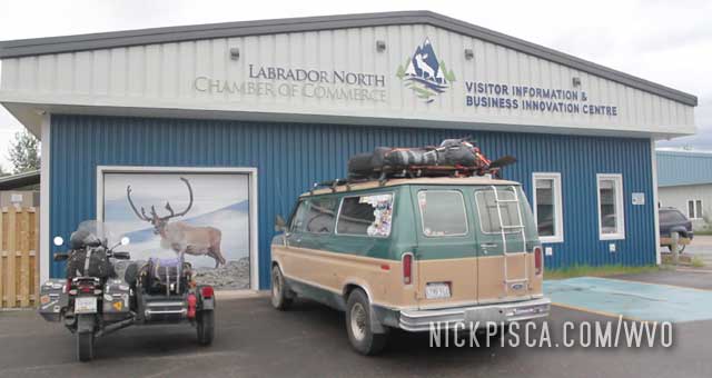
HVGB only has a handful of food options. The El Greco (run by a local family) clearly got the endorsement of the visitor’s center, so we all went out to dinner. It was a nice time talking to fellow travelers. It was this particular group that told me about the Canadian plans to finish the Dempster Hwy in November of 2017! We then drove that highway in July of 2018.
While in HVGB, we stopped off at their shops and hardware stores. We bought up dozens of Grade 8 locking nuts, washers, loctite, and other tricks to keeping our van in one piece! The roads up here are like putting your vehicle in a paint shaker for 500-miles.
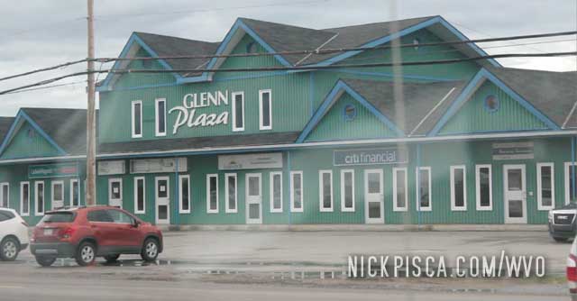
Glenn was partial to the “Glenn Plaza” for some reason. He’s such a narcissist.
After a few hours of fun, we decided to drive through the night from HVGB to the ocean shoreline. It’s a 620-km drive to Blanc Sablon. If we make good time, we can get on the ferry to Newfoundland by the afternoon.
Thankfully, they paved the road between Labrador and Happy Valley Goose Bay. This transformed our previous maximum speed of 25mph up to a reasonable 60mph.
This area is completely under construction, and it’s not uncommon to see whole houses and trailers driving on the majority of the lanes.
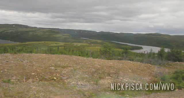
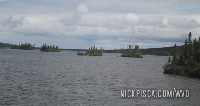
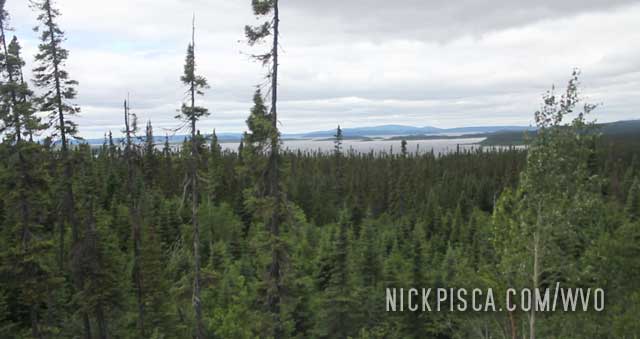
Basically, around every corner is a picturesque lake or shoreline. I suspect all of these lakes are suffuse with fish and other wildlife. It would be a great place for fishing and hunting, however, the drive up would not be worth the trip.
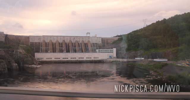
Eventually we met the massive Churchill River which means we are almost at the halfway point of the paved section: Churchill Falls.
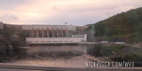
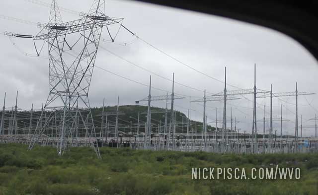
Churchill Falls is a rather small town, which I assume services the massive hydro electrical project to the east.
The power lines are massive. The network must have gone on for miles and miles. All this gets plugged into the grid further south to the more populated areas of Canada.
We have finally made it to Labrador City, and not a moment too soon. All the way from Thunder Bay, this had been a long drive since the last time we got a shower and bed. I hope we didn’t smell too bad.
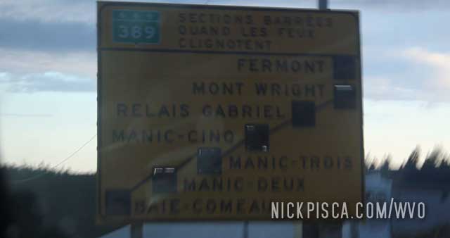
While driving the infamous Highway 389 (Labrador Hwy), we saw some nice sites like this bog near Fire Lake Quebec.
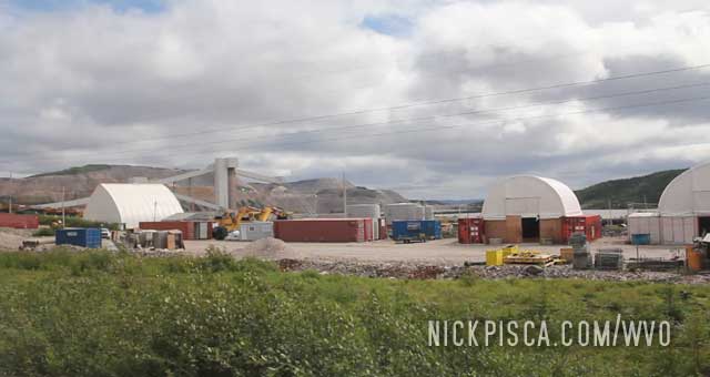
Also, as you approach Labrador City, there are massive mining operations and other forestry & hydro projects scattered on the landscape. We could tell recreational drivers never really travel up this way.
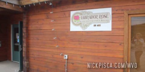
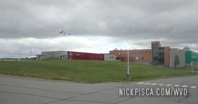
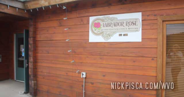
As we drove into town, we found a reasonable hotel called the Carol Inn to take us in. Thank goodness. We needed to refresh and reload. The next morning, we set off into the city to check out the sights and sounds. We got some souvenirs at the Labrador Rose and meandered the “downtown” area.
After a little bit of cruising, we noticed the van wasn’t running right. There was a fuel leak from the diesel side. With some quick repairs, all was good.
Onward to Churchill Falls and Happy Valley Goose Bay.
As a kid, I would look at a map of North America and notice interesting geographies. One place that captured my attention was the crater of Lac Manicouagan. From space, the classic crater circle is easily recognizable. The Labrador Highway runs along this massive crater (over 30-miles across) but due to the heavy forest and the lake’s enormous size, it’s almost impossible to see this lake in person.
Thankfully, there is a spot where the topography puts the highway high enough to see one edge of the crater. Pretty cool.
While driving up the Labrador Hwy, we noticed a handful of motorcyclists along side us every once in a while. They tended to go a bit faster than us, but not by much. One motorcyclist had this odd bicycle trailer. He appeared to have some mechanical issues and was limping along. Right after sightseeing the crater, we pulled off at a remote gas station where the motorcyclist happened to be parked. He appeared to be struggling with something on his bike.
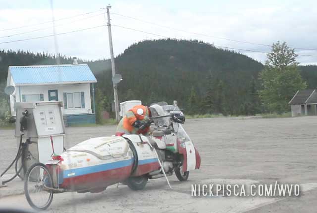
We walked up to offer some help. It turned out to be Canadian Motorcycle Hall of Famer Philip Funnell! What are the odds!?
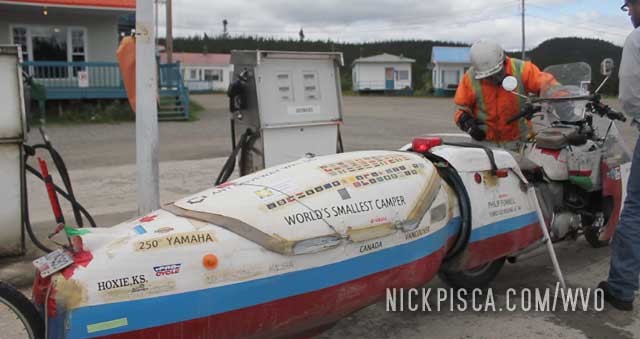
We talked to him for almost an hour. He discussed a bunch of stuff, and wasn’t shy about jibber-jabbering. I guess if you are on the road as long as him, you get the gift of gab. He talked about his sleeper trailer and all his modifications for his cycle. It was a pretty spiffy deal. We talked about our veggie van and our mods as well. He suggested we put locking washers, locking nylon nuts, and duct tape on all our loose bolts if we want to make it the rest of the way on the Labrador. ( In hindsight, he was RIGHT ON, because we often had to stop in each town to get new bolts from the ones that fell on the washboard gravel roads).
After a good talk, we took off. That was the last and only time we met him. It was 2015, and I think he said he as 80 years old at the time of our discussion. As we drove down the Labrador, Glenn remarked how spooky it would be to sleep in that fiberglass “coffin,” as he put it. He joked, Phil was getting up in age, and hopefully he can get that cycle back to B.C. without someone finding his corpse in the “coffin.”
Wherever he is, I wish him well. If he did croak, I suspect for a diehard motorcyclist and roadtripper like Philip Funnell, dying on the open road would be the way to go.
As we drove up the Labrador Hwy, our GPS was telling us to barrage Daniel Johnson in a few hundred miles. Kind of funny, because I know a guy named Daniel Johnson. He (as well as Glenn) went to my wedding. So we were truly intrigued how we were going to barrage him.
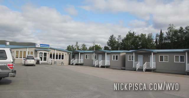
Just before we got to see how we’ll barrage him, we stopped in on one of the very few places along the Labrador Hwy: the Motel De L’Energie. This is an outpost for anyone who wants to take a break on this roadway, or if they brake down and need a place to stay. There is also a small restaurant and gift shop. We weren’t hungry, so we pressed on.
Then soon after, we found out about the barrage. I guess “barrage” is the French word for “dam.” LOL. Once we got to Labrador City, I posted a picture of our GPS to the real Daniel Johnson.
This was getting to be a long drive. The last place we had a hotel room was Thunder Bay, and we drove up to Wemindji, Matagami, and now Baie Comeau. Aside from a few lousy thunderstorming hours of rest in the van in Relais checkpoint, we hadn’t gotten much decent rest.
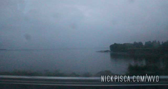
We drove through Saguenay and got to the St Lawrence Seaway.
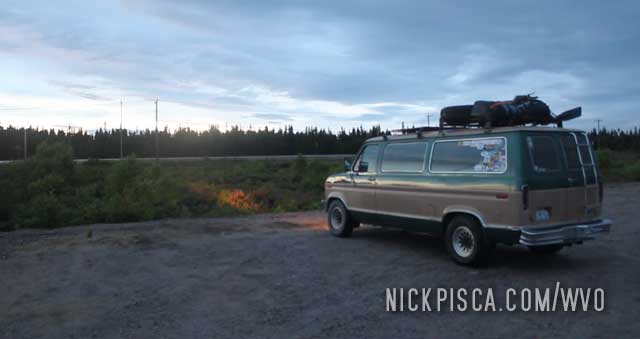
While it was a little dark, we pulled off in an abandoned lot to fill up our grease in the early morning, and rested for an hour or so.
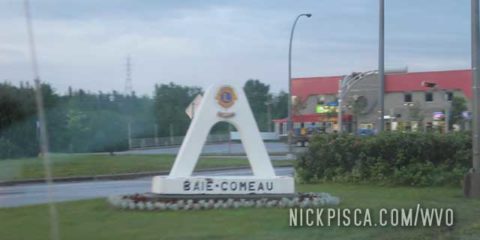
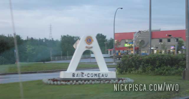
As the sun rose, we entered the tiny town of Baie Comeau on the coast of Quebec. This is the start of the Labrador highway, which is a gravel road that is hundreds and hundreds of miles long to Labrador City and Happy Valley-Goose Bay.
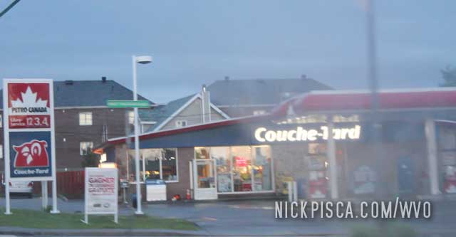
As with all French signs, we had to chuckle.
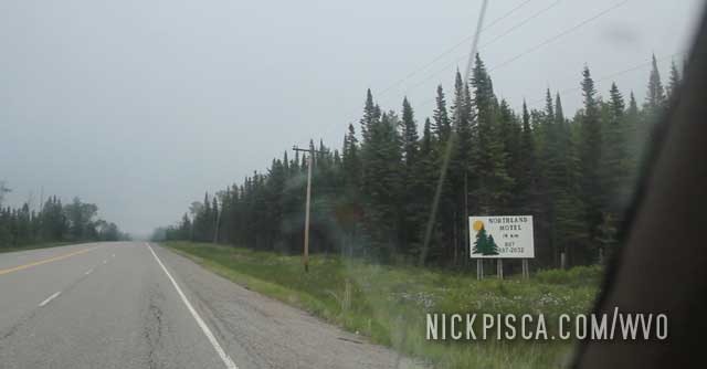
When you get to the Labrador Hwy entrance, they have a sign explaining where the roadway is closed. There is no guarantee the gravel road will be open. In fact, it commonly is closed due to washouts and other bad conditions.
Ever since our first trip to Quebec in 2009, we have always sought out poutine. It’s the best Canadian food ever. Back in those days, I worked with a group of Quebecois that recommended I try the stuff out. Ever since, we’ve been addicted.
Thankfully, the rest of Canada has caught on to this delicious food, and the more I travel around the continent, the more I find this treat on menus across the country.
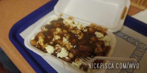
I distinctly remember this particular meal, because of the circumstances. We had been driving since our visit to Wemindji, and couldn’t find any decent food in the remote parts of northern Quebec. As we pulled into St Felicien, it was approaching 10pm, which means most restaurants were already closed.
On the main drag, we could this small poutine stand with a tiny interior dining space. They were cleaning up, so they probably didn’t want to see us pulling up. I got to use some of my piss-poor French, and I asked for two entrees of poutine. She said something, that I took as ” Want to eat inside or take it to go?” I knew the words for “eat inside” and “to go” so I said we would eat inside. She looked a little perturbed, but since she didn’t know English and I didn’t know French that well, she let us in.
After a short wait, this arrived. YUM!
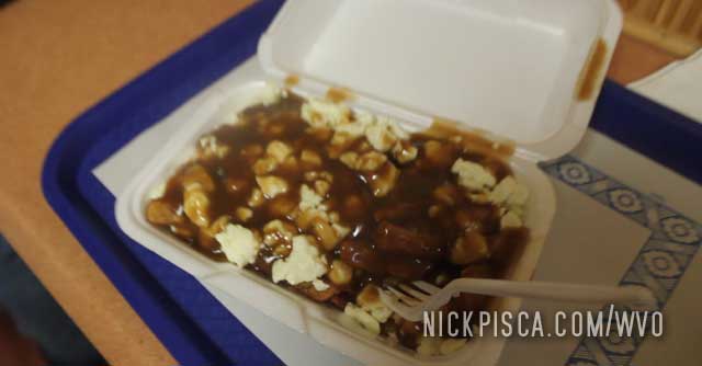
Only after we finished our meal and headed out on the road, did I re-review what the woman had said. Then it dawned on my she was saying we “couldn’t eat inside because it’s close at 9pm, and it would have to be ‘to-go.'” Ha! I just picked up on the words I knew and tried to piece it together from my experiences in Paris. We ate pretty fast, so I hope we weren’t too much of a burden.
We continued on passed Saguenay to the St Lawrence Seaway.
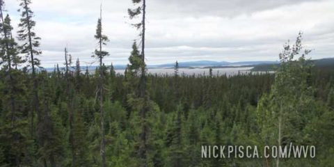
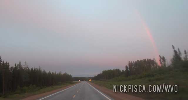
Northern Quebec sure is a perdy place. Seemed like around every corner, there was a rainbow or sunset or forest that was gorgeous.
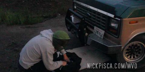
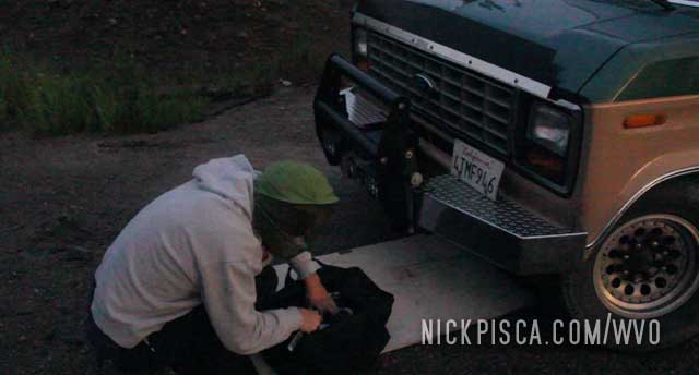
But the James Bay Road and the northern logging roads had done a number on our van. As we were driving, the bumper began to squeak. The roads had rattled the bolts free all over the van, but the bumper was getting precarious.
We pulled off just before it got dark to tighten everything up. The mosquitoes were horrendous.
This bolt loosening problem became one of our biggest concerns, as we took the several hundred mile drive on washboard gravel throughout all of Labrador.
After the storm near Relais and Eastmain on the James Bay Road, we decided to park the van at the Relais checkpoint until the storm cleared up. After a rough night sleeping in the van in a thunder and hail storm, we hit the road. We got down to the checkpoint at Matagami to tell the ranger that we made it back alive. In the checkpoint office, we got a picture of a logging road map that could be a good shortcut to Waswanipi that is the route we are taking across northern Quebec.
What we didn’t realize was, just how REMOTE this road system was. No signs, no lanes, no nothing. Just a one-lane gravel road system that the loggers use to ship their products down south.
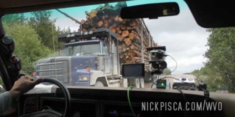
If we encountered a logging truck, it took up most of the gravel road.
At one point, we were driving on some random road in the bush, and we came across a grouping of workers near a pickup. They looked at us as if we were aliens. I suspect they almost never get any public traffic on these roads.
While Glenn drove, I cooked up some microwavable meals since it was getting late for lunchtime, and we don’t expect any restaurants in the next dozen hours.
Eventually we found our way to Waswanipi Quebec. We ended up having an overdrive problem, but it was fixed with some simple wiring fixes on the side of the road.
We also kept on trucking through the town of Chapais. No time to hang out… we were behind schedule, and we still need to get to Labrador and Newfoundland asap!
If we keep going, we plan to make it up to Lac Saint-Jean by late dinner. Our goal is to get on the Labrador Highway by tomorrow.
We wanted to use Wemindji’s location on the James Bay to “cheat” a trip to Nunavut. For the longest time, we were trying to figure out how to get to the Canadian territory of Nunavut. It’s the only place in Canada that cannot be driven to, except by ice road. We are not prepared to drive this veggie van through an ice road, so our only option is to fly up to Nunavut.
Except, I found a loop hole. After reviewing several maps, I found an interesting fact: Any island in the Arctic Ocean that is disconnected to the mainland at low tide is considered part of Nunavut. That rule also applies to any island in the Hudson Bay, as well as the James Bay. So even a tiny island off the coast of Wemindji is considered part of Nunavut.
Knowing this, we wanted to go out on a boat into the James Bay and find an island, and officially visit Nunavut. We had contacted a woman representing the burgeoning tourism “industry” in this town, and she said she would set us up. But just in case she flaked out, we also brought a small raft and outboard motor to get us out in the bay.
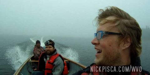
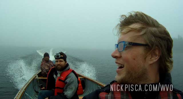
But before we could inflate our boat, we were stopped by our tourism agent and a local fisherman who was willing to give us a ride into the James Bay.
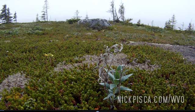
He took us out several miles into the bay, and to a small island out in the middle. He said the space was a holy island, and I can understand why. It was like no other place I had been. The ground was mysteriously colored with red rocks and there was a carpet of magenta jade-like plants covering the ground. When you walked, it was like walking on sponges. It was such an alien environment.
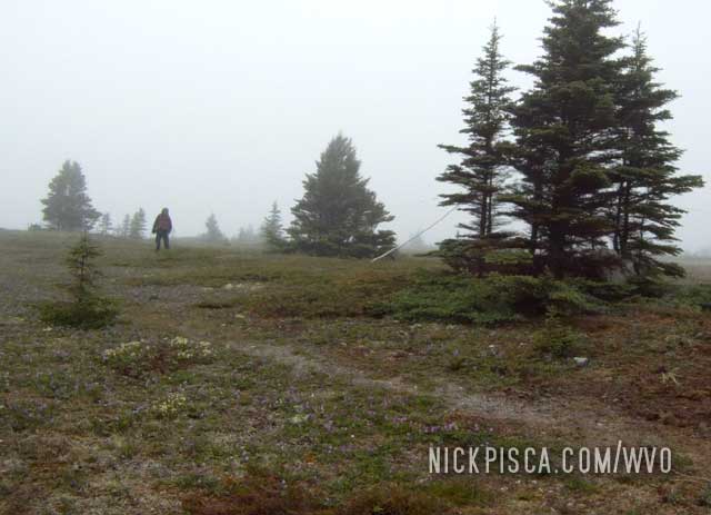
We circumambulated the island while our guide hung out on the east side. After an hour of adventuring, we wrapped up our visit. It proved to be a worthy trek.
Out on the bay, we could see icebergs. The locals said that just a few weeks ago, the bay was full of ice. It had just recently melted and floated up to the Hudson Bay. Also, a thick fog had rolled in. In hindsight, we were really glad the man took us out in his professional fishing boat, instead of us trying our hand with an inflatable raft and underpowered motor.
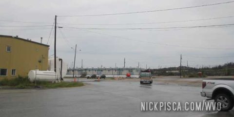
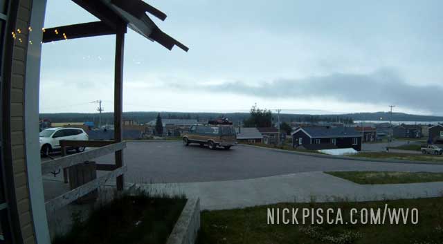
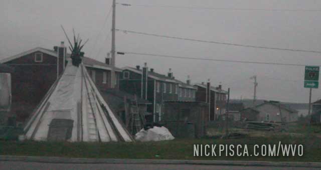
One of the first major destinations for our 2015 WVO Roadtrip was Wemindji Quebec. Wemindji is a wonderful town. Canadians are nice, but Wemindji residents are even nicer.
Our goals for the Wemindji visit were two-fold. One part was seeing this northern First Nation town. We had researched a lot of this, and found some interesting history here.
The second part, we wanted to use Wemindji’s location on the James Bay to “cheat” a trip to Nunavut. For the longest time, we were trying to figure out how to get to the Canadian territory of Nunavut. It’s the only place in Canada that cannot be driven to, except by ice road. We are not prepared to drive this veggie van through an ice road, so our only option is to fly up to Nunavut.
Except, I found a loop hole. After reviewing several maps, I found an interesting fact: Any island in the Arctic Ocean that is disconnected to the mainland at low tide is considered part of Nunavut. That rule also applies to any island in the Hudson Bay, as well as the James Bay. So even a tiny island off the coast of Wemindji is considered part of Nunavut.
Knowing this, we wanted to go out on a boat into the James Bay and find an island, and officially visit Nunavut. We had contacted a woman representing the burgeoning tourism “industry” in this town, and she said she would set us up. But just in case she flaked out, we also brought a small raft and outboard motor to get us out in the bay.
As we drove into town, the local police pulled us over. They were really cool about it, and said that we didn’t violate any law, they just wanted to talk to the people in the van with California plates. They must have spread the word about our arrival, because once we got to the shoreline, people were coming out of the woodwork. Eventually our tourism agent appeared with a man willing to give us a tour of the James Bay. Awesome!
After our tour, we ate at the Wemindji cafeteria. Most of these northern towns are subsidized by the Canadian government, and have some great food. The assistant mayor heard of our arrival and sat with us. He gave us a book about the history of Wemindji and some other souvenirs. The town was really special.
They wanted us to stay for the night and join in a tribal celebration. They were going to harvest some exotic meats for us, but unfortunately we had a lot of miles to go tonight.
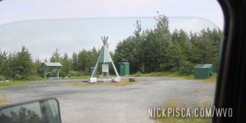
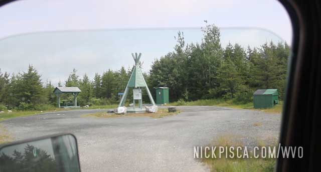
There is about a 100-mile gravel road that gets you from the James Bay Road to Wemindji. Here is the monument erected when you turn off from the JBR.
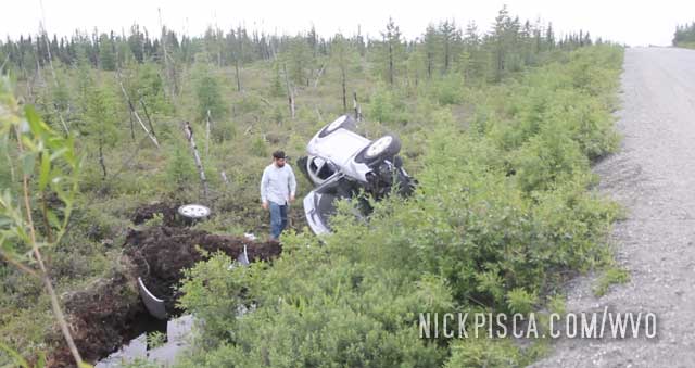
We drove a few dozen miles and saw a car rolled in the ditch. We were concerned, because we didn’t see a single other car on the road, so we approached with caution. For all we knew, we might have been the only vehicle on the road for days. There might have been a dead body in there.
Upon closer inspection, this car must have rolled months ago. No one was inside, so we continued on. I suspect this area does not have a lot of wrecking services that is affordable, so if you lose your car in this bog, you better have a lot of moolah to fish it out of the drink.
In the middle of nowhere, there is a small camp with a few trailers, buildings, and cafeteria called the Relais Routier. It’s an outpost between Matagami and Radisson on the James Bay Road that has some very basic services, so if you have a problem, this is your only hope for help. It is only open certain times of the day, so if you need fuel or mechanical help after hours, you are screwed. So plan your trip on the JBR carefully.
We pulled into the area in the morning to check it out. We didn’t need to stop, because we packed all our fuel and food with us, but since we drove 381 kilometers without seeing much, we figured it why not. It has a similar vibe as Eagle Plaines on the Dempster Hwy or Coldfoot on the Dalton Hwy, where it’s basically just bare-bones services.
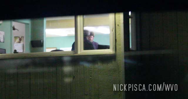
The cafeteria was open 24 hours. There was a Quebecois chef taking orders in French, and I mumbled my best attempt at ordering a vegetarian omelet. Overall, the food was pretty good, but the ingredients were kind of old. Not bad, just not fresh. Considering where we were, this was acceptable.
The cafeteria has a seating area with televisions connected to satellite stations. You can catch up on the news and weather while heading north. Also, there are land line pay phones that work. I tried one.
After a hot breakfast, we filled up and headed up to Wemidji.
On the return trip back south, we stopped in Relais again. This time, we were driving in the rain, and the storm was getting exceptionally bad. We wanted to get to the station, so we could see the TV’s and ascertain the severity of the storm. However, we quickly learned that this area is so remote, that most doppler radar stations are nowhere near this area. It wasn’t even showing any rain or radar signatures.
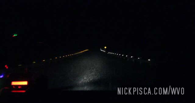
Photo of our drive on the James Bay Road in one of the worst rain storms we ever encountered. It was almost as if the road became a waterway.
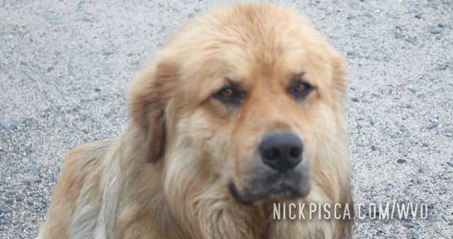
I decided to call my dad and see if he could use weather radar on the internet. He couldn’t find any radar stations in our area. It was about to hail, so we tried to park the van in a safe-ish area, but we were still rather exposed. The few rooms the station had were all booked up, so we just elected to sleep in the van for the night until the storm subsided.
When we woke up, this doge was sitting outside the driver’s door of our van. He was a good boy.
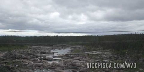
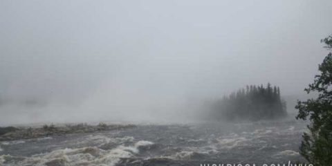
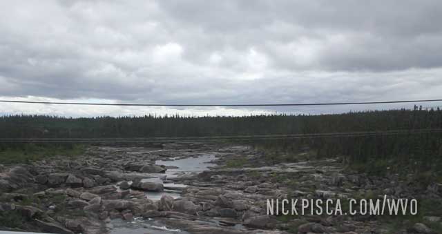
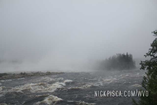
After a few hours of driving, we pulled off at a roadside “park” to see the rapids.
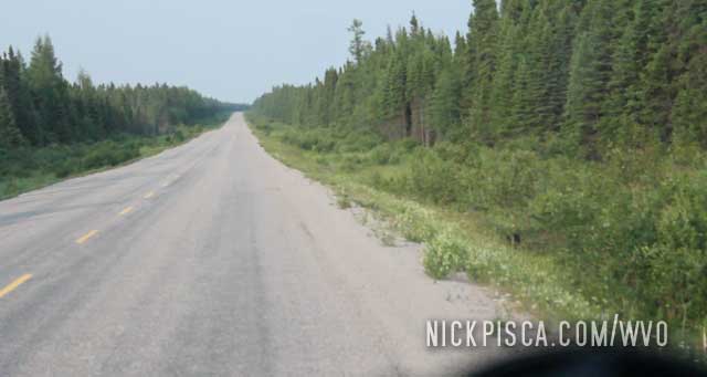
The interesting thing about the James Bay Road, is that it’s paved. We thought maybe this would mean the trip wouldn’t be so hard on the van, like all the gravel roads in the past. Turns out no. The James Bay is paved, and that makes the pavement all heaved up and buckled from decades of weather. In fact, I suspect it would be better if the road had been gravel, because at least they could have grated it every now and then.
The constant banging on the suspension caused us to slow way down to around 30 mph, so that the van wouldn’t fall apart on us.
The rapids was very nice. After not sleeping much (Glenn drove, but I stayed up to watch for moose, bison, or other animals in the road), it was good to stretch our legs.
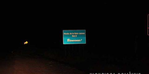
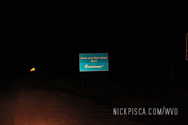
For those who don’t know, The James Bay Road is the longest road in North America (and one of the longest in the world) without services. The only places to get fuel is in the end town of Radisson and the camp known as Relais, which is 237 miles from Matagami. That’s 237 miles of no services. No homes, ranches, utilities… no nothing.
We have traveled all over the continent and been on some rather remote roadways. The Dalton in Alaska, the MacKenzie in NWT, the Cassair in BC and Yukon, and the Labrador Hwy. But the James Bay is by far the most remote and uninhabited.
So when you start the James Bay Road north of Matagami, there is a checkpoint restricting access. All drivers MUST log in and put their return date. If you don’t turn up, they send in a search party for you. We didn’t know this, and we figured since we’d be driving for hours on end anyway, we thought we it would be prudent to drive through the night to Wemindji. Instead, we drove to the start of the James Bay Road, and encountered this late-night outpost and a closed gate.
The man chattered in French through a loud speaker. We told him we spoke English and he asked why we were driving up here. He made me come inside and proceeded to lecture me on the danger of this road. Also, he said leaving right now would be a terrible idea, because we would be driving this remote road at night, and would be arriving in Relais when the gas pumps will be closed. Then we would be bear food while we waited for the pumps to reopen the following day. I told him we brought our own fuel and don’t need any from that station. He insisted we turn back to Matagami, but since it’s a public road, he wasn’t going to stop us.
Off we went.
The odd thing about going to Wemindji is, you have to make a rather lengthy drive due to the limitations of services. One cannot just drive to Relais and drive to Wemindji and back. There are too many miles between Relais-Wemindji-Relais to do it one tank. If you have a conventional vehicle without spare tanks of fuel, you have to drive to Relais, then fill up, then drive to Radisson, then fill up, then drive back down to Wemindji, then drive to Radisson, fill up, then drive to Relais then fill up, then drive back to Matagami. Wow. Thank goodness we have a veggie van with lots of fuel in the back. Whenever we need to fill up, we just fill up. No extra miles needed.
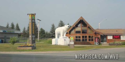
Glenn and I decided to take a mild risk once we got to Cochrane ON. Instead of detouring around a few hundred kilometers to the south, we elected to take a “shortcut” through some logging roads near Highway 652. At first, it seemed to be ok.
Then the signs and markers started getting pretty small and infrequent. It wasn’t a good place to get lost. There wasn’t anyone on this roadway for the duration of our travel.
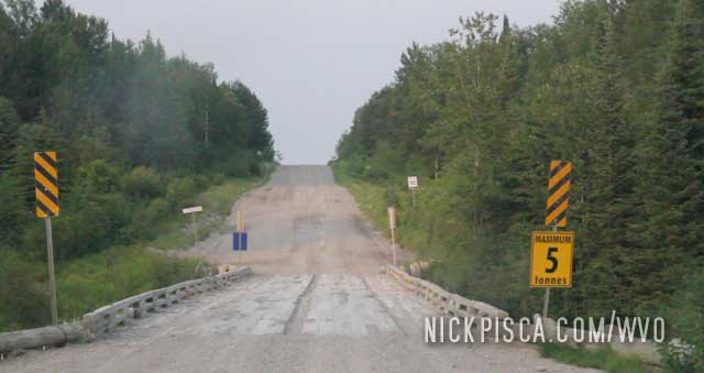
Then the road and bridges started getting VERY sketchy. In fact, we got to some bridges where we had to stop, calculate our veggie oil load + vehicle weight, and cross our fingers that the bridge wouldn’t collapse into the ravine.
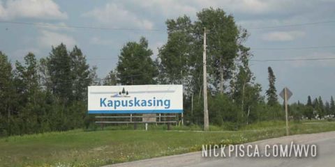
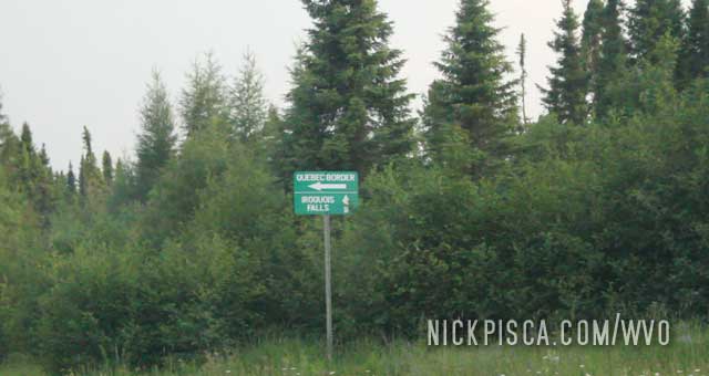
After what felt like an eternity, we got to the Quebec border, near La Reine. Yippie. I get to use my French finally!
We didn’t really do much here other than eat and cruise on by. We were running out of time and had to make it up to Quebec.
Smooth Rock Falls:
We are chuggin along and come along the first decent town in a thousand kilometers, Hearst Ontario. We are still several hundred clicks from the Quebec border, and we figured we should pull off to get some supplies at the Canadian Tire. As we wait to talk to the staff, we begin to notice a pattern.
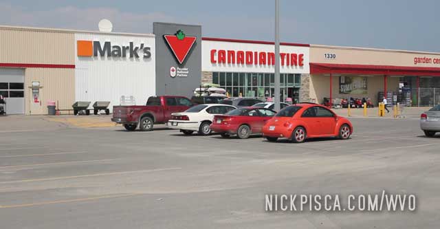
Every customer is speaking French. And the staff is speaking French. In fact, NO ONE is speaking English. Maybe we fell asleep on the THC and got to Quebec faster than expected. Once we got to the front of the line, I asked the staff if we were in Quebec. They laughed. They said Hearst is so remotely situated that their French heritage has been preserved. So the majority of inhabitants speak French or Cree. Wild!
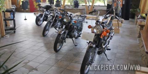
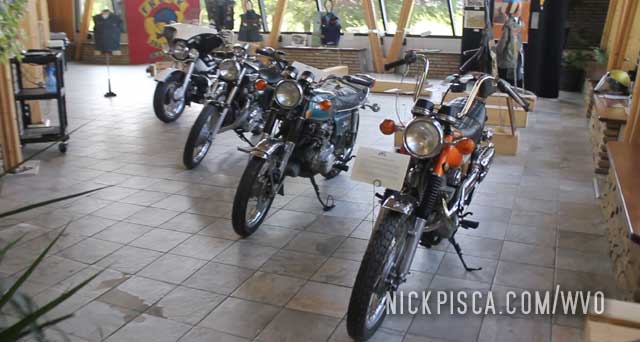
We pulled off at the Hearst Visitor’s Center to ask what else is good to see here.
She suggested the Hearst Motorcycle Museum that is attached to the Visitors Center. They have some kind of renegade motorcycle culture up there, so they are showcasing some of the old bikes. Canadians are funny; they consider anything older than 40 years to be “historical.”
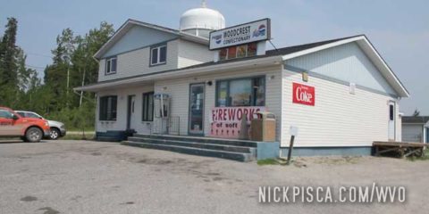
All these towns in northern Ontario are basically tiny little First Nation hamlets, that have all sorts of different names for food. We were going to cruise on passed Longlac, but there was a sign selling something called “Wedgies.” Intrigued, we pulled off to check it out. In the Woodcrest Confectionary, they were selling the mystery wedgies. We asked for a large set of whatevertheyare, and it turned out they were just potato wedges.
Now that we got our daily supply of sodium and carbs, we were free to continue on….

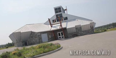
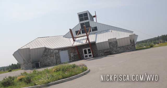
So we are driving this remote roadway in northern Ontario, and out of the blue is this crazy looking building which has a sign for a museum. We do a u-turn and check it out.
It was a historical museum for the area. Pretty cool. They also had a walking path to stretch the legs.
This is the first post for the 2015 WVO Roadtrip, which skips over a few hundred miles from Wisconsin Rapids to Thunder Bay. We had an oil cooler repair that delayed our departure a full day in Wisconsin, so we were running behind schedule. Instead of sightseeing and photographing and filming a bunch of places that we’ve already visited a 1000 times in our lives (we grew up in northern Wisconsin and Minnesota), we just pushed on to Thunder Bay and got a hotel.
The next morning, we hit the road across the northern “highways” of Ontario. Here is the turn off for HWY 11, which is the northernmost corridor of the THC (our name for the Trans Canadian Highway).
When turning off, the first major town is Nipigon. It resides on the shore of Lake Nipigon, and there are lots of rivers and lakes around here. Consequently, there are lots of beautiful bridges and parkways in the area.
After getting a bite to eat at the Red Iguana in SLC, we drove through the evening to get a hotel Cedar City by midnight. We needed to find a hotel that was just north of the entrance to Zion National Park for the morning.
That morning we reorganized the cubes and grease, filled up the tank, and wrapped up any last minute things, because after our national park visit, we would plan to finish the remainder of the drive to Vegas and ultimately Los Angeles before midnight.
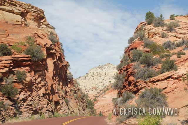
Driving into Zion is kind of a pain. You have to take state roads to find the entrance, which is a lengthy detour. Eventually you make it to the gate, but since this place is heavily visited and it’s the middle of July, the tourism overload is in full effect.
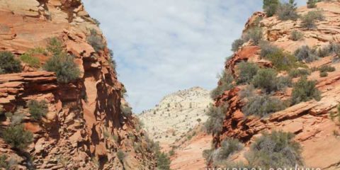
Ultimately we finally got in and Zion didn’t disappoint.
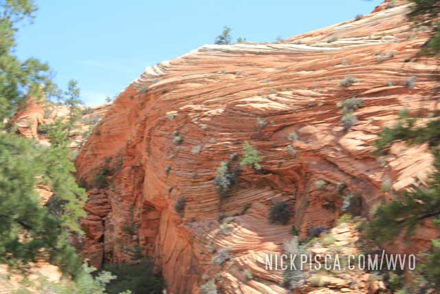
The mountains are surreal. Warped and twisted layers of red rock everywhere. And the roadway was make with red aggregate, so it’s truly almost like a Martian environment.
We pulled over many times to stop and survey the landscape. At the end of the park, there is a massive visitor’s center with a gift shop, museum, and other restaurants. But since it was so packed, the parking was a nightmare. Just imagine parking a massive veggie van amongst thousands of other cars… It took some finagling.
Overall, I like Zion, but I will only return to the park in the off season. Onward to Vegas!
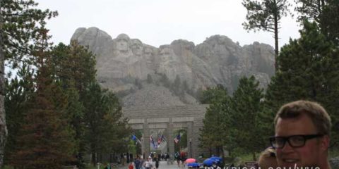
Another South Dakota site we’ve visited over and over and over is Mount Rushmore. It never really gets old.
In 2013, it happened to be raining so we rushed out of the van to the patio. I think the rain lead to decreased visitors, which was good because we were here in the heart of the summer tourist season.
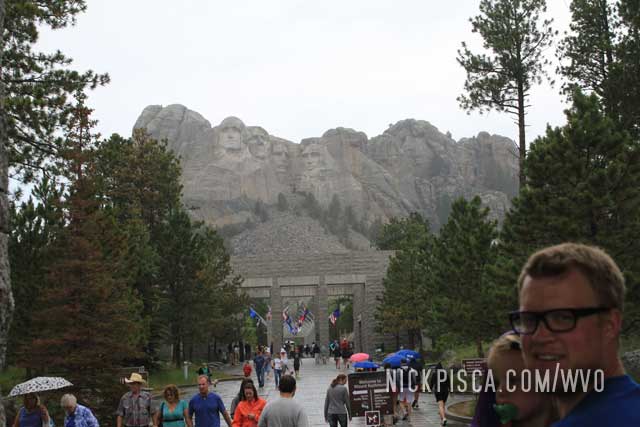
In 2015, we stopped here to see the monument at night. We were driving through with some family friends hitching a ride with us to Los Angeles, and it happened to be really late by the time we got to Wall Drug. I didn’t realize they have a night-show at Mount Rushmore, so we “rushed” to the monument to get a good spot.
I don’t have the pictures from that day. Bummer. It was really cool, but they are lost in the digital ether. We left to drive through the night to get to Yellowstone before the morning.
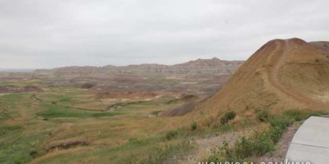
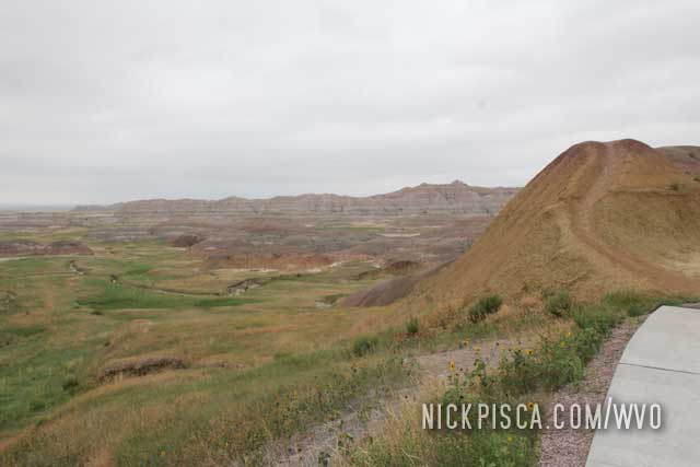
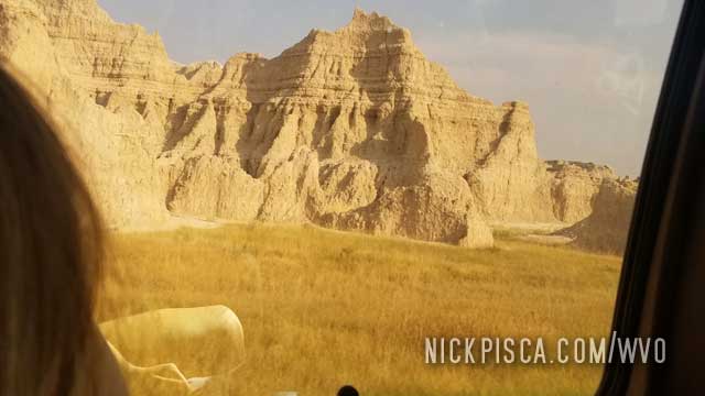
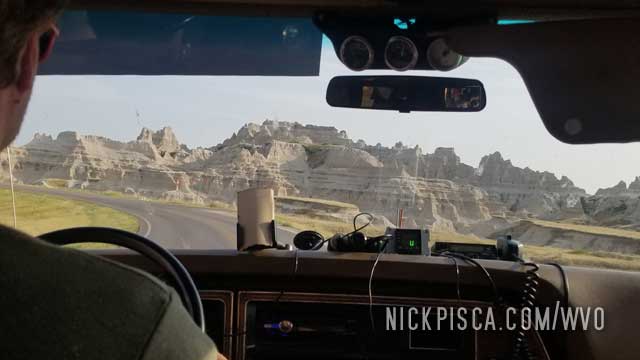
We’ve been to the Badlands on several of these trips. It’s one of the quintessential national parks in the western United States. It’s a must stop if you are cruising the I-90.
We stopped here in 2013, 2015, and we even stopped here in 2004 before we even got started with the biofuel fun. Eons ago, back when I was a tiny lad, I stopped here with my family on my first westward road trip in 1993. It was places like this that inspired me to be a traveler.
In 2013, we pulled over here on the Badlands Scenic Drive, because my 2-year-old got car sick. We just ate at the Badlands diner at the entrance, and then took the curvy and windy road amongst the hills. I guess it was too much for the little girl, and she blew chunks. Just by coincidence, I was in the back of the van with her playing a game, and I had the “fortune” of being able to catch the vomit in my hand and throw it out the window. Not my idea of a fun day, but at least we didn’t to wash puke out of the carpet.
It rained later that day, so most of the chunks got washed off on the road. Memorable times….
On to 2021….
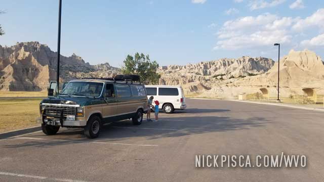
We were on the epic 2021 convoy roadtrip with our California family, we stopped through the Badlands again.
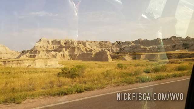
It was already after 5pm, so all the museums, gift shops, and sites were closed up. We did get to drive the main road, and stop off at a few places to climb up and around the formations.
The kids decided to be the camera-guys on this venture.
Eventually, I had to pull over and fill up the old grease tank. We inspected the trans leak, and it appeared to be ok. There was still a drip, but it seemed to stop when idling. Hard to tell if it was draining while at highway speeds.
On to Rapids City to find the hotel.
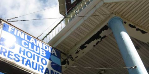
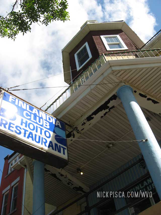
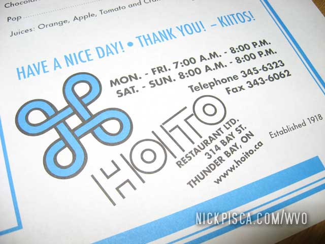
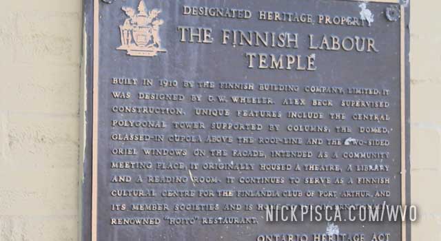
One of our regular restaurants in Canada is Hoito. It’s in Thunder Bay in an area that is supposedly full of Finns. I couldn’t tell you if that’s true, but Hoito makes the Finnish style pancake. It’s basically like a thicker crepe.
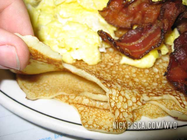
In 2009: This was the first time we got to eat here. We crossed the border near Grand Portage, and the Ontario tourist clerk told us that the most unique place to eat is Hoito. Intrigued, we decided to indulge our Scandinavian heredity.
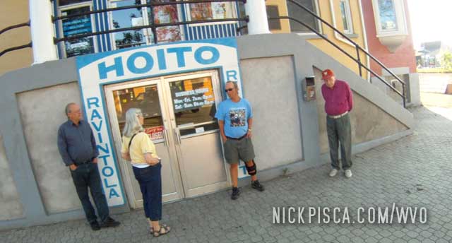
If you want to eat without waiting an hour in line, get here right as they open. Even then, it’s still not a sure bet that you’ll get a table right away. The early bird gets the flapjack.
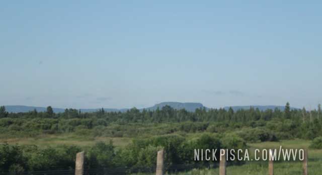
In 2012, we got up early in Wisconsin, and headed up to Thunder Bay as soon as possible. Our goal was to hit the border right when they open, and then get up to TB for breakfast. There are nice bluffs on the drive to TB, and the terrain really changes once you get out of Minnesota.
We were surprised to find a line to get into the place. It’s just pancakes after all.
As we waited, we meandered the nearby neighborhood. More proof of the Finnish influence.
We came back here all sorts of times in 2015, 2010, and 2012, and more.

2015

2015

2015

2015

2015

2015

2015

2015

2015

2015

2015

2015

2015

2015

2015

2015

2015

2015

2015

2015

2015

2015

2015

2015

2015

2015

2015

2015

2015

2015

2015

2015

2015

2015

2015

2015

2015

2015

2015

2015

2015

2015

2015

2015

2015

2013, 2015

2013, 2015

2013, 2015, 2021

2009, 2012, 2015