We’ve been to Regina several times, notably in 2012 and 2018.
In 2012, we cruised through the downtown and visited their Tourism Center. Since it was getting late, we didn’t have time to see any sites, but we did find a hotel in the area thanks to the help of the Visitor’s Center agents.
In 2018, it was getting dark, so we booked it through Regina to get to our hotel in Saskatoon. After driving for two days straight with some brief van camping in between and lots of days of loading, we were beat.
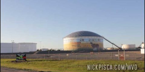
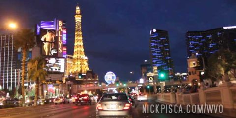
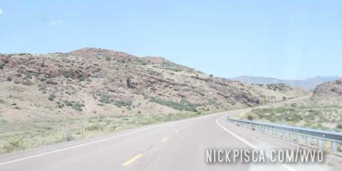
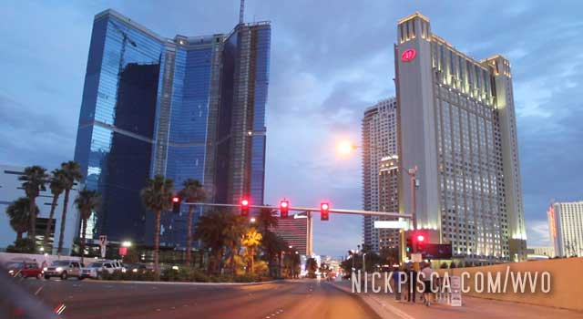
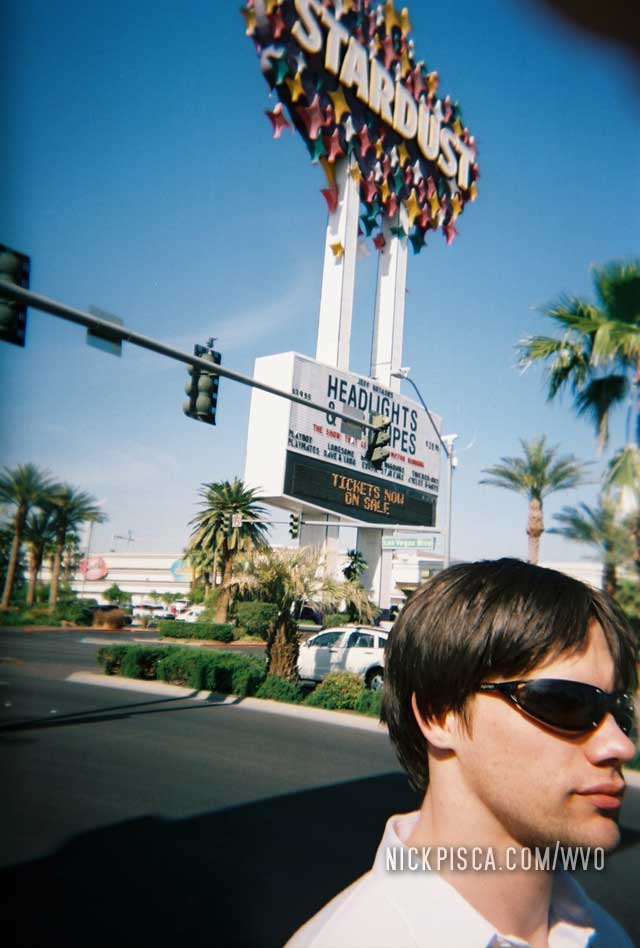
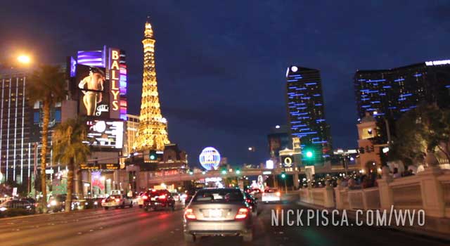
We have visited Vegas I don’t know how many times now. I suspect that 90% of our WVO roadtrips have us driving through or stopping in Las Vegas. It’s on the main route to Los Angeles, so unless you are coming down the coast or along the Mexican border, you’ll come thru Vegas.
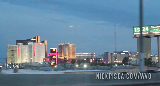
It’s one of those places where it’s just too irresistible to drive the strip.
On the 2006 WVO Roadtrip,
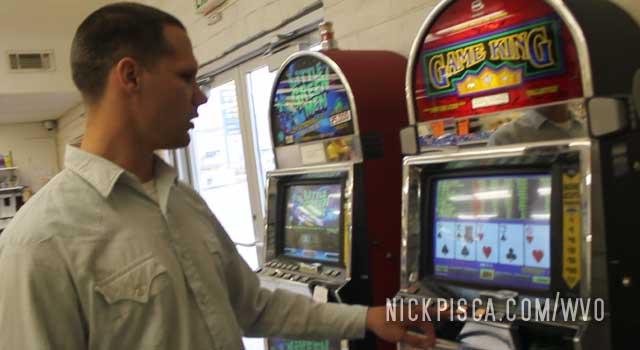
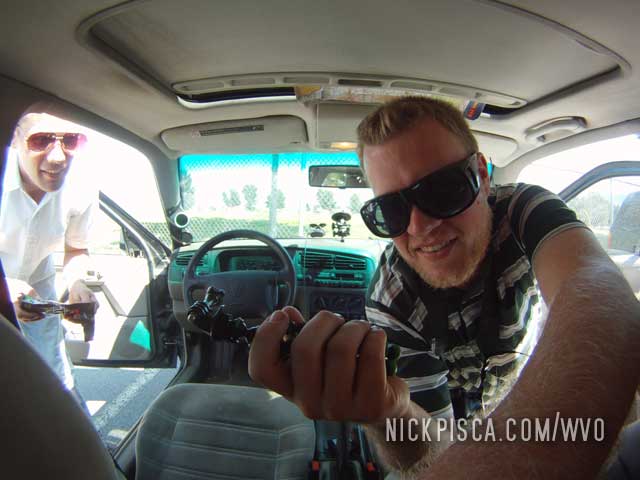
After a couple laps around the Mesquite Nevada Walmart parking lot, Glenn stated, “Fuck it. Let’s go.” After ten miles down I-15, the vibration returned to a relatively loud level and we repacked the boots at a desert underpass. We repeated this procedure five times until we made it to Vegas and parked at Circus Circus, due to my experience with that casino and proximity to the north of town. Since they didn’t have a wireless network in the lobby, we set out for a under-construction Hilton but found some service at the Travel Lodge nestled in between. While the sun rose over the desert, we surfed through some forums finding independent Mercedes mechanics, hoping they aren’t coots. “Sig’s” sparked our interest because the testimonials claimed he was less expensive than most Vegasian repairmen, but there was a report that he’s known to take his time.
After a breakfast at the Peppermill, we parked the car at the front of Sig’s office, a white building with disassembled vehicles scattered about. Serendipitously, his place happened to reside in the chaotic mish-mash of industrial one-stories behind the Circus Circus casino. We arrived a half-hour before his scheduled opening, but a gruff main in a white van appeared to confront us about our wagon. Turned out he was Sig himself, and after some phone calls, he found the rebuilt axles at a neighboring shop. But it would cost us $800!
2:12pm GN Tuesday. 2120 Trip Meter Reading. Las Vegas, Nevada.
Sig completed the repairs on schedule, to the contradiction of the aforementioned online reports. Glenn insists he knew we were in a tight spot and exploited it. Whatever really happened, we had to keep moving if we were going to make Victorville to meet Jeff, the first contributor for the journey, by sunset. We crossed the Mojave desert with little trouble with our vegetable oil temperatures maintaining temp. “Maintaining Temp” was a term Glenn continually repeated to describe the hot temperature of the VO. The engine must have the fuel heated in order to use it as a diesel substitute.
Things were looking up for us. The engine was running great on VO, the axles were replaced, the suspension is maintaining its height and we have one third of our original VO cubies left. We even had time to visit a ghost town west of Victorville. Turns out it was refurbished by the Knott family trust, so who knows how much was Disneyized or authentic.
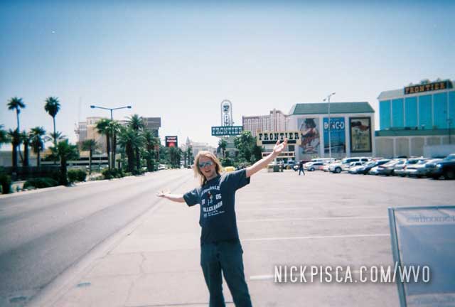
On the 2012 WVO Roadtrip, we arrived kind of late in the evening, but it’s Vegas! Everything is still open. We found an Indian Buffet (Glenn’s idea) and gobbled up some food that wasn’t cooked in a microwave or served in an American diner.
That was the end of the 2012 WVO Roadtrip. We wrapped up the remaining drive to Los Angeles in the night.
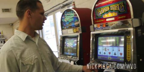
If want to know something about Glenn, the most important thing to him is money. He loves to spend frivolously, have lavish clothes and hairstyles, and of course, he loves to gamble. We stopped off at this gas station in Crystal Springs, and he found a couple one-armed bandits. After about 12 hours of gambling, he allowed us to move on to Vegas.
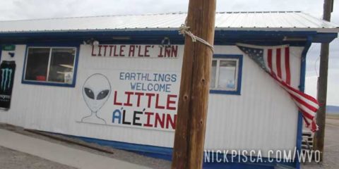
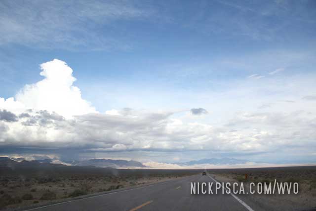
In the central part of Nevada is a mystery military base near Groom Lake, that is rumored to be the infamous Area 51. Lots of conspiracy types like to visit this place in the hopes to get anally probed or whatever, and we are no different. In order to get nearby the base that supposedly holds various alien remains and spacecraft, you have to drive State Road 375. In the last few decades, 375 has been nicknamed the “Extraterrestrial Highway.”
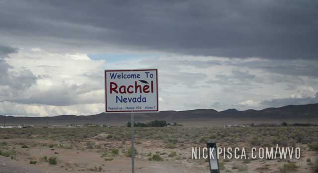
The closest settlement to Area 51 is the tiny town of Rachel NV. There ain’t much here. But there are some diehards that can survive the brutal Mojave deserts.
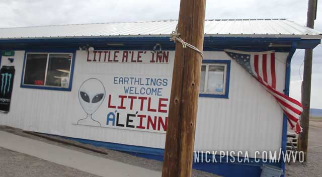
There’s an entrepreneurial family that takes advantage of this proximity to the military base and the speculation of all the alien theories. It’s the restaurant called the “Little A’Le Inn.” They have decent food and lots of souvenirs. I tried to film and photograph in their shop, and they promptly shut it down. Apparently they have some strict permissions and fees with respect to filming rights in their property.
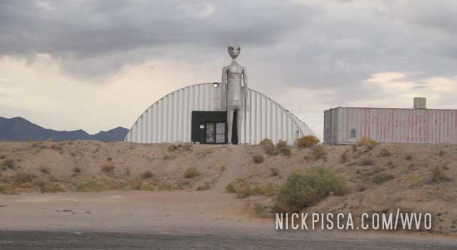
We talked to a guy at the bar about all the alien stuff. He had a lot of theories. 9-11, aliens, aircraft, abduction, and all sorts of stuff was on his mind. After a few hours and few burgers, we left on the ET Hwy passed more odd alien sculptures and monuments. This place has some real character.
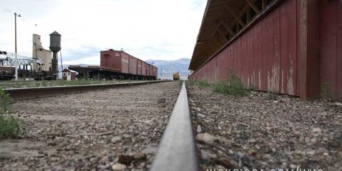
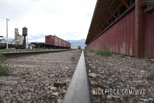
Nevada is a rather large state. And it has a rather small population. That means you can drive for hundreds of miles without seeing more than a few houses or people. It was getting boring, so we stopped in Ely to see what is going on. Turns out they have this cool train museum, and they have a functioning locomotive mechanic shop. We even got to jibber jabber with the main mechanic on hand. Pretty neat.
Now for the fun part…. we are headed south to Groom Lake, Area 51, and the tiny hamlet of Rachel NV!
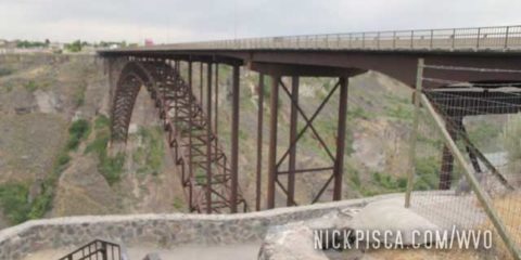
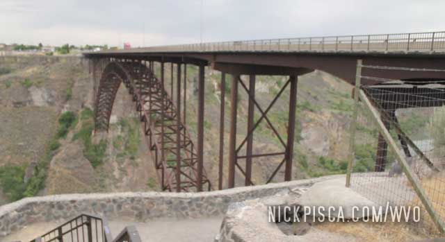
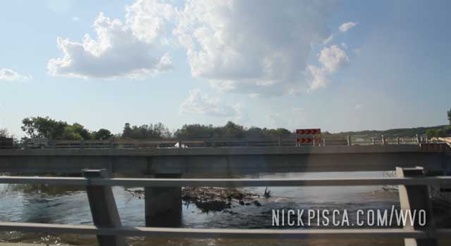
North of Twin Falls is a massive gorge and impressive bridge spanning the Snake River. It’s actually kind of surprising. One minute you are driving on Highway 93 in the desert, and the next you are on this precarious bridge with flimsy railings.
There is a small pedestrian area on the side of the gorge that lets visitors check out the geography.
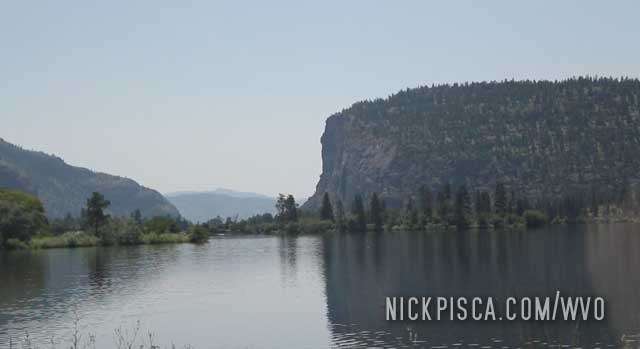
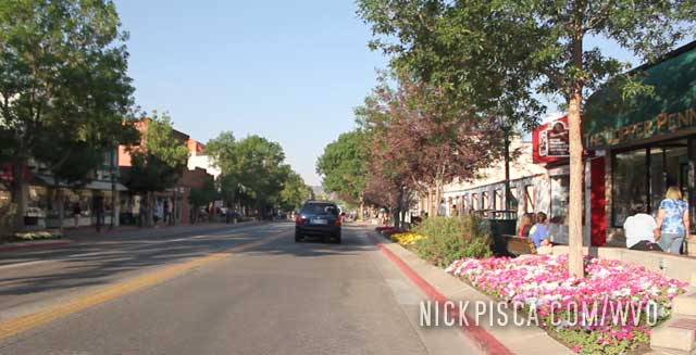
Twin Falls is one of our favorite places in America. It’s great little town, and has a lot of resources. Also, they have a good main drag with lots of good people.
In 2012, we got in really late, so we found a parking lot to rest our eyes for a bit. If we could catch a few Z’s, then we’d be refreshed to push on to Reno in the morning.
The skies were gloomy and we had a slight rain in the night. Since it was sprinkling, we filled up our veggie tank under an abandoned gas station canopy. We can’t let any water get in our fuel system. We headed southbound from Idaho Falls to more sights on the horizon.
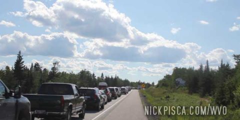
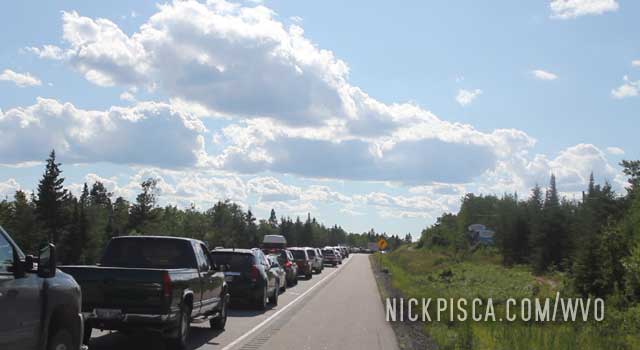
I remember there was this odd traffic jam in the middle of the desert. Something like a few hundred cars stopped up on State Road 74. Crazy. A lot of truckers were pissed.
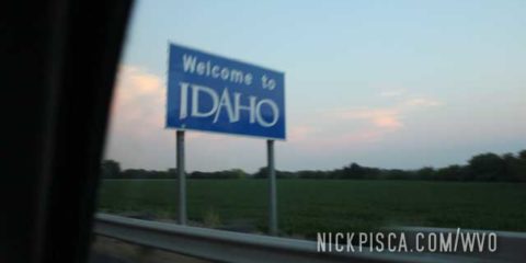
We tried to make it to Boise before it got dark, but time was slipping away. We pulled off near Huntington Oregon to fill up the tank, and kept on to the Idaho border.
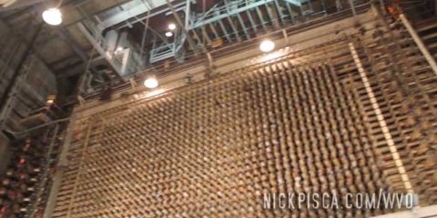
The burgeoning field of Nuclear Tourism has some quintessential sites. One of the most important places from the Manhattan Nuclear Project is the Hanford Reactor in Washington.
This site had one of the very first nuclear reactors in history. Also, they produced most of the plutonium used in the first nuclear explosion in history at the Trinity Site, as well as the plutonium used in the Nagasaki bomb.
This is the kind of place that you can’t just walk up to and visit. In order to go on the tour, you have to purchase a ticket months in advance. You have to pass a lengthy background check, must be an American citizen, and fit other strict criteria. The tour can reject you on the smallest consideration, so we hoped for the best.
Thankfully a few weeks before the trip, we received word that we were accepted.
There is a visitor’s center that is the meeting place for the tourists, and then we got shuttled to the plant:
![]()
The plant is situated in the middle of nowhere nowhere. Like nowhere. Nothing for miles.
They let you in, and you get to experience the massive horizontally-loaded reactor in person. You can almost touch the control rods. It’s wild. It’s also much bigger than the Oak Ridge nuclear reactor. Kind of weird to think this bad boy was pumping out nuclear-generated electricity in the 1940’s. All the electronics and tubing looked ancient, nothing like the electronics of today.
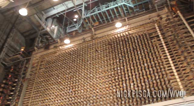
The tour took all day. It was exceptional. Afterwards, we loaded up the grease and headed toward Huntington Oregon.
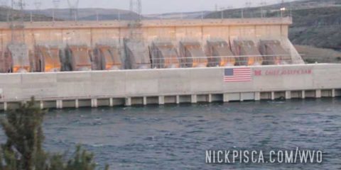
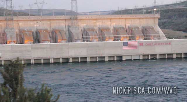
We wanted to go on the Chief Joseph tour, but since some jerk at the Oroville US Border crossing detained us for 6 hours, we were resigned to just visit the outside of the dam.
It was getting late, and we had to get to the Osoyoos Border Crossing before dark. This was not an all-night crossing. We drove through some pristine Canadian wilderness and got close to the station.
Now, I would have more photographs and videos of this US crossing, but things did not go our way. Long story short: The US Border Agent deleted much of our files and detained us for 6 hours.
We drove to the border station thinking nothing of our setup. We’ve crossed the US border so many times in the passed with veggie oil in the back, without any issues. We crawled our way to the agent and he took our passports. Everything seemed normal. Then he directed us to park near the station. No biggie. We’ve been searched before, and once they realize it’s just vegetable oil, they let us go.
But this was different. They put us in a room and made us sit for a while. Then they called us in to talk about the cameras. We always film our roadtrips, so there are microphones and gopros and DSLR’s and memory cards and hard drives everywhere. They are literally suctioned to our windshield. We didn’t conceal this fact. It was obvious.
They accused us to filming the border crossing and planned to sell this footage to terrorists. I was shocked. They spent hours going through all the SD cards and hard drives looking for any footage of us filming this gawd-awful remote border crossing. We tried to aide them in deleting these files, but they wouldn’t have it. They literally just wiped several cards which contained hundreds of photos and pictures of our stay in British Columbia.
They even considered charging us with the “crime” of filming the border. They claimed that was “illegal” and it was posted, but we didn’t recall any such posting. In fact, you can go to Google Maps Street View and review that border area, and there is not any posting limiting photography.
The shocking thing about this was, if we were to believe this hairbrained theory from the border agent, then we must have been the most incompetent reconnaissance people of all time. Instead of hiding our cameras and hard drives in covert areas on the car, we had them suction cupped to the windshield and windows. A DSLR was slung around my neck. It was obvious we were tourists filming a road trip. But no, the agents twisted everything we told them to justify their idiotic conspiracy theory that we were aiding the terrorists.
At the end of the 6-hour detention, they threw everything into the car and told us to get out. There was so much of our stuff destroyed, that we couldn’t even sit in the chairs. They were excessively rude and insisted we get out as soon as possible, but it was too hard to drive. We opened the trunk to see all our stuff ransacked. I found one of our hard drives just millimeters from the large speaker magnet. I told him that magnets can destroy hard drives, but the agent was a total asshole and insisted that is only if the radio was on. I was shocked at his stupidity. The magnet is still magnetized even if the radio is off. One of our drives was destroyed, but one survived.
We finally got enough of the piles of stuff out of the front seats so that we could drive a few blocks to the nearby town of Oroville. There, we spent about an hour cleaning, searching, inspecting, and rebuilding our film, veggie oil, and automotive apparatuses.
The US Border Patrol near Oroville is full of assholes. There was one nice old guy, but the rest can suck a dick.
We were supposed to spend the day sightseeing in central Washington, but due to this unwarranted search and detention, we headed south to Tonasket to reassess our plans.
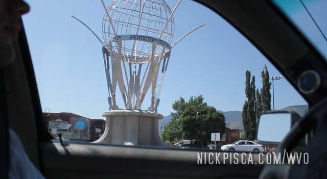
We cruised down Route 5 from Kamloops passed Walloper Lake to Penticton.
As we pulled into town, we noticed something odd about the wheels. Turns out the tire that we had replaced in Socorro New Mexico on this trip, failed. Since Penticton is tiny, there wasn’t much for auto shops. So we had to resort to our worst favorite place in all of Canada: the dreaded Canadian Tire. This was the first time we ever went to the Canadian Tire for an actual tire. Usually we go there to buy useless crap that is worse than anything found at Harbor Freight. One of Glenn’s infamous quotes is “the only good thing about going to Canadian Tire is to ask someone where there is a REAL auto parts store.”
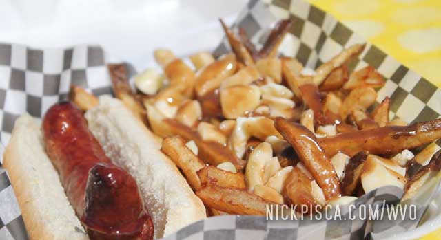
While we waited for the tire replacement, there was a poutine stand in the parking lot. They also sold sausages. This is what I’m talking about.
We headed south to the border. This would conclude our time in Canada for the 2012 WVO Roadtrip.
It was getting late. We cruised through the town of Salmon Arm and pushed on to Kamloops. My memory is a bit fuzzy… I know we found a hotel, but I don’t know if it was in Kamloops or in a surrounding area.
The next morning, we took Route 5 south back to the States. We cruised passed Walloper Lake on the way to Penticton.
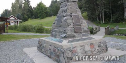
Strange things happen in the mountains. Near Revelstroke BC, we cruised passed a supposed “Enchanted Forest,” and pushed on to Craigellach.
We needed to fill up the grease, and there was a rest area near town. Coincidentally, this was the actual site of the “Last Spike” of the Canadian Pacific Railroad. There is a gift shop, small museum, and some hiking paths in the wilderness.
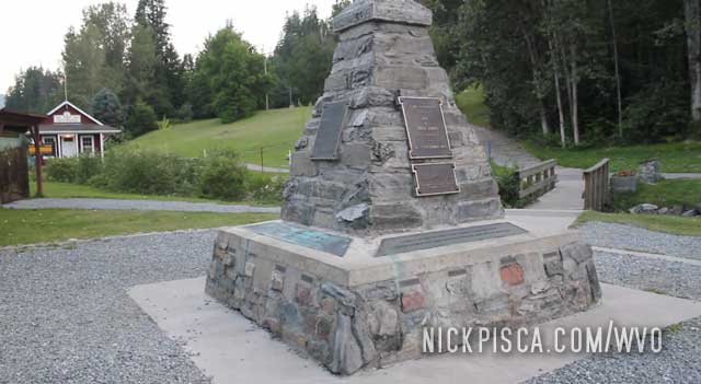
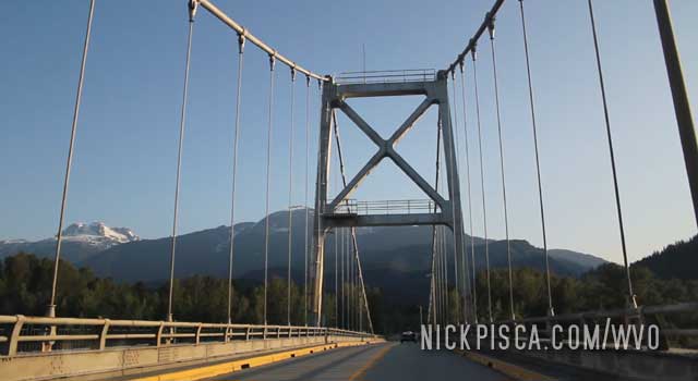
We filled up the tank after checking the monument out. The mosquitoes were getting bad, so we moved on. Bridge near Sicamous BC:
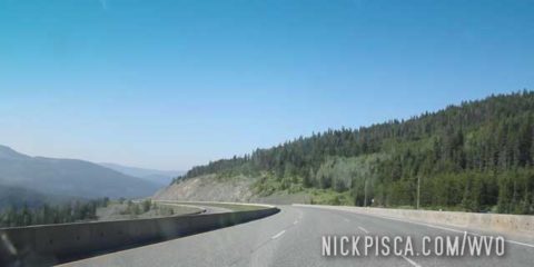
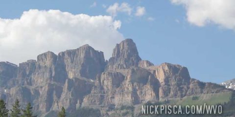
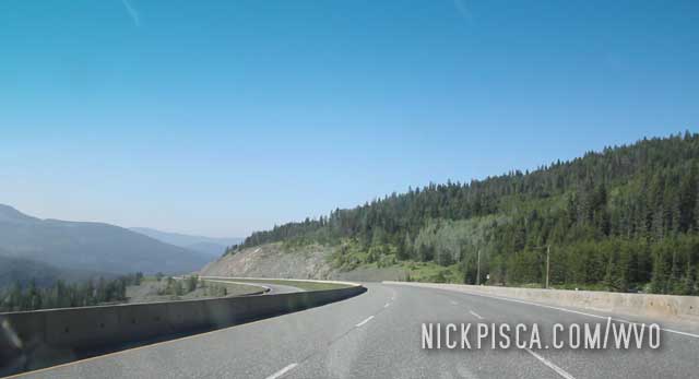
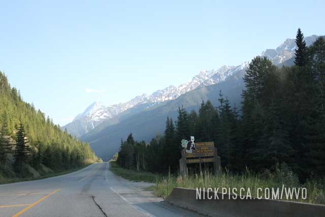
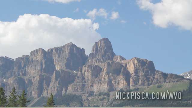
The Canadian Rockies are more picturesque than any of the ranges in Colorado or Alaska. They get no love. Driving the THC through these Rockies is like seeing a postcard vista around every corner.
Entering Bear Valley:
Driving passed the Heather Mountain Lodge Area:
This is one of the most major roadways in all of Canada, but in this area, there was little traffic. Not a problem… more room for us. We pulled off here to refill the veg tank and kept on rolling.
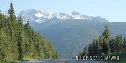
Much like our visit to Jasper along the Yellowhead Highway in 2010, we visited the other gateway to the Canadian Rockies: Banff National Park
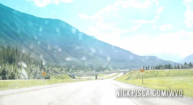
It’s a welcome sight, after thousands of miles of flat farm and forest land, to see some high-altitude terrain.
Banff is an exceptional place to visit.
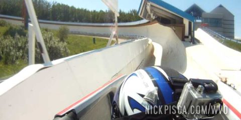
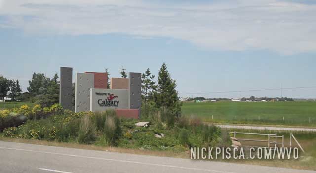
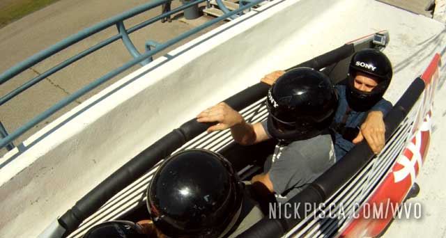
We pulled into Calgary mid-day, just in time to go to the Olympic Village.
We got to the village and asked the clerk what’s the best thing to do. She suggested going Bobsledding. They claim the drivers are Olympic-level athletes that know what they are doing. She insisted it wasn’t too scary or bad.
We bought our expensive tickets and went to the top of the hill. They packed us in with another couple and pushed us down the mountain.
Just to give you some perspective, I lettered in downhill skiing for 4 years and I’m used to speed on a slope. But this bobsledding was awful. The driver didn’t have any control, it was mainly just a hell-ride down a tube.
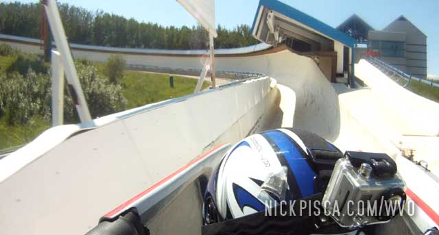
I’m surprised more people don’t get killed doing this. The driver thought it was funny, but I would never do this again. Glenn screamed the whole time down the hill, and afterwards he claimed it was screams of joy. I can tell the difference between joy screams and bobsledding rape screams.
The night before, we contemplated how best to tackle the THC drive to Vancouver. We could find a hotel, or drive through the night. Just before sunset, we filled up the veggie tank, and started the long drive across Saskatchewan.
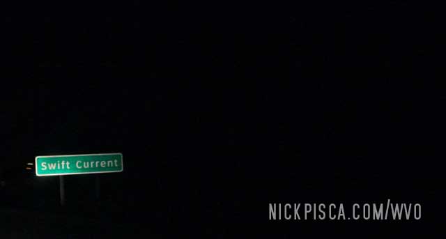
We passed through Swift Current in the middle of the night. No sense in stopping unless we had to fill up or fix some mechanical issue.
By sunrise, we were in the Medicine Hat area.
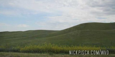
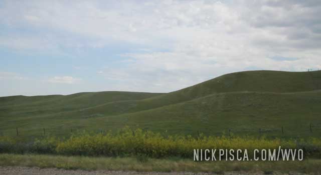
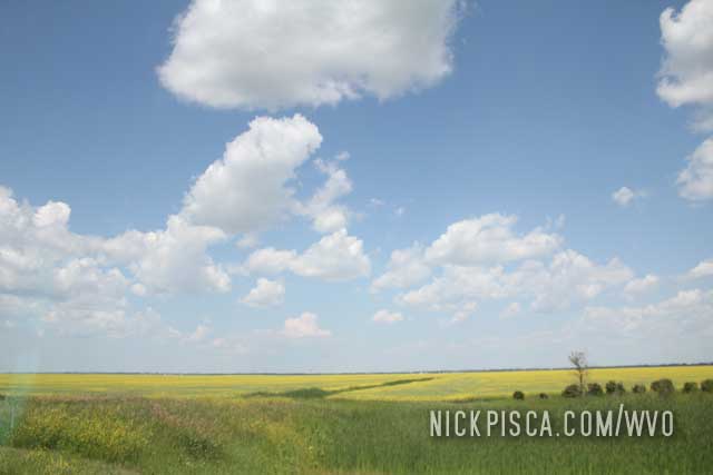
The hills and fields of Alberta are amazing. There are few trees and it’s a really foreign place.
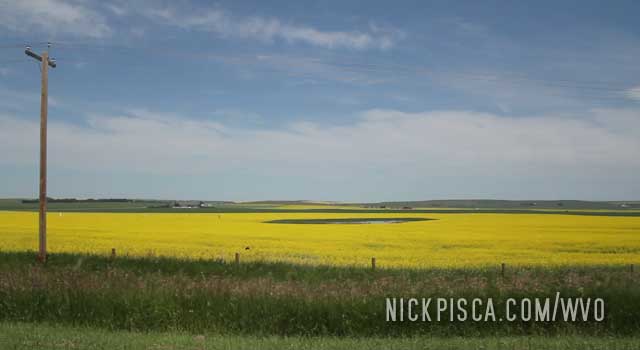
As we approached Strathmore Alberta, more farms took advantage of the flatter topography. Glenn was getting hungry (as usual) and wanted to get to Calgary asap. We had plans to visit the Olympic village.
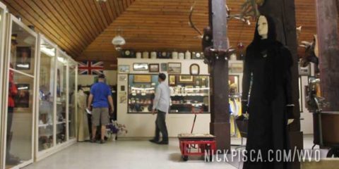
About every 30 miles down the THC and Yellowhead highways, there are these “museums” where the locals collect anything older than 22 years old and call it “antique” or “historical.” One such place was the Fort La Reine Museum near Portage La Prairie.
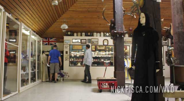
We almost always visit these sites even though they are typically the same thing all the time. Nearby, we also visited the grounds of the Manitoba Agricultural Museum and Homestead as well.
Sometimes we get to see some cool old tractors or cars from the 1910’s or so, but for the most part, it’s just a collection of oddities and buildings. A good place to get out of the heat and humidity and jibber jabber with some of the locals.
We returned to driving on the THC and crossed into Saskatchewan.
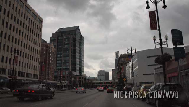
Winnipeg is swaddled in a blanket of farmland. Unlike most American cities, Canadian cities have very little sprawl. We’ve visited the Peg so many times, starting in 2010, and almost every year till present day.
In 2012:
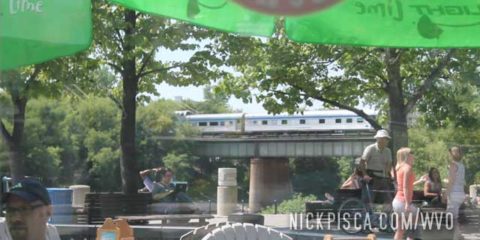
This is really cool, and you can be driving in a place like this,
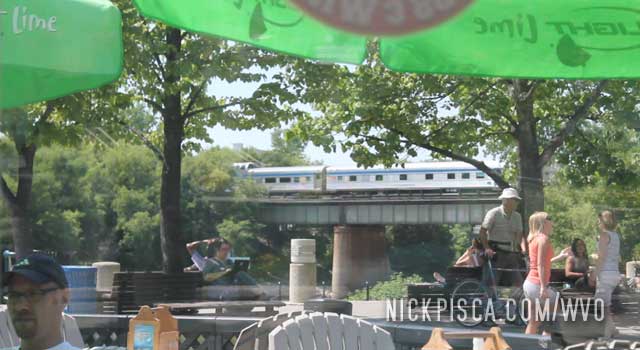
and within a few minutes, be eating at a restaurant in The Forks (in downtown Winnipeg). Whenever we visit this place, we usually stop by The Forks to check out the town. It’s a community place, it’s open all the time, and there are lots of shops and places to eat. It’s just nice to get out of the car, and fill our guts with more fucking food.
In 2010:
Five miles west of the Peg, Manitoba. 205226. 8:03pm Sat.
After hitting up Lower Fort Garry, we were told to visit the Forks district. I guess it wasn’t bad, but it wasn’t that awesome either. It was just a bunch of shops and places for Canadian posers can figure out ways of justifying the time they wasted on their skateboards. They even had some sort of event where a flock of wallflowers showed off their skateboard moves. The announcer was really hardcore when he continually remarked after every trick with “Oh my gosh.” Canada.
From Winnipeg to Yorkton. Sat.
We ran into some storms and showers for the duration of the trip to Yorkton. We were stuck in the Forks for an extra hour because of a major downpour in the city. After grabbing some sushi, we set up to run the two blocks to our car in the rain. No biggie. On the way out of the restaurant, the owner insisted that we use her umbrella to get to our car. She was rather insistent, but we maintained that it wouldn’t be that big of a deal. Just outside the restaurant under a canopy, we got ready to sprint over to the car, and another woman insisted that we take her umbrella. It was getting a bit weird. She said she trusted us to bring the umbrella back. After being barraged with Canadian kindness, we relented and took an umbrella. Crazy.
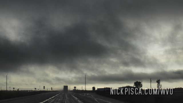
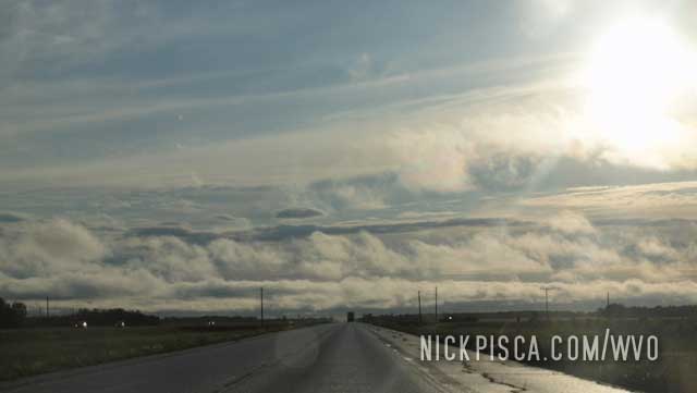
More on the way to Yorkton, SK
The clouds would open up occasionally. It was strange, because the clouds formed so close to the ground.
One of the downsides to having the “only road” in Canada, is if there is a problem, it’s catastrophic. We were approaching Kenora, and hit some kind of logjam. It was so bad, that we stopped for almost two hours. People were getting out of their cars and walking around. The radio said the hold would be for a while.
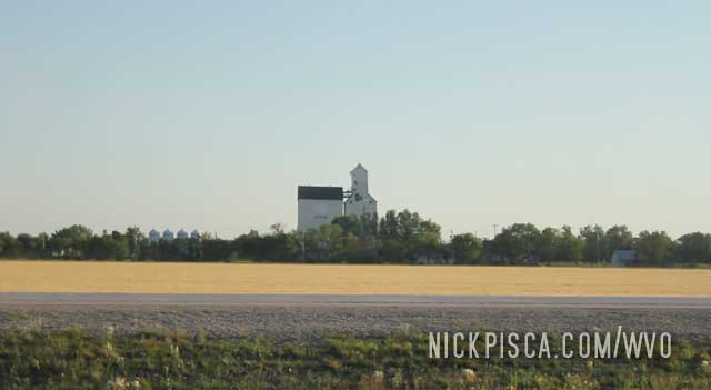
Eventually we started moving again, and headed toward The Peg. Once you hit Manitoba, the scenery changes from forests to flat farmland, like in southern Illinois. This is a typical grain elevator near Ste Anne MB.
This town is the companion border city to International Falls Minnesota. It’s the gateway to western Ontario. We’ve been to Fort Francis twice: once in 2010 and once in 2012. The 2010 trip had us coming up to Canada from Int’l Falls, and the 2012 had us coming from the east.
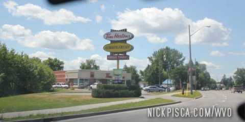
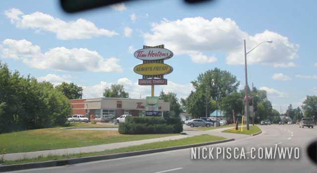
It’s a typical Canadian town. Tim Horton’s, Boston Pizza, etc.
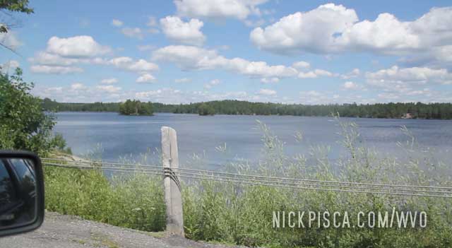
Here’s a lake near Nestor Falls Ontario. There are thousands of lakes all across Ontario and very few lake houses or boats on the water. If this were in central Wisconsin, there would be a hundred Flatlanders in their gasoline boats ruining the scenery.
The 2010 trip allowed us more time to stop and see the Fort Francis sites, but we were on a schedule and had to keep on to Kenora.
Fort Francis, ON. 10:42pm Fri, 2010
Finally made it across the border. We got there at a reasonable hour in International Falls, and we thought it’d be a simple jump across the border like always. No way. Normally we get no problems with Canadian side of the crossing, but this time we got a full search of everything. They pretty much took out everything and searched it all. Except the veg. Crazy, they wasted so much time on trivial things like underwear and receipts, but left 17 cubes of grease completely unsearched. We had nothing worth searching anyway, but I would have thought the priorities would have been reversed.
Added 1 5/8 cubes. We drove up from Fort Francis and were only a few kms from the turn off for the Trans-Canada Highway when a couple flagged us down. Turns out one of their cars had a flat tire. It looked like the stock jack they were using wasn’t cutting it, so we helped out with my hydraulic jack. Also, their dummy tire was a bit low on pressure, so we used my cigarette lighter pump.
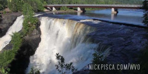
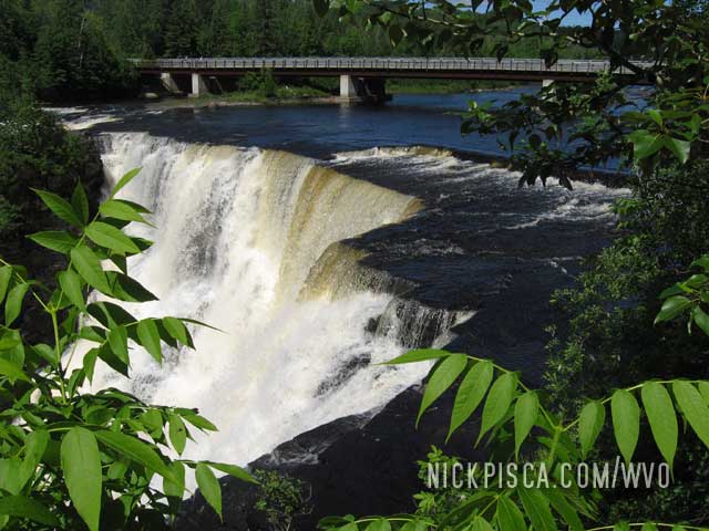
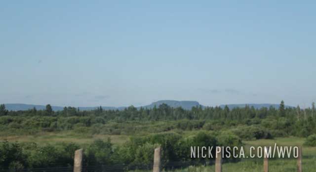
We have been to Kakabeka Falls several times. In fact, one of my earliest memories is visiting this waterfall as a child. On our WVO Roadtrips, we have stopped here in 2009, 2010, 2012, and 2015. If you are in Thunder Bay, you must stop at this water fall.
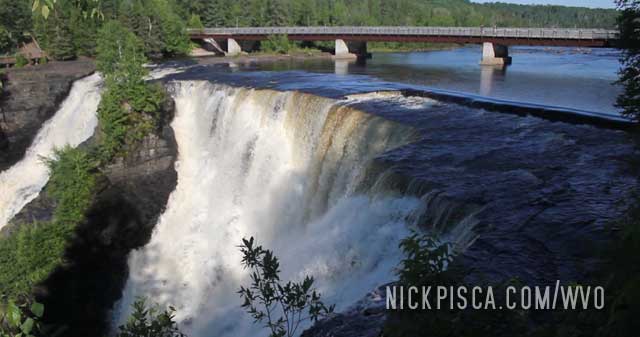
Just remember to bring some Canadian coins. You have to pay for parking, but it’s an unmanned station. The machine only takes Canadian money, and since we are so early into our Canadian roadtrip, we still hadn’t acquired any substantial coinage.
In 2009:
269920. Kakabeka Falls, ON. 11:30am Friday
Strangely, we calculated that I may have been at this very falls twenty years to the day. Note to visitors to the falls: the rangers have a parking kiosk that only takes Canadian coins, so bring more than just plastic or paper money. They patrol the area looking for unlabeled vehicle.
Wow. Things really have changed so much.
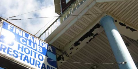
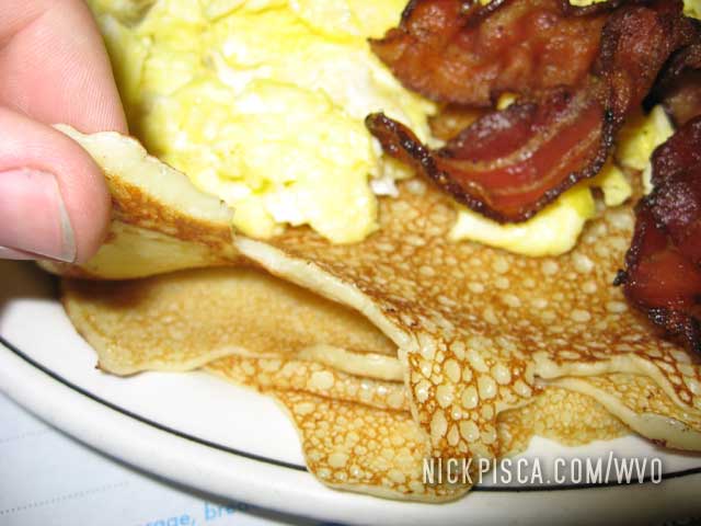
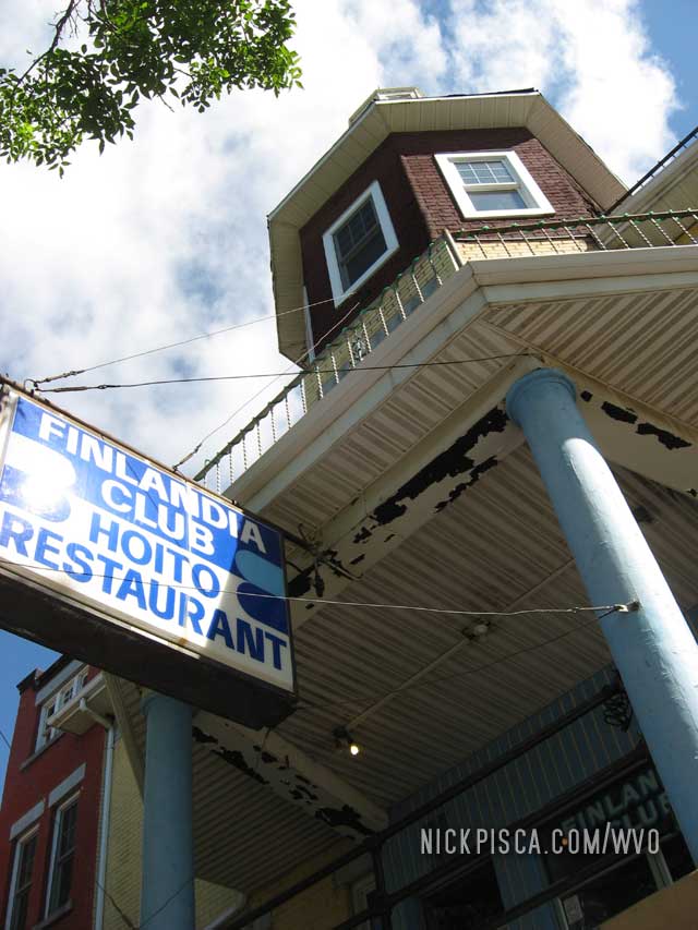
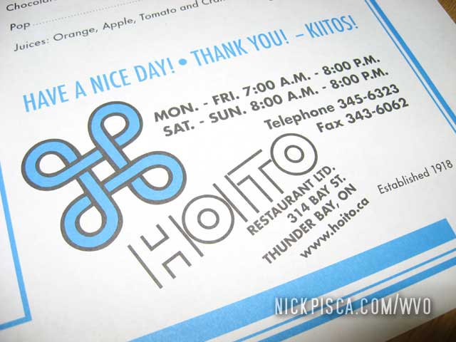
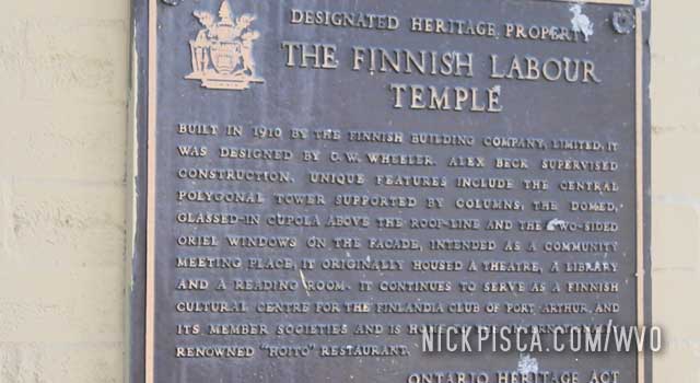
One of our regular restaurants in Canada is Hoito. It’s in Thunder Bay in an area that is supposedly full of Finns. I couldn’t tell you if that’s true, but Hoito makes the Finnish style pancake. It’s basically like a thicker crepe.
In 2009: This was the first time we got to eat here. We crossed the border near Grand Portage, and the Ontario tourist clerk told us that the most unique place to eat is Hoito. Intrigued, we decided to indulge our Scandinavian heredity.
If you want to eat without waiting an hour in line, get here right as they open. Even then, it’s still not a sure bet that you’ll get a table right away. The early bird gets the flapjack.
In 2012, we got up early in Wisconsin, and headed up to Thunder Bay as soon as possible. Our goal was to hit the border right when they open, and then get up to TB for breakfast. There are nice bluffs on the drive to TB, and the terrain really changes once you get out of Minnesota.
We were surprised to find a line to get into the place. It’s just pancakes after all.
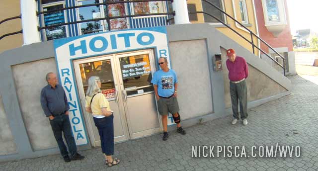
As we waited, we meandered the nearby neighborhood. More proof of the Finnish influence.
We came back here all sorts of times in 2015, 2010, and 2012, and more.
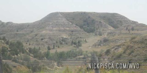
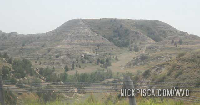
Earlier on this WVO Roadtrip, we stopped at another Teddy Roosevelt National Park or Forest in Colorado. Now apparently there is a second one in North Dakota.
The park is full of small mountains and groundhogs. We drove the loop and got back on the interstate.
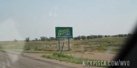
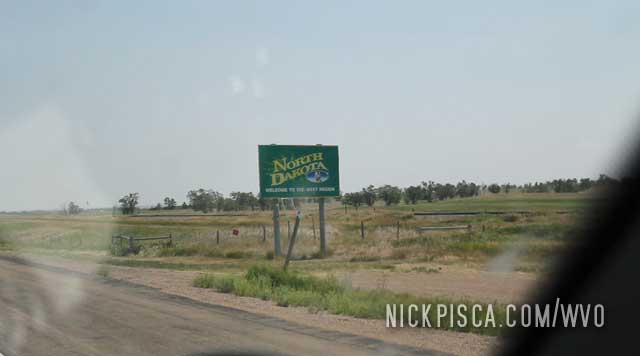
Driving through North Dakota….
We had spent several days visiting all sorts of geological, astronomical, and pioneer sites in New Mexico, Colorado, and Wyoming. Now it was time to stop at a place that is devoid of science, even though they call it the “Glendive Dinosaur and Fossil Museum.”
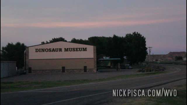
Instead of explaining the truth about dinosaurs and known history, this “museum” purveys Christian mythology as fact, even showing dioramas where raptors walked side by side with humans.
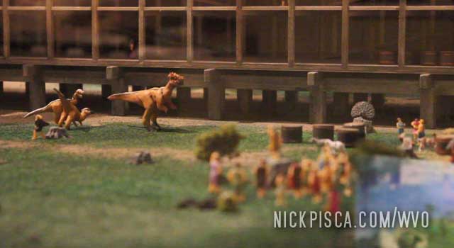
The employees of this “museum” felt compelled to follow us around as if we were common criminals. Eventually their curiosity got the best of them, and they finally confronted us to determine our intentions. We just wanted to check out their museum, nothing more. But now that we had an audience, I asked some simple questions like “What did the carnivores eat after they departed the Ark?” and “Why didn’t god tell Noah to load the Ark up with eggs, instead of living birds, insects, turtles, and other shell-based animals?”
They didn’t really have compelling answers, in fact, one of the workers was impressed by my second question. It’s not every day that I think of something that appears to be a better plan than God’s plan. Just another day in being awesome.
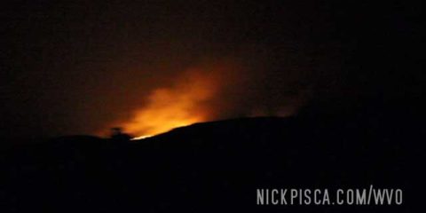
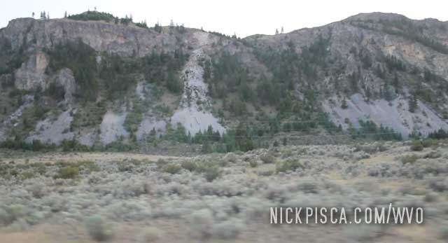
Throughout the day, we knew we were driving closer and closer to danger. There was smoke all the way from Cheyenne to Montana. In order to make this much smoke, there had to be a lot of fire.
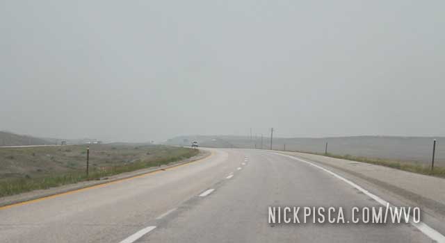
And as the day progressed, we continued to drive northbound on I-25. When reached the Bighorn National Forest, there was an influx of increased smoke. It was super thick, and we had many 1/4 mile visibility at best.
Off to the west, we could see the ridge, and there was an ominous orange glow silhouetting mountains. The fires were just on the other side of the peaks, and the flames were picking up on our side. There was only a few hundred yards from the highway to the forest, so we hammered down. Soon, there were visible flames approaching our location, like this:
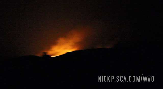
We kept going north in the hopes we would beat the fires. By the time we hit the Montana border, the fires were behind us. As we listened to the radio, they eventually closed down the I-25 just where we had seen these flames. It apparently took over the interstate, forcing the state patrol make the call. Thankfully we made it, and we continued to Miles City.
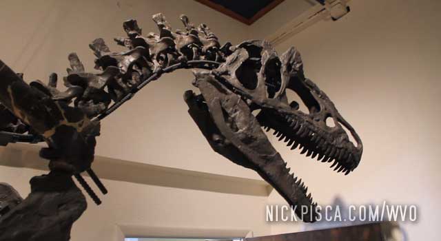
We pulled into Glenrock and Casper in the afternoon. First, we stopped at the Glenrock Paleo Museum. This is a living museum. They have archaeologists working on site, cleaning and preserving various Jurassic and Triassic fossils from the area. Wyoming is a hotbed of dinosaur artifacts, so there is a lot of interest around here.
Also, the artifacts and skeletons here are REAL. Not plaster recreations. It’s astounding. We spent a decent amount of time here even though it’s rather small. And one of the scientists gave us a personal tour of the premises.
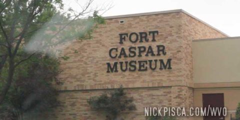
Then we headed over to the Fort Casper Museum. We didn’t take into account what time it was. Turned out it was 4:45pm, and they closed at 5pm. We sweet talked the clerk into letting us quickly check out the museum.
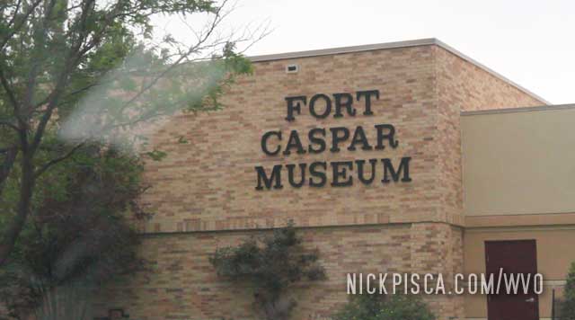
What we didn’t know is, there is an associated Fort Casper Park, which has wagon train and architectural artifacts from all over the area. It’s massive, and it’s on par with the quality of content like the Western Expansion Museums in Saskatchewan. That’s a high bar.
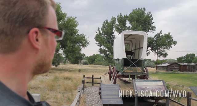
We proceeded to sprint though the grounds to “see” everything before it closed. Maybe a lengthy run was just what our wrecked bodies needed after driving for 2000 miles at high altitude.
It was a great museum, but sadly we never really got to take it in. Maybe some day we’ll be coming through and can check it out again.
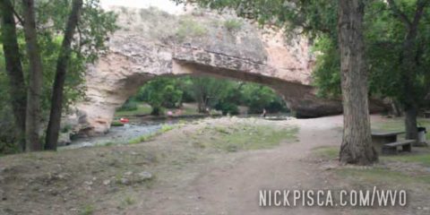
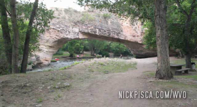
Against our best judgments, we decided to delve deeper into the Wyoming wilderness, even though massive 2012 wildfires were raging all around us. Why? Cuz some local said there was a natural bridge, bitches! We pulled off near Douglas and took some remote roads to the site. It was kind of in the middle of nowhere, but to our surprise, some people were swimming in the creek.
We decided to eat a quick lunch from the food we packed in the Jetta, and then get back on the road. Maybe we can make it to Montana before sunset.
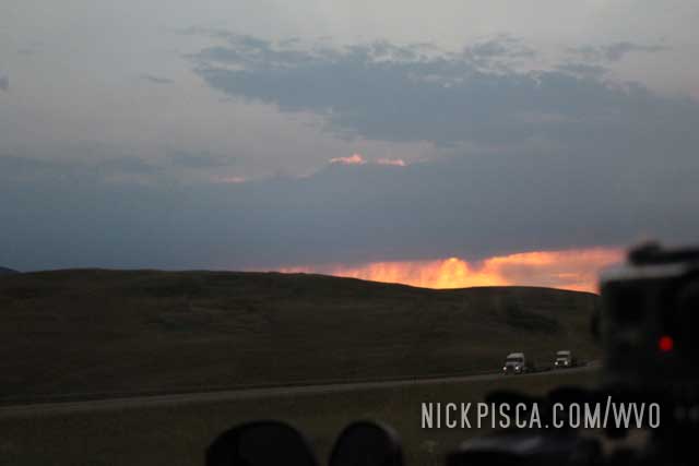
The 2012 Wyoming fires were getting worse and worse as we drove further north.
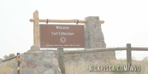
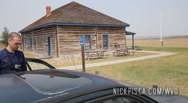
Along the way, we saw a 19th Century Fort site on the map. We jokingly figured we should see this place before the fires burn it down. It was Fort Fetterman.
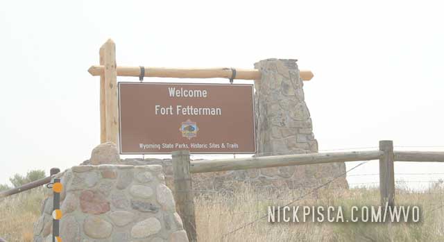
It’s basically a small site that commemorates the junction of the Bozeman Trail and North Platte River.
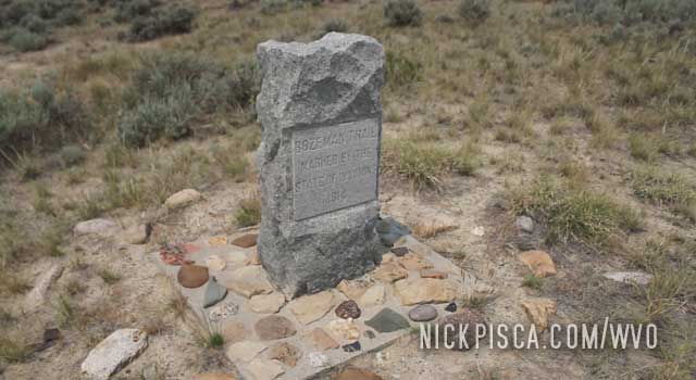
There is a small museum and a hiking tour of the hills. We did walk around a bit, but the constant smoke didn’t endear itself to our lungs. So we decided to fill up the veggie tank and keep on going.
It was at this site, that we conceived the concept of automated drone cameras. We drew up some plans, and in 2013, we bought a bunch of early RC electric helicopters and attached our gopros to them. Sadly, in those days, the batteries were just too weak and the choppers were too wobbly to get any decent shots. But we gave it a shot.
Nowadays, camera drones are affordable and ubiquitous. We were ahead of our times.
As we departed Teddy Roosevelt National Forest, it was getting dark. We pressed on to Cheyenne, and found a DECENT hotel, instead of the crap we had to endure in Los Alamos. This was the first full night’s rest we had since we left Los Angeles.
The next morning, we filled up the grease, and checked over the vitals. The Jetta was good to keep on going north.
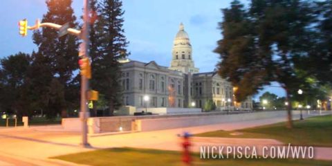
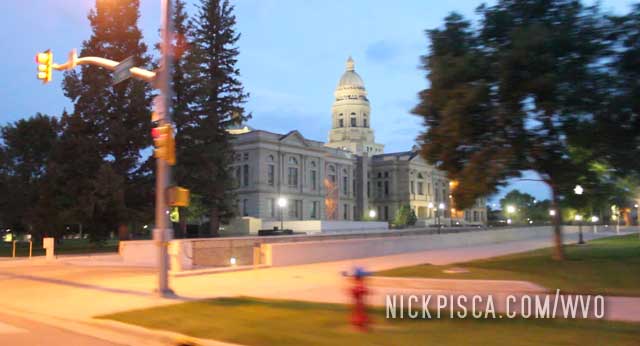
We cruised passed the Capitol.
Before we left the hotel, they mentioned some forest fires up north. We didn’t think much of it. I live in Southern California, so forest fires are pretty typical. But it wasn’t a few miles down the road until we realized just how expansive and massive this crisis was.
The smoke basically lasted from Casper all the way to Montana. It NEVER ended. It was like a foggy day.
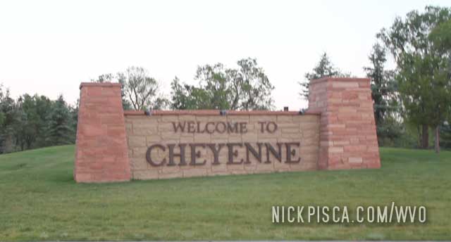
In 2017, we visited Cheyenne again. But this time, we had some TERRIBLE luck. We couldn’t find a park to rest in, we couldn’t find a decent restaurant, and we couldn’t find a good bathroom. Hell, we couldn’t even find a parking spot on any street. It was crazy. Some rodeo had taken over the town, and instead of people paying the measly $3 for parking, the cheap asses just parked all over town. If I was a homeowner, I would have filed complaints and forced my city council to enforce parking laws during these private events. I’m not interested in coming back to Cheyenne, just because of this experience.
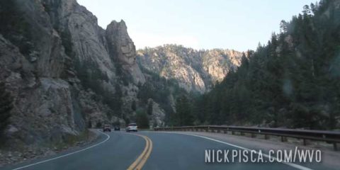
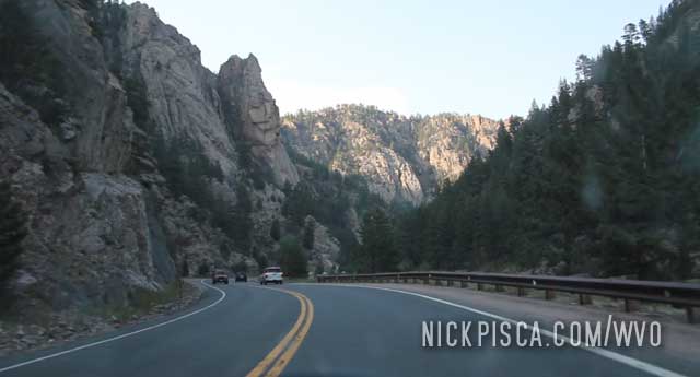
After driving through Rocky Mountain National Park, it was hard to top. But the sheer cliffs and boulders of Teddy Roosevelt Forest lives up to the challenge. We had a hard time keeping the vegetable oil warm enough, because the cold in both national preserves and the downhill driving led to cold coolant temps, and thusly cold veg temps. We had to cycle the diesel and biofuel off and on to make sure our injector pump didn’t clog up.
We have been to the stratospheric Rocky Mountain National Park twice: 2012 and 2018.
In 2012, we came from the south and had to negotiate the Milner Pass at 10759 ft. But that was just the tip of the iceberg.
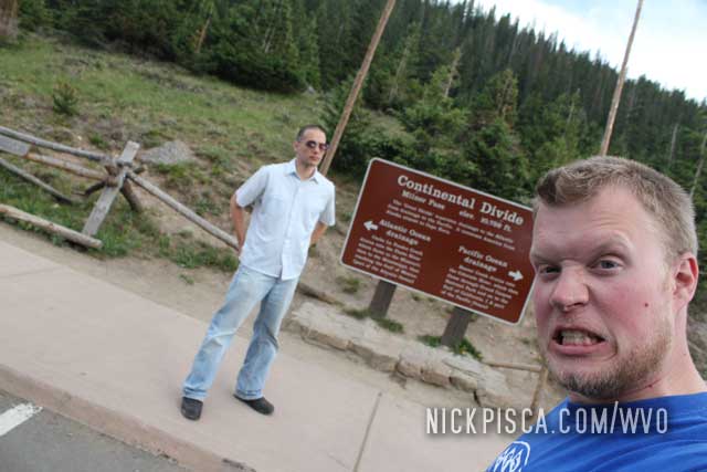
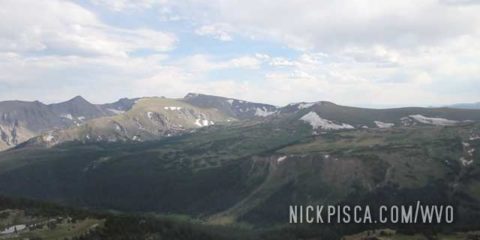
Rocky Mountain National Park is a spectacular place. It’s the only place in America where you can drive a paved road over 12,000 ft in elevation. Also, around every corner is a spectacular view. Also, this park is closed in the winter, for good reason. It must be inundated with snow by early September.
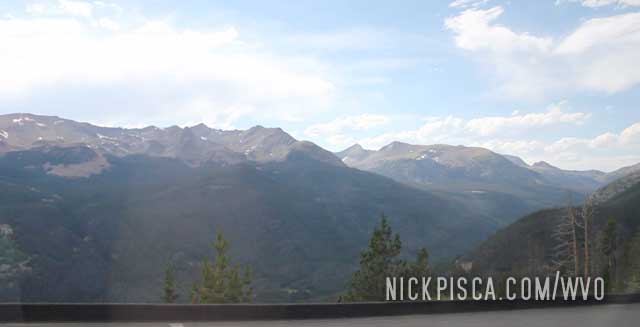
We drove through in July, which is prime season for tourists. It was a little crowded. Also, it was cold. We ended up driving to the elevation of 12,183 ft (3,713 m), which is the highest elevation we had ever achieved on any of our WVO roadtrips.
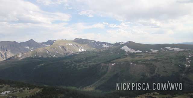
In 2018, it was even colder. Even though we were driving up in late June, the temperatures decreased dramatically. As we climbed the hiking path at the Alpine Ridge Trail, the light rain turned into flurries. We didn’t plan for 32 degree weather and high winds for a summer roadtrip, but it was still cool to experience.
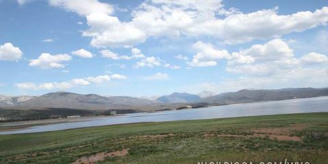
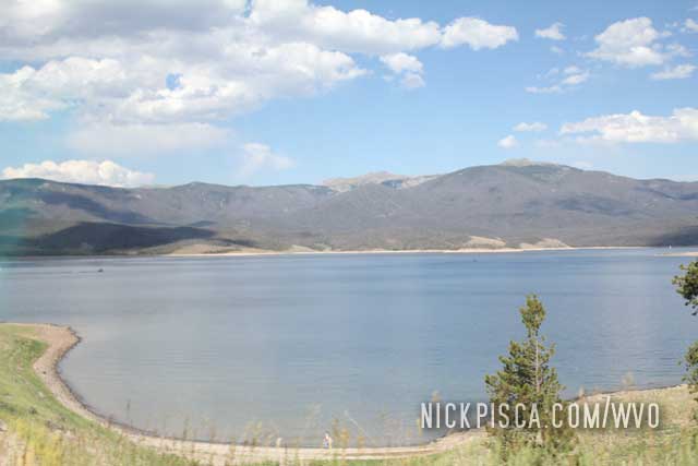
On our way to Rocky Mountain National Park, we passed through the town of Granby and cruised by Lake Granby.
There were lots of interesting geological formations on the side of the road.
Granby kind of snuck up on us.
We wanted to stop, but time was slipping away. If we didn’t get to Rocky Mountain National Park before they closed, we would have to find a different route to Wyoming, and also, it would defy the original principle of our trip: to stay as close as possible to the Continental Divide. Rocky Mountain Nat’l Park has a pass that is over 12,000 ft in elevation!
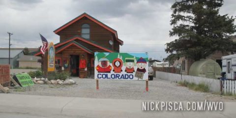
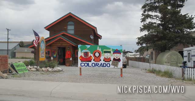
We happened to pass through the tiny town of Fairplay. Never heard of it? That’s because it’s known better as the inspiration for the semi-fictitious town of South Park. Coincidentally, South Park is the name of the county, and you find all sorts of South Park (municipality) and South Park (the show) references.
After we stopped at the literal South Park High School (we couldn’t find a South Park Elementary), we headed north to the skiing town of Breckenridge. We grabbed a quick bite to eat and headed north.
Driving up from Taos, we tried to stay as close as possible to the Continental Divide. Sometimes the roads would meander away, but we stayed close.
We drove through Ault CO and saw this ranch on the horizon.
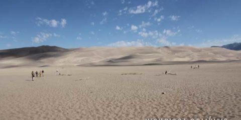
To the east of Alamosa CO, we pulled off to see the Great Sand Dunes National Park and Preserve. Not many people know there is a massive sand dune in the southern part of Colorado. Most think Colorado is all mountains and valleys, but there is a lot of desert here as well.
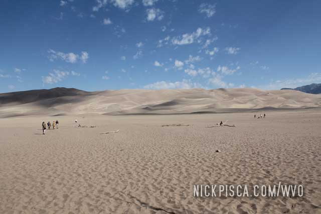
We took a few hours to climb the dunes. They let people hike around and for a weekday, it was rather highly traveled.
After a rocky morning in Los Alamos, we drove up to Taos. We wanted to see if we could hear the infamous “Taos Hum.” After dinking around for a half hour, we didn’t hear any hum. We pushed on up north.

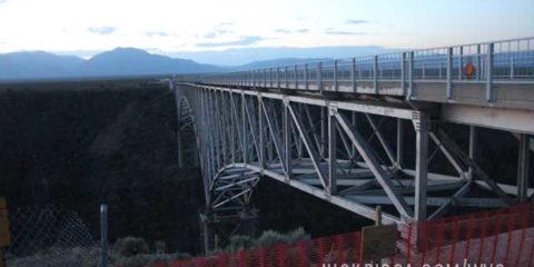
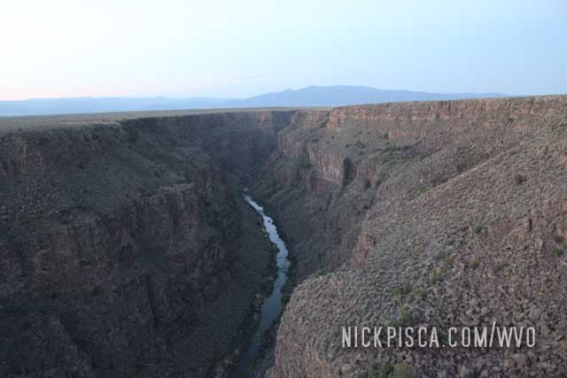
In the middle of nowhere, there was a massive canyon. It turned out to be the Rio Grande Gorge. Talk about a lucky stop. We pulled over to take in the majesty.
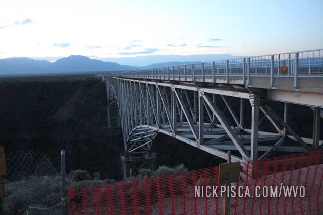
It’s wild this isn’t a national or even a state park. This was just some land along State Highway 64. I suspect some rancher owns this for all I know.
We kept going on northbound.
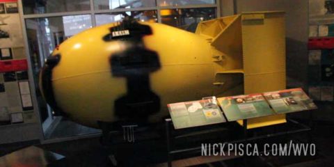
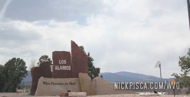
We pulled into Los Alamos in the afternoon. Our goal of this trip was to visit sites along the Continental Divide, and one place we had to see was the former Manhattan Project location of Los Alamos. In the 1940’s (and still today), this was a hotbed of scientific discovery.
We visited the Los Alamos nuclear museum, which I think now is called the Bradbury Science Museum. They have replicas of the nuclear bombs that were dropped on the Trinity, Hiroshima, and Nagasaki sites. Also, they have all sorts of nuclear artifacts. We have visited all the major Manhattan Project locations, like Oak Ridge, Hanford, Los Alamos and so on. The only place that is off limits is the Trinity site, which is only open 2 days out of the year.
![]()
After going on the Los Alamos Laboratory tour, we made the mistake of staying at the local Motel 6. We have had terrible luck with that franchise. The only reasonable Motel 6 in the history of Motel 6’s, is the one in Boise. Other than that, they are all terrible. And the one in Los Alamos was worse than anything we had ever encountered.
It all started ok. We pull up, get a room, and enter it. Then we find it not very clean, both in the bedroom and bathroom. We ordered pizza delivery, and ate our food. Then we went to bed, because we had driven all night and day from Los Angeles to get here.
In the night I awoke to crinkling of a bag on the floor. I snatch it up, and capture the creature in the bag. It was a massive cockroach. We immediately took it to the lobby and asked for our money back. They didn’t exterminate the bug; they just threw it away, and I’m 100% sure it just climbed out of the trash and reentered the lobby. We gathered our things and went into the parking lot. We didn’t want to bring any stowaways into my veggie car, so we took the time to shake out our clothes one-by-one from our luggage in the parking lot. While this was happening in the middle of the night, a cop showed up. Apparently, the owners of that shithole called the cops on us for spending a few minutes making sure we didn’t bring any bedbugs or cockroaches into our car. We explained it to the cop, he rolled his eyes, and entered the lobby. He returned after chastising the owners. He took our side on the issue.
Not a good endorsement of Los Alamos at the end, but the Nuclear sites were cool. Now we got an early start to head north into Colorado.
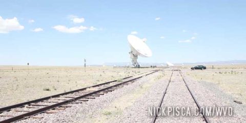
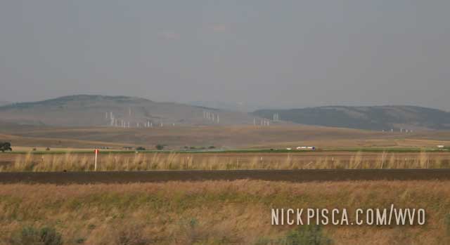
We love to visit anything that has to do with science, especially astronomy, physics, or energy. So it’s imperative science-nuts like us visit the “Very Large Array” of Radio Telescopes, or as it is better known as V.L.A.
There are several of these MASSIVE radio telescopes (looking like satellite dishes) in the New Mexico desert west of Socorro. This array sits atop the continental divide, so there is a lot less atmosphere to interfere with the signals.
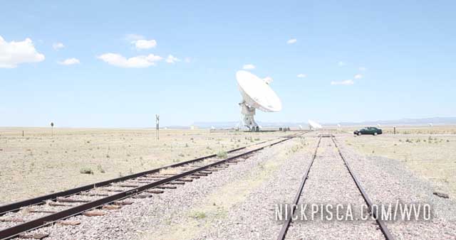
We drove around the base for an hour to check out the place. We showed up on a day when they weren’t doing tours. Bummer. It would have been nice to see the insides of the command station, but we’ll have to do that on a future date.
We headed north and needed to fill up. We pulled off at an old gas station that had some abandoned tourist traps looking like plywood teepees.
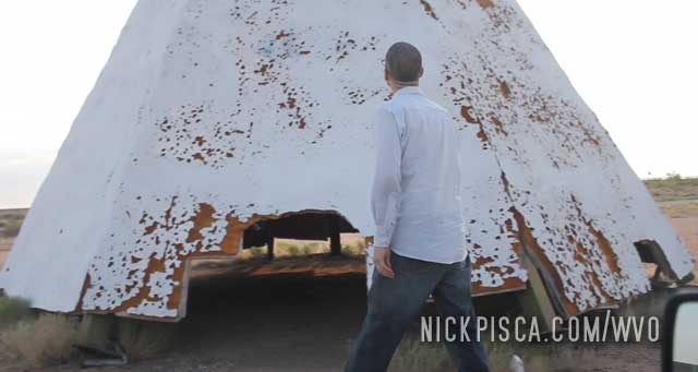
Watch out for tarantulas there, Glennie.
We got an early start for the 2012 WVO Roadtrip. We left Los Angeles around 8pm and drove through the night to Las Cruces NM. It was July, so it was exceedingly hot. Even in the middle of the night, Arizona and New Mexico was over 90 and 100 degrees. I remember pulling over near Phoenix to fill up the veggie tank, and our Air Conditioning wasn’t working well. I opened my window to see if it was warm outside, and boy it was. It was like feeling the hot wind of a hair dryer.
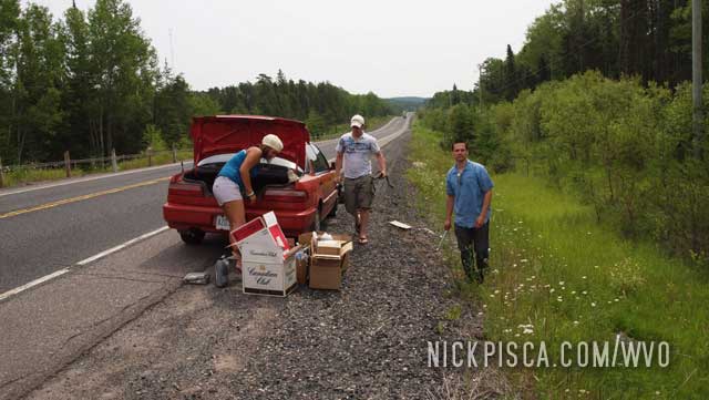
Eventually we got to Las Cruces and headed north. The tires must not have liked all the heat, because near Socorro we felt an unnerving vibration from the back. We thought maybe it was a bad bearing (like what happened to the Passat in Scranton in 2011), but as we examined the tire, it was clear we had a bulge. We limped the Jetta to the nearby town, found a shop, and they set us up with a new tire. Back on the road in an hour.


2012, 2018

2006, 2012

2012

2012

2012

2012

2012

2012

2012

2012

2012

2012

2012

2012

2012

2012

2012

2012

2012

2010, 2012

2012

2010, 2012

2009, 2012

2009, 2012, 2015

2012

2012

2012

2012

2012

2012

2012

2012, 2017

2012

2012, 2018

2012

2012

2012

2012

2012

2012

2012