 |
 |
 |
| HOME | PRODUCTS | FORUM | RESOURCES | KIT COMPARISON | FREQUENTLY ASKED QUESTIONS | |||
|---|---|---|---|---|---|---|---|---|
| GALLERY | HISTORY | VO THEORY | SYSTEM | MEDIA | CONTACT | |||
|
|||||||||||||||||||||
|
Welcome, nick.
You last visited: 10-25-2011 at 11:45 PM Private Messages: Unread 0, Total 48. Your PM box is 96% full. |
||||||
 |
|
|
Thread Tools

|
Search this Thread
|
Rate Thread
|
Display Modes
|
|
#51
 07-12-2008, 09:44 AM
|
||||
|
||||

It turns out I lost my log near the end of the trip. We have a few markers where I don’t have exact mileage, but it should be relatively close. Whistler & nearby wilderness, British Columbia. 184204 (est). Mid-day Tuesday. The central BC wilderness is surprisingly desert-like for its latitude. Rather than taking the 4-lane Canadian Interstate 1 to Vancouver, we opted to cruise the smaller Route 99 thru Whistler. Even though we heard reports that the 1 had some construction, I don’t think 99 was shortcut by any means. There were portions that were one lane and even a 4m railroad overpass at 20kph 90-degree turn! And the crazy part was that rigs were one this death trap and speeding. 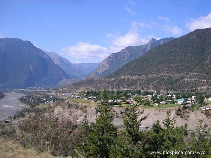 Whistler was at a higher altitude, so the vegetation was a little more lush. However, it was a little disappointing due to the number of a-holes on the road. Plus there was construction from Whistler to the edge of Vancouver, which was very slow. For some comedy, we happened to be following a guy in a white S-10 that could drive the whole mountainous stretch without hands. The only time he pulled his arms from behind his headrest was to shift, and he had some rather close-calls and often ran over the yellow and white road lines. 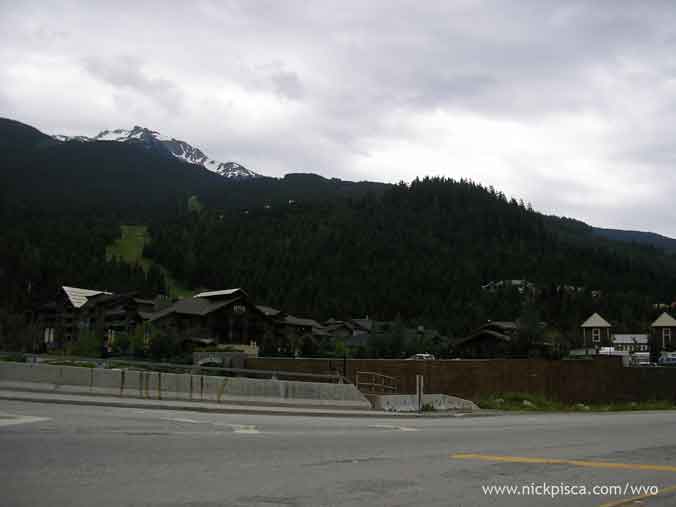 Vancouver, British Columbia. 184281 (est). 1:50pm Tuesday. You’d be very surprised that you’d be entering a large metropolitan area when you get within a few miles of this city. There are many trees and it only opens up once you hit the main bridge to get on the island. We stopped off at the Capilano Suspension bridge which was something like 27 dollars to enter. Since we only had a few minutes (we want to be in Seattle by 5pm to hopefully get to Frybrid before store hours end) we convinced the staff to let us in for 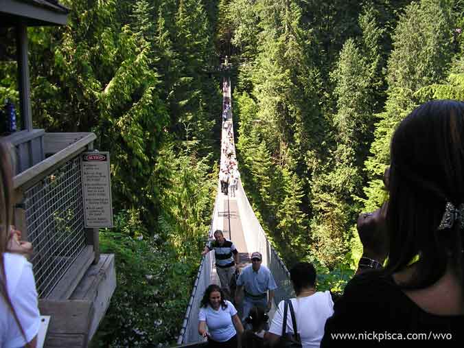 From the bridge. . . 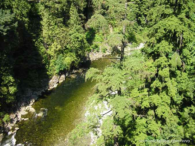 In the city. . . 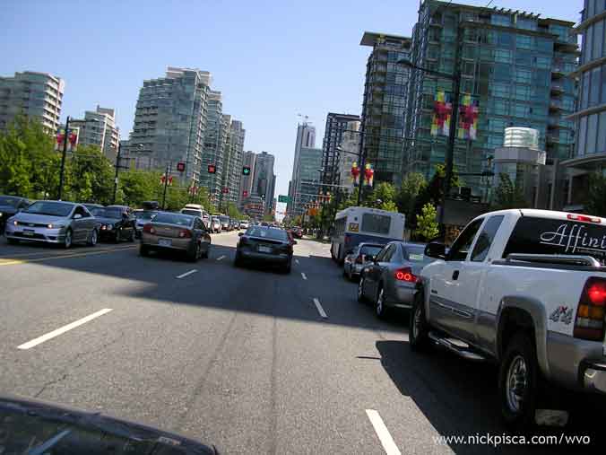 Seattle, Washington. 184422 (est). 4:45pm Tuesday. We crossed the border rather quickly, without issue. They asked about the veg thinking it was bio, but we told him it was straight veg. He inquired if we filtered it and said yes. Then he made a poor attempt to “search” the vehicle by thumping the fenders and other panels. After hearing nothing worth searching, he let us through. We got into Seattle after Frybrid closed, but we tried to knock anyway. Some lights were on, but it looked pretty empty. We stayed at a nearby hotel and got ready to meet up with Chris in the morning.
__________________
-Nick WVO Travel and Awareness Digital Sherpa Blog Pants Pocket Saver (Tape Measure Holder) Maya MEL Scripting Manual "I'd put that oil in my body, but not my engine." 

|
|
#52
07-12-2008, 09:47 AM
|
||||
|
||||
|
Seattle, Washington. 184422 (est). 9am - 12:30pm Wednesday.
We walked down to the shop rather early and Chris wasn’t in yet, so we visited the needle and Frank Gehry EMP building. 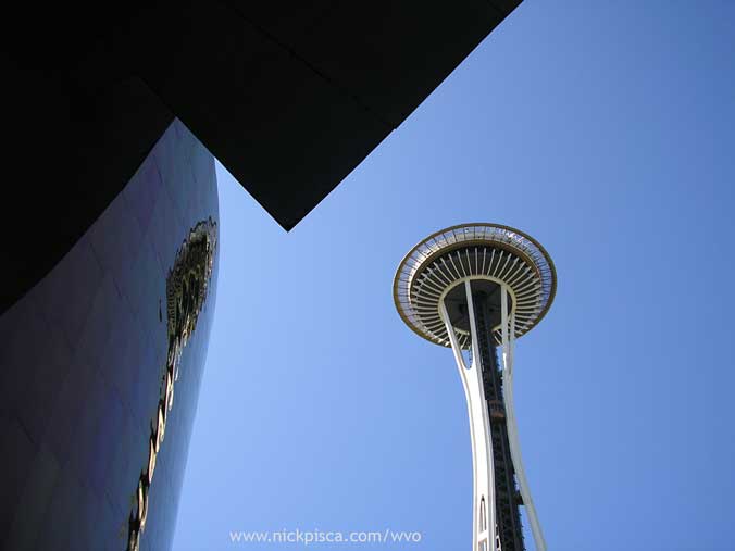 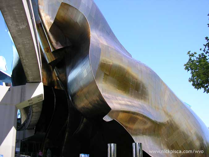 From the top of the tower, we snapped the top of Mt Rainier from the Space Needle. 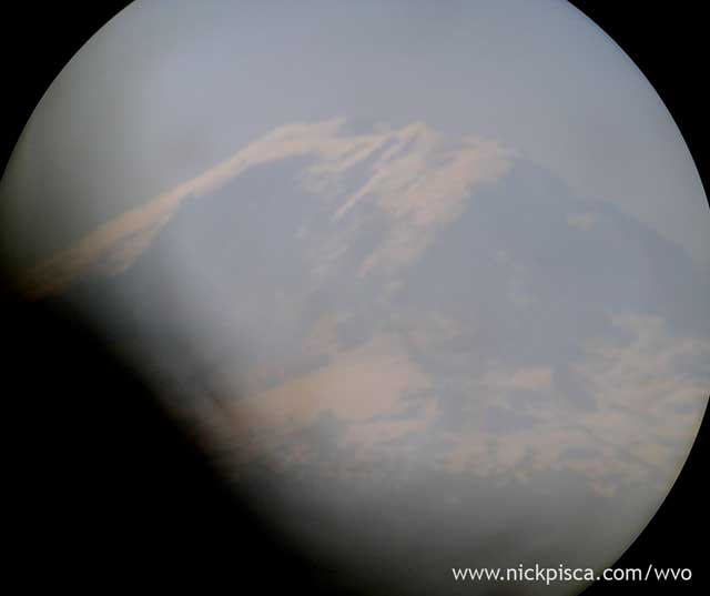 We got back to Frybrid to see Chris outside his shop working on something in the back of his truck. We checked out the ride and hung out with the Frybrid crew for a bit. Anyone greasing thru Seattle MUST visit this shop—it’s the best. They should think about making a reality show or something because we were busting a gut at some of the trash-talk. ;-) Mt Rainier, Washington. 184524 (est). 4pm Wednesday. Surprisingly, you can drive up to a high elevation on the mountain. This left a mile-or-so hike (in the snow) to a decent vantage point to view the peak above the tree-line. Note to anyone hiking, bring a cubie box to the top, so you can get down fast by sledding. 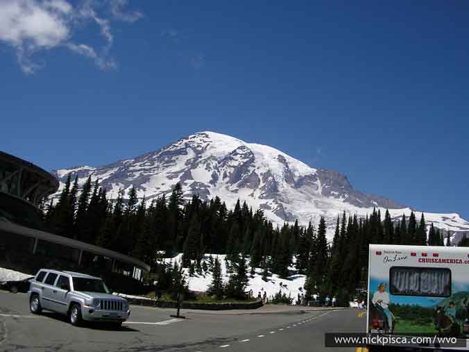 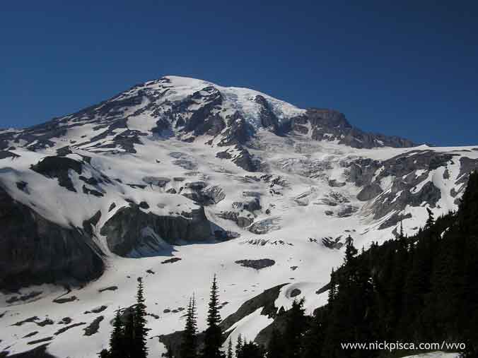 Mt St Helens, Washington. Wednesday. Heading south on some Washington two-lane, there was a sign to “view” the volcano from a nearby hill. I’m not sure if we are actually looking at the peak, so it could have been a tourist trap. 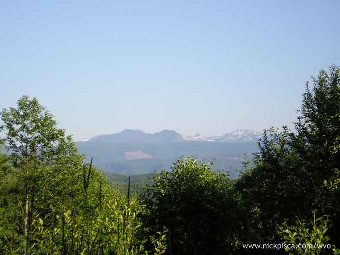 Somewhere on Interstate 5, Southern Washington. Wednesday. Cruising the highway to Portland, we noticed an individual had constructed a rather modest watercraft. I’m sure this small boat help the owner putter around the lake quietly. 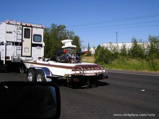 Portland, Oregon. 184678 (est). 8:30pm Wednesday. We decided to stay in Portland, because Bryan was going to hook us up with some spare veg. We grabbed some food, but later, his pump went out on him. Since our schedule is pretty tight, we calculated that we could make it back to LA on the grease we have and a tank of diesel.
__________________
-Nick WVO Travel and Awareness Digital Sherpa Blog Pants Pocket Saver (Tape Measure Holder) Maya MEL Scripting Manual "I'd put that oil in my body, but not my engine."
|
|
#53
07-12-2008, 04:43 PM
|
||||
|
||||
 Road Trip DONE!
Portland, Oregon. 184678 (est). 9am Thursday.
We needed to get an early start, but the trip has really drained us. We needed to get to Crater Lake and Redwood National before it got dark, and it would mean mainly 2-lane roads. I was driving, and after reviewing the map, I found what appeared to be a decent road that would shave off an hour. Here is the route we ended up taking. Bad idea. We noticed a pattern with northwestern states and provinces: if people or maps refer to something at “scenic,” replace that word with “scary.” This road, which on the map appeared as a two-lane, was mostly a one-lane gravel route where portions were missing and large trees had fallen nearby. And for 60% of the journey, we skirted ravines that seemed to endless. There were so many hairpin turns that it took us an extra hour longer to get out of it. 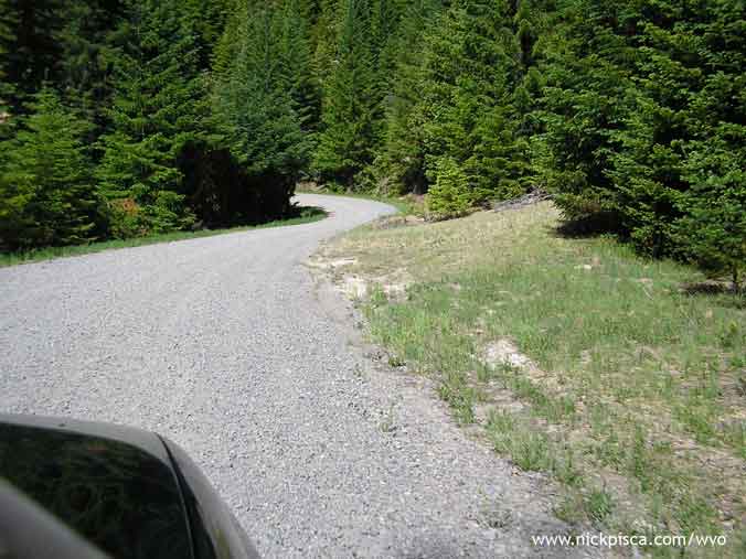 Also, since we were so far into the Oregon wilderness, we happened to stumble upon strolling Sasquatch. He didn’t seem to afraid of us, but eventually he scurried off into the woods. We only got one photo though. 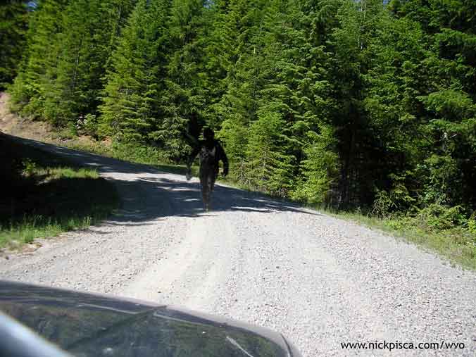 Crater Lake, Oregon. 185002. 1pm Thursday. Added 1 cube. There was still a decent amount of snow on the ground at the tops of Crater Lake and Mt Ranier, even though it was near mid July. 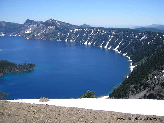 Redwood National Park. 185207. 6pm Thursday. Added 1 cube in Crescent City. All I can say is these trees are gargantuan. 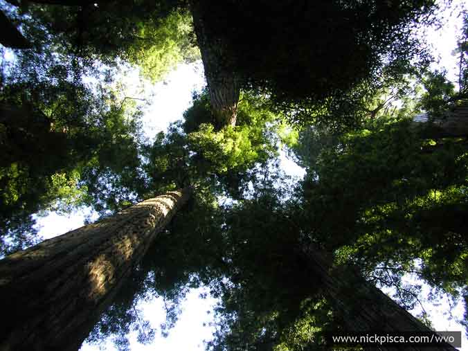 We had to drive a ways into the park to find that infamous tree through which we could drive. If you are heading from the north, it around 8 miles south of the main part of Crescent City. 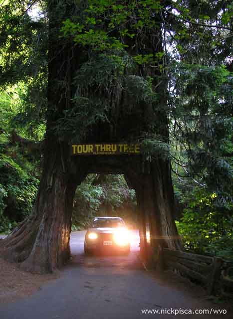 Pacific Ocean in Northern California. 7:30pm Thursday. We decided rather than finding a hotel room in the area, we would skip the visit to San Francisco. We were supposed to visit Mike in the city to pick up a few cubes, but we didn’t want to bother him at such a late hour. With our math, we wouldn’t make it to SF until 1am. Also, we’ve already been to SF on a previous road trip, and even though there are many things to see there, we were too beat. If we pushed thru the evening, we could possibly make it to Los Angeles before the Friday rush hour. 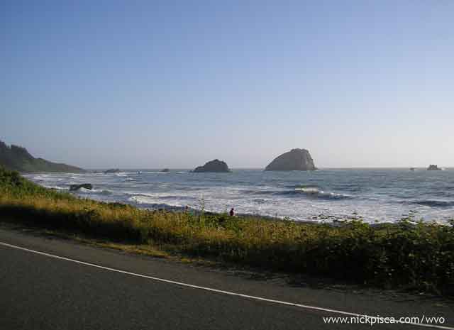 Sunset on the Pacific. 9pm Thursday. A fitting image to end our journey. We are still several hours from home, but we were able to capture this shot of the sun meeting the horizon. 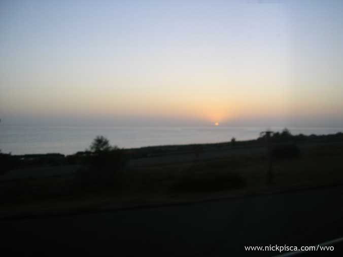 Hopland, California. 185444. 11pm Thursday. Added one cube. We wanted to take a mountain road to get us off of the windy 101 (to take the flat and straight I-5), but there were some really bad wildfires. They had LED signs stating that our access road would have fires and debris on the road surface. So we continued on the 101 for several hours until we drove through San Francisco. The fires were so bad that the moon shined blood red. 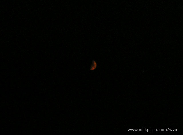 Los Banos, California. 185658. 2am Friday. Ran out of VO. I always keep a half cube of SVO in case of emergencies, so we used part of it to keep some veg up against one side of my supply Hydraforce valve. We are still a few hundred miles away from LA, but it seemed ok to burn a little dino to make it before the morning rush. Los Angeles, California. 185944. 7:15am Friday, July 11, 2008. FINISHED! Thank God it’s done! Thank you to everyone to contributed and helped us on the way. We couldn’t have done it without you. Stats: Total Miles Driven: 8934 miles (14378 km) Total VO: 170 gallons (644 liters) Total Diesel: about 28 gallons (106 liters) Average mileage: 45.1 mpg (19.2 kpl) Total Duration: 13.26 days Average miles-per-day: 673.7 miles (1084 km) Average velocity (including rest): 28.1 miles per hour (45.2 km per hour) Monetary savings with VO (assuming US$4.99 per gallon Diesel): US$847.68 Quote for the Trip: "A Montanan would say that is 90% good road. A pessimist would say that road is 10% washed out."
__________________
-Nick WVO Travel and Awareness Digital Sherpa Blog Pants Pocket Saver (Tape Measure Holder) Maya MEL Scripting Manual "I'd put that oil in my body, but not my engine."
|
|
| Tags |
| None |
|
|


 Linear Mode

